État libre de Saxe
Nom local: Freistaat Sachsen
Situé dans Allemagne Coordonnées: 51°00′00″ N 13°15′00″ E
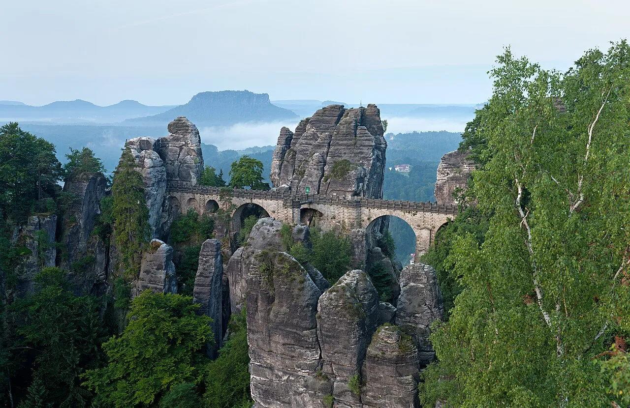
- Population
- 4 077 937
- 4,1 M
- Altitude
- 342 m
- au-dessus du niveau de la mer
- Heure locale
- UTC+01:00
- Europe/Berlin · UTC+01:00
- Lieux rattachés
- 806
- classés sous État libre de Saxe
À propos : État libre de Saxe
État libre de Saxe est une région. Situation : Allemagne. Population : 4 077 937.
La Saxe (en allemand : Sachsen [ˈzaksn̩] ), en forme longue État libre de Saxe (en allemand : Freistaat Sachsen [ˈfʁaɪ̯ʃtaːt ˈzaksn̩] ; en bas sorabe : Zwězkowy kraj Sakska ; en haut sorabe : Swobodny stat Sakska), est un État fédéré de l'Allemagne. État fédéré situé dans l'est du pays, frontalier de la Tchéquie, de la Pologne, de la Bavière, de la Thuringe, de la Saxe-Anhalt et du Brandebourg, l'État libre de Saxe est le sixième en nombre d'habitants et le dixième en superficie des lands allemands.
Lire la suite sur Wikipédia Texte : contributeurs de Wikipédia · CC BY-SA 4.0 · abrégé
En bref
- Construction
- 1918
- Superficie
- 18 416 km²
Source : Wikidata
En comparaison
- 30 sites et lieux naturels à moins de 10 km Zellwald, Der Helle Grund
- Recensés ici : Site naturel: 370, Cours d’eau: 292, Lac: 102, Village: 16
Lieux : État libre de Saxe
806 lieux-
Forst Lohmen Site naturel
-
Forst Lößnitz Site naturel
-
Forst Lungkwitz Site naturel
-
Forst Marienberg Site naturel
-
Forst Markersbach Site naturel
-
Forst Milkel Site naturel
-
Forst Mittelhöhe Site naturel
-
Forst Naunhof Site naturel
-
Forst Neschwitz Site naturel
-
Forst Neudorf Site naturel
-
Forst Niederzwönitz Site naturel
-
Forst Obernhau Site naturel
-
Forst Oberwald Site naturel
-
Forst Oberwiesenthal Site naturel
-
Forst Olbernhau Site naturel
-
Forst Otenhain Site naturel
-
Forst Pfaffroda Site naturel
-
Forst Pöhla Site naturel
-
Forst Raschau Site naturel
-
Forst Rauenstein Site naturel
-
Forst Reichstein Site naturel
-
Forst Reinhardtsdorf Site naturel
-
Forst Reitzenhain Site naturel
-
Forst Reudnitz Site naturel
-
Forst Rützengrün Site naturel
-
Forst Scharfenstein Site naturel
-
Forst Schmiedeberg Site naturel
-
Forst Schönberg Site naturel
-
Forst Schonfeld Site naturel
-
Forst Schönfels Site naturel
-
Forst Schönheide Site naturel
-
Forst Sdier Site naturel
-
Forst Seidewitz Site naturel
-
Forst Sitzenroda Site naturel
-
Forst Sollichau Site naturel
-
Forst Stadt Kamenz Site naturel
-
Forst Stein Site naturel
-
Forst Steinbach Site naturel
-
Forst Stollberg Site naturel
-
Forst Tannenberg Site naturel
-
Forst Tannenhaus Site naturel
-
Forst Taura Site naturel
-
Forst Thammenhain Site naturel
-
Forst Trünzig Site naturel
-
Forst Untertriebel Site naturel
-
Forst Weißig Site naturel
-
Forst Wermsdorf Site naturel
-
Forst Wildenfels Site naturel
-
Forst Wittgendorf Site naturel
-
Forst Zabeltitz Site naturel
-
Forst Zöblitz Site naturel
-
Frauenholz Site naturel
-
Freiberger Stadtwald Site naturel
-
Freiwald Site naturel
-
Freiwald Site naturel
-
Friedewald Site naturel
-
Friedrichsbach Cours d’eau
-
Friedrichsgrund Site naturel
-
Fuchslöcher Site naturel
-
Fuchs-Teich Lac
Principales villes
-
Chemnitz Ville, Chemnitz247,2 k
-
Zwickau Village, Arrondissement de Zwickau87,4 k
-
Hoyerswerda Village, Landkreis Bautzen30,8 k
-
Pirna Village, Sächsische Schweiz-Osterzgebirge40,1 k
-
Görlitz Village, Landkreis Görlitz55,2 k
-
Freiberg Village, Landkreis Mittelsachsen41,5 k
-
Bautzen Village, Landkreis Bautzen37,6 k
-
Leipzig Village, Kreisfreie Stadt Leipzig611,8 k
Nature et patrimoine : État libre de Saxe
-
Sonnenstein Montagne, Pirna6,3 k
-
Zeisiggesang Montagne, Eibenstock
-
Wüste-Berg Montagne, Haselbachtal
-
Wurzelberg Montagne, Oberwiesenthal, Kurort
Sources et licences
Données mises à jour le: · 2 sources indépendantes