County Meath
Bulunduğu yer: Leinster, İrlanda Koordinatlar: 53°40′00″ K 6°40′00″ B
Bu yerin adı bu dilde henüz doğrulanmadı; özgün haliyle gösteriliyor.
- Nüfus
- 220.296
- 220,3 B
- Rakım
- 47 m
- deniz seviyesinden
- Yerel saat
- UTC+00:00
- Europe/Dublin · UTC+00:00
- İçindeki yerler
- 740
- County Meath altında listelenen
County Meath hakkında
County Meath bir ilçedir. Konum: Leinster, İrlanda. Nüfus: 220.296.
Karşılaştırmalı bilgiler
- 10 km içinde 33 gezilecek ve doğal yer Donaghmore Church and Round Tower, Pollboy Bridge
- Burada listelenenler: Köy / Mahalle: 587, Önemli yapı: 61, Göl: 19, Mahalle: 16
County Meath içindeki yerler
740 yer-
Wardstown Köy / Mahalle
-
Whistlemount Köy / Mahalle
-
Whitecommons Köy / Mahalle
-
Whitehall Mahalle
-
White Lough Göl
-
Wilkinstown Köy / Mahalle
-
Williamstown Köy / Mahalle
-
Windtown Köy / Mahalle
-
Windtown Köy / Mahalle
-
Windy Harbour Köy / Mahalle
-
Woodfort Köy / Mahalle
-
Woodpole Köy / Mahalle
-
Woodpole Bridge Önemli yapı
-
Woodside Köy / Mahalle
-
Woodtown Köy / Mahalle
-
Woodtown Köy / Mahalle
-
Yellow Bridge Önemli yapı
-
Yellow Furze Köy / Mahalle
-
Yellow River Bridge Önemli yapı
-
Yellow Walls Köy / Mahalle
Yakındaki turistik ve doğal yerler
Yakındaki her şey-
 Hunky Dorys Park Önemli yapı, County Louth21 km D
-
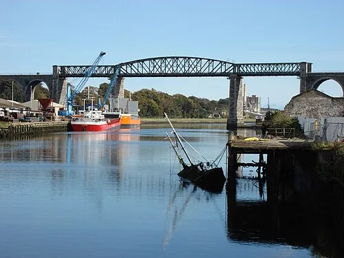 Boyne Viaduct Önemli yapı, County Louth22 km D
-
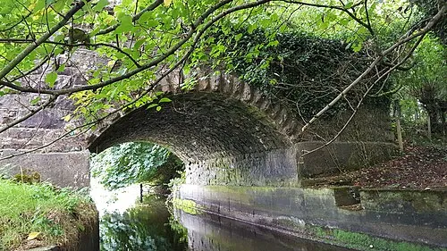 Lisclogher Bridge Önemli yapı, County Westmeath24 km B
-
Fieldstown Hill Dağ, County Louth23 km KD
Kaynaklar ve lisanslar
Verilerin son güncellenmesi: