Sternehøj
Situé dans Holstebro Kommune, Jutland-Central Coordonnées: 56°15′26″ N 8°22′22″ E
- Altitude
- 44 m
- au-dessus du niveau de la mer
- Heure locale
- UTC+01:00
- Europe/Copenhagen · UTC+01:00
À propos : Sternehøj
Sternehøj est une montagne. Situation : Holstebro Kommune, Jutland-Central. Altitude : 44 m.
En comparaison
- Langeskov : n° 166 sur 271 sommets par altitude
Villes et villages les plus proches
Sites et nature à proximité
Tout ce qui est proche-
Rødhøj Montagne, Herning Kommune15 km E
-
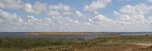 Fjandø Île, Holstebro Kommune15 km NO
-
Trehøje Montagne, Herning Kommune20 km SE
-
Tihøje Montagne, Herning Kommune19 km E
-
Tavlborg Høje Montagne, Herning Kommune22 km E
-
Finderup Rishøj Montagne, Ringkøbing-Skjern Kommune21 km S
-
Tophøj Montagne, Ringkøbing-Skjern Kommune23 km S
-
Næsø Site naturel, Ringkøbing-Skjern Kommune16 km SO
Sources et licences
Données mises à jour le: · 2 sources indépendantes