Innertkirchen
Situé dans Interlaken-Oberhasli District, Canton de Berne Coordonnées: 46°41′11″ N 8°21′24″ E
Le nom de ce lieu n'a pas encore été vérifié dans cette langue ; il est affiché sous sa forme d'origine.
- Population
- 1 069
- 1,1 k
- Altitude
- 1 712 m
- au-dessus du niveau de la mer
- Heure locale
- UTC+01:00
- Europe/Zurich · UTC+01:00
- Lieux rattachés
- 147
- classés sous Innertkirchen
À propos : Innertkirchen
Innertkirchen est une commune. Situation : Interlaken-Oberhasli District, Canton de Berne. Population : 1 069. Altitude : 1 712 m.
En comparaison
- Interlaken-Oberhasli District : n° 14 sur 28 lieux par population
- Localité plus grande la plus proche : Hasliberg, à 12 km (NO)
- 216 sites et lieux naturels à moins de 10 km Triftsee, Gläckblatten
- Recensés ici : Montagne: 102, Site naturel: 21, Village: 15, Lac: 9
Lieux : Innertkirchen
147 lieux-
Äbnisgrat Montagne
-
Alpligerstock Montagne
-
Alpligerstöckli Montagne
-
Bänzlouwistock Montagne
-
Bärglistock Montagne
-
Bättlerhoren Montagne
-
Bin der Chlempen Montagne
-
Bockberg Montagne
-
Bottigerdümen Montagne
-
Brunnenstock Montagne
-
Brunnenstock Montagne
-
Chipfestock Montagne
-
Chli Gletscherli Site naturel
-
Chlyne Tälli Montagne
-
Chlyn Wendestock Montagne
-
Chööbärgli Montagne
-
Dossengrat Montagne
-
Drosigletscherli Site naturel
-
Drosistock Montagne
-
Engstlensee Lac
-
Erggelihubel Montagne
-
Fahrnersegg Montagne
-
Feldmoos Village
-
Feldmoshubel Montagne
-
Fleschenhoren Montagne
-
Fleschenhubel Montagne
-
Fünffingerstöck Montagne
-
Furen Village
-
Gadenlouwisee Lac
-
Gadmen Village
-
Gadmerflue Montagne
-
Gallouwisteck Montagne
-
Gauligletscher Site naturel
-
Gaulisee Lac
-
Genthalhütten Village
-
Gigliegg Montagne
-
Gigligletscher Site naturel
-
Giglistock Montagne
-
Gläckblatten Montagne
-
Glogghüs Montagne
-
Glogghüser Montagne
-
Grätli Montagne
-
Graui Stöckli Montagne
-
Grienbärgli Montagne
-
Grienbärgligletscher Site naturel
-
Grund Village
-
Gummen Montagne
-
Gwächte Montagne
-
Gwächtenhorn Montagne
-
Gwärtler Montagne
-
Hangendgletscher Site naturel
-
Hangendgletscherhorn Montagne
-
Heuberg Montagne
-
Hienderstock Montagne
-
Hiendertelltihoren Montagne
-
Hiri Montagne
-
Hittenegg Montagne
-
Hohjegiburg Montagne
-
Hublen Montagne
-
Inder Urathubel Montagne
Sites et nature à proximité
Tout ce qui est proche-
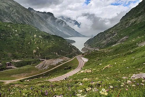 District d'Oberhasli Site naturel, Canton de Berne4,6 km O
-
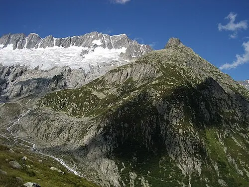 Dammastock Montagne, Göschenen6,9 km SE
Sources et licences
Données mises à jour le: