Pessada
Name in Landessprache: Πεσάδα
Liegt in Kefalonia, Kefallonia Regional Unit Koordinaten: 38°06′48″ N 20°34′42″ O
- Einwohner
- 246
- 246
- Höhe
- 94 m
- über dem Meeresspiegel
- Ortszeit
- UTC+02:00
- Europe/Athens · UTC+02:00
- Flughäfen
- EFL Kefalonia International Airport "Anna Pollatou"7 km
- ZTH Zakynthos International Airport "Dionysios Solomos"48 km
Über Pessada
Pessada ist ein Dorf. Lage: Kefalonia, Kefallonia Regional Unit. Einwohner: 246. Höhe: 94 m. Die beste Reisezeit: Mai, Oktober. Nächster Flughafen: Kefalonia International Airport "Anna Pollatou" (7 km). In der Nähe: Agios Andreas Milapidias monastery und Dionisi Kefallinias.
Fotos: Pessada
-
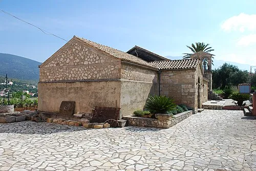
Agios Andreas Milapidias monastery Jean Housen · CC BY-SA 3.0

Einwohnerentwicklung von Pessada
| 1991 | 191 | |
|---|---|---|
| 2001 | 223 | |
| 2011 | 233 | |
| 2021 | 246 |
Volkszählungen und amtliche Schätzungen; Quelle: Wikidata.
Klima in Pessada
Beste Monate für BesichtigungenBeste Monate für Besichtigungen: Mai, Oktober.
Dieser Monat · November
Ein regenreicher Monat
Tag 18° · Nacht 12° · Regen 159 mm
- Wärmster Monat
- August (Tag 31°)
- Kältester Monat
- Januar (Nacht 7°)
- Nassester Monat
- November (159 mm)
- Trockenster Monat
- Juli (9 mm)
Balken: mittlere Monatstiefst- und -höchsttemperatur. Darunter: Niederschlag. Monatsmittel 1970–2000 bei etwa 18 km Auflösung, höhenkorrigiert. Hervorgehobene Monate sind mild und relativ trocken. Quelle: WorldClim 2.1 (CC BY 4.0).
Werte als Tabelle anzeigen
| Monat | Jan | Feb | Mär | Apr | Mai | Jun | Jul | Aug | Sep | Okt | Nov | Dez |
|---|---|---|---|---|---|---|---|---|---|---|---|---|
| Mittleres Maximum (°C) | 14° | 14° | 16° | 19° | 23° | 28° | 30° | 31° | 27° | 23° | 18° | 15° |
| Mittleres Minimum (°C) | 7° | 7° | 8° | 11° | 14° | 18° | 20° | 21° | 18° | 15° | 12° | 9° |
| Niederschlag (mm) | 122 | 116 | 86 | 64 | 28 | 13 | 9 | 13 | 42 | 113 | 159 | 152 |
Anreise nach Pessada
Nächster Flughafen ist Kefalonia International Airport "Anna Pollatou" (EFL), Luftlinie 7 km Richtung Westen. Nächste Großstadt ist Piräus, 270 km Richtung Osten.
Flughäfen
- Kefalonia International Airport "Anna Pollatou" (EFL) Kefallinia Island 7 kmWesten
- Zakynthos International Airport "Dionysios Solomos" (ZTH) Zakynthos 48 kmSüdosten
- Patras Araxos Agamemnon Airport (GPA) Patras 74 kmOsten
Großstädte in der Nähe
- Piräus Einwohner: 163.688 270 kmOsten
- Athen Einwohner: 664.046 277 kmOsten
Luftlinie; die Straßenentfernung ist länger. Flughafendaten: OurAirports.
Tagesausflüge ab Pessada
Im Umkreis von 100 km: 9 historische und kulturelle Stätten, 25 Seen, Flüsse und Küsten.
0–25 km8 Orte
- Kefalonia Insel 15 kmN
- Agios Andreas Milapidias monastery Sehenswürdigkeit 3 kmNW
- Panagia Kipouraion monastery Sehenswürdigkeit 23 kmNW
- Moni Theotokou Atrou Sehenswürdigkeit 16 kmO
25–60 km5 Orte
- Chlemoutsi Historische Stätte 55 kmSO
- Nisídes Falarídes Insel 52 kmNO
- Skartsoumbonisi Ithakis Insel 31 kmN
- Atheronisi Insel 30 kmNW
60–100 km21 Orte
- Lakopetra Beach Strand 80 kmO
- Askos islet Insel 72 kmNO
- Angynara islet Insel 66 kmNO
- Church of Panagia of Panaxiotissa at Gavrolimni Sehenswürdigkeit 97 kmO
Luftlinie.
Sehenswertes & Natur in der Nähe
Alles in der Nähe-
Agios Andreas Milapidias monastery Sehenswürdigkeit, Kefalonia2,9 km NW
-
Dionisi Kefallinias Insel, Ionische Inseln4,3 km SW
-
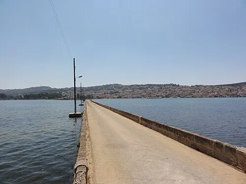 De-Bosset-Brücke Wahrzeichen, Kefalonia9,9 km NW
-
Moni Theotokou Atrou Sehenswürdigkeit, Kefalonia16 km O
-
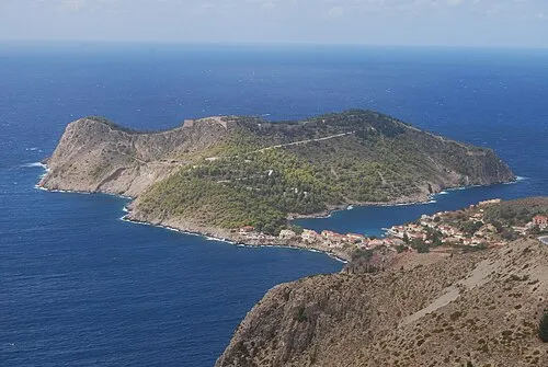 Kefalonia Insel, Kefallonia Regional Unit15 km N
-
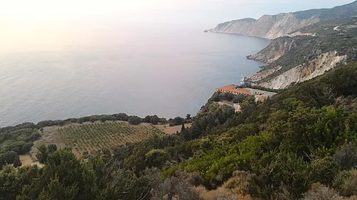 Panagia Kipouraion monastery Sehenswürdigkeit, Kefalonia23 km NW
Weitere Städte und Orte in Kefalonia
-
 Simotata, Kefalonia Dorf, Kefalonia5,8 km O
-
Miniá Dorf, Kefalonia6,9 km W
-
Epanochori Dorf, Kefalonia5,3 km N
-
Menegata, Kefalonia Dorf, Kefalonia6,1 km NW
-
Razata Dorf, Kefalonia9,4 km NW
Quellen & Lizenzen
Daten zuletzt aktualisiert: · 2 unabhängige Quellen