Bloody Foreland
Liegt in County Donegal, Provinz Ulster Koordinaten: 55°08′12″ N 8°15′45″ W
Der Name dieses Ortes wurde in dieser Sprache noch nicht verifiziert und wird in der Originalform angezeigt.
- Höhe
- 314 m
- über dem Meeresspiegel
- Ortszeit
- UTC+00:00
- Europe/Dublin · UTC+00:00
- Flughäfen
- CFN Donegal Airport11 km
- LDY City of Derry Airport71 km
Über Bloody Foreland
Bloody Foreland ist ein Berg. Lage: County Donegal, Provinz Ulster. Höhe: 314 m. Nächster Flughafen: Donegal Airport (11 km). In der Nähe: Inishsirrer und Magheraroarty Mountain.
Klima in Bloody Foreland
Dieser Monat · November
Ein regenreicher Monat
Tag 8° · Nacht 4° · Regen 195 mm
- Wärmster Monat
- August (Tag 16°)
- Kältester Monat
- Februar (Nacht 1°)
- Nassester Monat
- Januar (200 mm)
- Trockenster Monat
- Mai (97 mm)
Balken: mittlere Monatstiefst- und -höchsttemperatur. Darunter: Niederschlag. Monatsmittel 1970–2000 bei etwa 18 km Auflösung, höhenkorrigiert. Hervorgehobene Monate sind mild und relativ trocken. Quelle: WorldClim 2.1 (CC BY 4.0).
Werte als Tabelle anzeigen
| Monat | Jan | Feb | Mär | Apr | Mai | Jun | Jul | Aug | Sep | Okt | Nov | Dez |
|---|---|---|---|---|---|---|---|---|---|---|---|---|
| Mittleres Maximum (°C) | 6° | 6° | 7° | 9° | 12° | 14° | 15° | 16° | 14° | 11° | 8° | 7° |
| Mittleres Minimum (°C) | 1° | 1° | 2° | 3° | 5° | 8° | 10° | 10° | 8° | 6° | 4° | 2° |
| Niederschlag (mm) | 200 | 142 | 149 | 104 | 97 | 101 | 124 | 139 | 162 | 198 | 195 | 196 |
Anreise nach Bloody Foreland
Nächster Flughafen ist Donegal Airport (CFN), Luftlinie 11 km Richtung Südwesten. Nächste Großstadt ist Belfast, 162 km Richtung Osten.
Flughäfen
- Donegal Airport (CFN) Donegal 11 kmSüdwesten
- City of Derry Airport (LDY) Derry, Derry and Strabane 71 kmOsten
- Islay Airport (ILY) Isle of Islay, Argyll and Bute 141 kmNordosten
Großstädte in der Nähe
- Belfast Einwohner: 348.005 162 kmOsten
- Dublin Einwohner: 1 Mio. 240 kmSüdosten
- Glasgow Einwohner: 626.410 266 kmOsten
- Limerick Einwohner: 102.287 276 kmSüden
- Edinburgh Einwohner: 514.990 332 kmOsten
Luftlinie; die Straßenentfernung ist länger. Flughafendaten: OurAirports.
Tagesausflüge ab Bloody Foreland
Im Umkreis von 100 km: 54 historische und kulturelle Stätten, 622 Naturorte, 522 Seen, Flüsse und Küsten.
0–25 km225 Orte
- Umfin Island Insel 8 kmSW
- Tory Island Insel 14 kmN
- Rutland Island Insel 22 kmSW
- Inishkeeragh Insel 25 kmSW
25–60 km496 Orte
- Island Roy Insel 31 kmO
- Lisfannon Beach Strand 50 kmO
- Gull Island Insel 45 kmSW
- Rooney’s Island Insel 58 kmS
60–100 km477 Orte
- Portstewart Beach Strand 98 kmO
- Benone Beach Strand 88 kmO
- Portstewart Strand Strand 96 kmO
- Strandhill Beach Strand 99 kmS
Luftlinie.
Nächstgelegene Städte und Dörfer
-
Brinlack Dorf, County Donegal2,6 km SW
-
Meenlaragh Dorf, County Donegal4,9 km O
-
Doirí Beaga Dorf, County Donegal6,2 km S
-
Gweedore Dorf, County Donegal9,8 km S
-
Falcarragh Dorf, County Donegal10 km O
-
An Bun Beag Dorf, County Donegal8,9 km S
Sehenswertes & Natur in der Nähe
Alles in der Nähe-
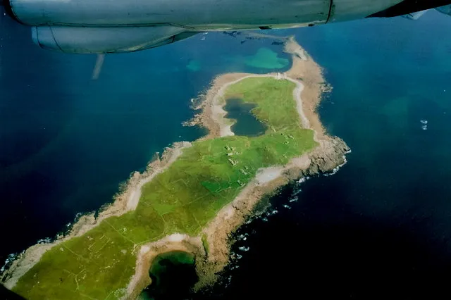 Inishsirrer Insel, County Donegal5 km SW
-
Magheraroarty Mountain Berg, County Donegal4,5 km SO
-
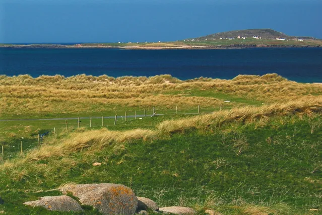 Inishmeane Insel, County Donegal6 km SW
-
Tievealehid Berg, County Donegal7,2 km SO
-
Dooey Naturgebiet, County Donegal8 km O
-
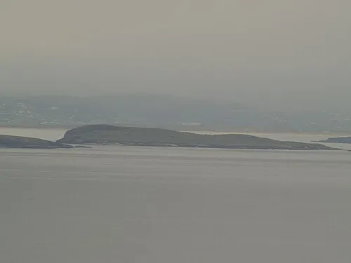 Inishdooey Insel, County Donegal8,8 km NO
-
Bo Island Insel, County Donegal7,9 km SW
-
Carnboy Naturgebiet, County Donegal9,7 km SW
Mehr Natur in Irland
-
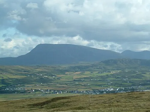 Muckish Mountain Berg, County Donegal17 km O
-
Moylecrock Berg, County Donegal14 km SO
-
Grogan More Berg, County Donegal14 km S
-
Black Burrow Berg, County Donegal15 km O
-
Crocknafarragh Berg, County Donegal16 km S
-
Ballyboe Mountain Berg, County Donegal16 km O
Quellen & Lizenzen
Daten zuletzt aktualisiert: