- Elevation
- 468 m
- above sea level
- Local time
- UTC+03:00
- Europe/Istanbul · UTC+03:00
- Airports
- GNY Şanlıurfa GAP Airport34 km
- ADF Adıyaman Airport73 km
About Çayiçi Deresi
Çayiçi Deresi is a river. Location: Şanlıurfa Province, Turkey. The best months to visit are April. The nearest airport is Şanlıurfa GAP Airport (34 km). Nearby sights include Gory Germush and Yanış Tepesi.
Climate of Çayiçi Deresi
Best months for sightseeingBest months for sightseeing: April.
This month · November
Outside the best season
Day 19° · Night 7° · Rain 44 mm
Better nearby cities in November
- Suruç · 40 km southwest20°
- Viranşehir · 82 km east18°
- Kızıltepe · 155 km east19°
- Hottest month
- July (day 40°)
- Coldest month
- January (night 2°)
- Wettest month
- December (77 mm)
- Driest month
- July (1 mm)
Bars: average monthly low and high temperature. Below: precipitation. Monthly averages for 1970–2000 at about 18 km resolution, adjusted for elevation. Highlighted months are mild and relatively dry. Source: WorldClim 2.1 (CC BY 4.0).
Show values as a table
| Month | Jan | Feb | Mar | Apr | May | Jun | Jul | Aug | Sep | Oct | Nov | Dec |
|---|---|---|---|---|---|---|---|---|---|---|---|---|
| Average high (°C) | 11° | 13° | 17° | 23° | 30° | 36° | 40° | 40° | 35° | 28° | 19° | 12° |
| Average low (°C) | 2° | 3° | 6° | 10° | 16° | 21° | 25° | 24° | 20° | 14° | 7° | 4° |
| Precipitation (mm) | 74 | 66 | 67 | 47 | 30 | 4 | 1 | 1 | 2 | 26 | 44 | 77 |
Other places to visit in this season: April
How to get to Çayiçi Deresi
The nearest airport is Şanlıurfa GAP Airport (GNY), 34 km to the north as the crow flies. The nearest large city is Sanliurfa, 4 km to the northwest.
Airports
- Şanlıurfa GAP Airport (GNY) Şanlıurfa 34 kmnorth
- Adıyaman Airport (ADF) Adıyaman 73 kmnorthwest
- Gaziantep Oğuzeli International Airport (GZT) Gaziantep 122 kmwest
Nearby large cities
- Sanliurfa Population: 449.5K 4 kmnorthwest
- Suruç Population: 101.2K 40 kmsouthwest
- Siverek Population: 175.3K 80 kmnortheast
- Viranşehir Population: 154.2K 83 kmeast
- Adıyaman Population: 290.9K 85 kmnorthwest
Straight-line distances; road distances are longer. Airport data: OurAirports.
Day trips from Çayiçi Deresi
Within 100 km: 40 historic and cultural sites, 161 natural sites, 113 lakes, rivers and coasts.
0–25 km26 places
- Kaşmer Dağı Mountain 16 kmNW
- Kara Tepe Mountain 14 kmW
- Gora Khalladzhmansur Mountain 21 kmSW
- Çılktaş Tepesi Mountain 20 kmSW
25–60 km94 places
- Atatürk Barajı Lake 53 kmN
- Tektek Dağları Mountain 48 kmE
- Gora Shendzheri Mountain 37 kmS
- Gora Korchik Mountain 33 kmN
60–100 km194 places
- Soydan Sulama Göleti Lake 99 kmNE
- Topraksu Sulama Göleti Lake 82 kmE
- Çataltepe Sulama Göleti Lake 70 kmN
- Mülk Sulama Göleti Lake 68 kmN
Straight-line distances.
Nearest towns and villages
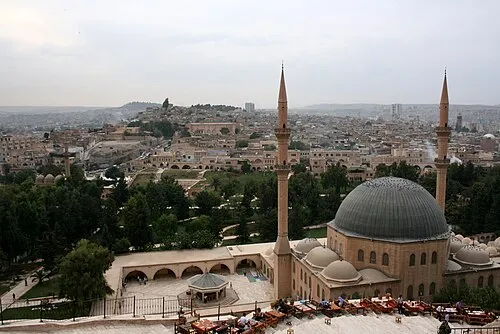
Nearby attractions & nature
Everything nearby-
Gory Germush Mountain, Şanlıurfa Province7.9 km NE
-
Yanış Tepesi Mountain, Haliliye8.2 km N
-
Zülmiye Camii Attraction, Eyyübiye4.1 km W
-
Der-Yakup Kilisesi Attraction, Eyyübiye4.1 km W
-
Gora Chardak Mountain, Eyyübiye8 km W
-
Urfa Kalesi Historic site, Eyyübiye4.2 km W
-
Gora Alaklytepe Mountain, Eyyübiye9.9 km SW
-
Mucit Deresi River, Şanlıurfa Province9.8 km E
Sources & licences
Data last updated: