Ceylanpınar Bucağı
Located in Şanlıurfa Province, Turkey Coordinates: 36°50′34″ N 40°02′35″ E
- Elevation
- 359 m
- above sea level
- Local time
- UTC+03:00
- Europe/Istanbul · UTC+03:00
- Airports
- MQM Mardin Airport67 km
- KAC Qamishli International Airport104 km
About Ceylanpınar Bucağı
Ceylanpınar Bucağı is a municipality. Location: Şanlıurfa Province, Turkey. Elevation: 359 m. The best months to visit are April, November. The nearest airport is Mardin Airport (67 km). Nearby sights include Aliyerelli Deresi and Büyükkepez Tepesi.
Climate of Ceylanpınar Bucağı
Best months for sightseeingBest months for sightseeing: April, November.
This month · November
A good month to visit
Day 20° · Night 5° · Rain 34 mm
- Hottest month
- July (day 41°)
- Coldest month
- January (night 1°)
- Wettest month
- January (62 mm)
- Driest month
- July (1 mm)
Bars: average monthly low and high temperature. Below: precipitation. Monthly averages for 1970–2000 at about 18 km resolution, adjusted for elevation. Highlighted months are mild and relatively dry. Source: WorldClim 2.1 (CC BY 4.0).
Show values as a table
| Month | Jan | Feb | Mar | Apr | May | Jun | Jul | Aug | Sep | Oct | Nov | Dec |
|---|---|---|---|---|---|---|---|---|---|---|---|---|
| Average high (°C) | 11° | 14° | 18° | 24° | 31° | 37° | 41° | 40° | 36° | 29° | 20° | 13° |
| Average low (°C) | 1° | 2° | 5° | 9° | 14° | 18° | 22° | 21° | 16° | 11° | 5° | 2° |
| Precipitation (mm) | 62 | 55 | 59 | 47 | 24 | 4 | 1 | 1 | 2 | 20 | 34 | 57 |
How to get to Ceylanpınar Bucağı
The nearest airport is Mardin Airport (MQM), 67 km to the northeast as the crow flies. The nearest large city is Viranşehir, 49 km to the northwest.
Airports
- Mardin Airport (MQM) Mardin 67 kmnortheast
- Qamishli International Airport (KAC) Qamishli 104 kmeast
- Diyarbakır Airport (DIY) Diyarbakır 118 kmnorth
Nearby large cities
- Viranşehir Population: 154.2K 49 kmnorthwest
- Kızıltepe Population: 150.2K 61 kmnortheast
- Mardin Population: 129.9K 81 kmnortheast
- Sanliurfa Population: 449.5K 117 kmwest
- Diyarbakır Population: 1.8M 120 kmnorth
Straight-line distances; road distances are longer. Airport data: OurAirports.
Day trips from Ceylanpınar Bucağı
Within 100 km: 56 historic and cultural sites, 150 natural sites, 57 lakes, rivers and coasts.
0–25 km13 places
- Kara Tepe Mountain 18 kmN
- Fazlı Tepe Mountain 7 kmW
- Büyükkepez Tepesi Mountain 4 kmN
- Gora Kyuchyuk-Kebes Mountain 8 kmN
25–60 km53 places
- Topraksu Sulama Göleti Lake 56 kmNW
- Tilki Tepesi Mountain 53 kmW
- Kirdut Tepesi Mountain 49 kmN
- Kartal Tepesi Mountain 30 kmNW
60–100 km197 places
- Göksu Barajı Lake 98 kmN
- Dumluca Baraj Göleti Lake 65 kmN
- Künreş Sulama Göleti Lake 79 kmN
- Şerefli Sulama Göleti Lake 77 kmN
Straight-line distances.
Nearby attractions & nature
Everything nearby-
Aliyerelli Deresi River, Şanlıurfa Province3.5 km W
-
Büyükkepez Tepesi Mountain, Ceylanpınar İlçesi4.4 km N
-
Fazlı Tepe Mountain, Ceylanpınar İlçesi6.6 km W
-
Gora Kyuchyuk-Kebes Mountain, Ceylanpınar İlçesi8 km N
-
Pervane Tepeleri Mountain, Ceylanpınar İlçesi16 km NE
-
Çatalca Mountain, Kızıltepe İlçesi21 km NE
-
Kara Tepe Mountain, Ceylanpınar İlçesi18 km N
-
Harbetitahan Historic site, Ceylanpınar İlçesi23 km NW
Other cities and towns in Şanlıurfa Province
-
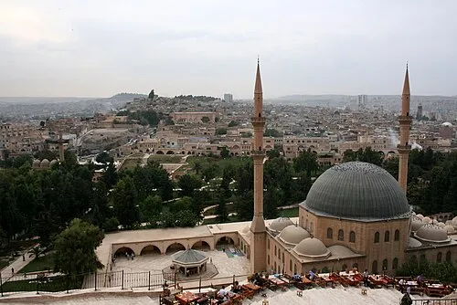 Sanliurfa City, Şanlıurfa Province117 km W
-
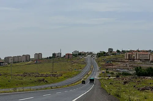 Siverek City, Siverek İlçesi120 km NW
-
Viranşehir City, Viranşehir İlçesi49 km NW
-
Harran City, Harran İlçesi90 km W
-
Suruç City, Suruç İlçesi145 km W
-
Viranşehir Bucağı Municipality, Şanlıurfa Province49 km NW
Sources & licences
Data last updated: