Afyonkarahisar Province
Local name: Afyonkarahisar ili
Located in Turkey Coordinates: 38°45′00″ N 30°40′00″ E
- Population
- 747,555
- 747.6K
- Elevation
- 1,060 m
- above sea level
- Local time
- UTC+03:00
- Europe/Istanbul · UTC+03:00
- Places inside
- 139
- listed under Afyonkarahisar Province
About Afyonkarahisar Province
Afyonkarahisar Province is a region. Location: Turkey. Population: 747,555.
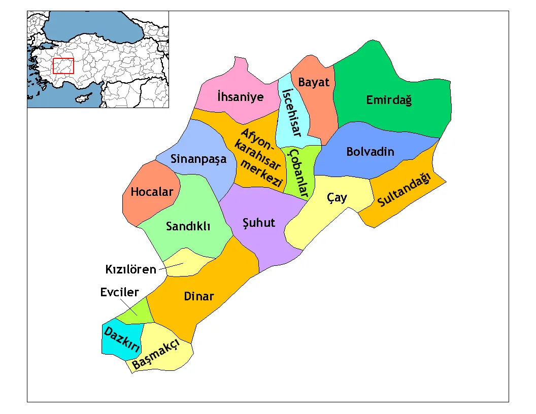
Afyonkarahisar Province (Turkish: Afyonkarahisar ili), often shortened to Afyon Province, is a province in western Turkey. Its area is 14,016 km2, and its population is 747,555 (2022). The provincial capital is Afyonkarahisar. Adjacent provinces are Kütahya to the northwest, Uşak to the west, Denizli to the southwest, Burdur to the south, Isparta to the southeast, Konya to the east, and Eskişehir to the north.
Read more on Wikipedia Text: Wikipedia contributors · CC BY-SA 4.0 · shortened
At a glance
- Area
- 14,230 km²
Source: Wikidata
In comparison
- 7 sights and natural places within 10 km Yelönü Tepesi, Derbent Boğazı
- Listed here: River: 49, Natural site: 33, Municipality: 20, District: 18
Places in Afyonkarahisar Province
139 places-
Şeker Çeşmesi Natural site
-
Sel Çayı River
-
Seme Çeşmesi Natural site
-
Seyrangah Tepesi Mountain
-
Sinanpaşa Bucağı Municipality
-
Sıtma Pınarı Natural site
-
Şuhut Bucağı Municipality
-
Şuhut Çayı River
-
Sultandağı Bucağı Municipality
-
Ulu Dere River
-
Umraniye Bucağı Municipality
-
Yakaağıl Deresi River
-
Yeldeğirmeni Dağı Mountain
-
Yeldeliği Tepesi Mountain
-
Yenice Çeşmesi Natural site
-
Yeni Çeşme Natural site
-
Yenidoğan Village
-
Yürük Çeşmesi Natural site
-
Zinar Deresi River
Largest cities and towns
Nature and heritage in Afyonkarahisar Province
-
Kumalar Dağı Mountain, Sandıklı İlçesi
-
Ulu Tepe Mountain, Şuhut İlçesi
-
Kükürtdağı Tepesi Mountain, Sandıklı İlçesi
-
Kocakavak Tepe Mountain, İhsaniye İlçesi
-
Kartınçal Tepesi Mountain, Bayat İlçesi
-
Başyurt Tepesi Mountain, Bolvadin İlçesi
Sources & licences
Data last updated: · 2 independent sources