Karabük Province
Local name: Karabük ili
Located in Turkey Coordinates: 41°15′00″ N 32°30′00″ E
- Population
- 252,058
- 252.1K
- Elevation
- 1,019 m
- above sea level
- Local time
- UTC+03:00
- Europe/Istanbul · UTC+03:00
- Places inside
- 68
- listed under Karabük Province
About Karabük Province
Karabük Province is a region. Location: Turkey. Population: 252,058.
Karabük Province (Turkish: Karabük ili) is a landlocked province in the northern part of Anatolia (northern central Turkey), located about 200 km (124 mi) north of Ankara, 115 km (71 mi) away from Zonguldak and 113 km (70 mi) away from Kastamonu. Its area is 4,142 km2, and its population is 252,058 (2022). The main city is Karabük which is located about 100 km (62 mi) south of the Black Sea coast.
Read more on Wikipedia Text: Wikipedia contributors · CC BY-SA 4.0 · shortened
At a glance
- Area
- 2,420 km²
Source: Wikidata
In comparison
- 6 sights and natural places within 10 km Karakaya Tepesi, Uluziyaret Tepe
- Listed here: River: 36, Village: 20, District: 6, Municipality: 4
Places in Karabük Province
68 places-
Şimşir Boğazı Natural site
-
Şimşir Deresi River
-
Tarlabaşı Deresi River
-
Taşcıdeğirmen Çayı River
-
Üçbaş Deresi River
-
Uzunöz Deresi River
-
Yeşilköy Village
-
Zorköy Deresi River
Largest cities and towns
-
Karabük City, Karabuk125.4K
-
Safranbolu City, Safranbolu District35.2K
-
Ovacık City, Ovacık District5.1K
-
Bostanbükü Town, Safranbolu District5.6K
-
Cumayanı Village, Karabuk3.1K
-
Yazıköy Village, Safranbolu District4.2K
-
Gözyeri Town, Eskipazar District8.3K
-
Zopran Village, Karabuk2.5K
Nature and heritage in Karabük Province
-
Uzunçam Tepesi Mountain, Yenice District
-
Pendekli Tepesi Mountain, Yenice District
-
Kel Tepe Mountain, Karabuk
-
Hacıdede Tepesi Mountain, Karabuk
-
Göktepe Mountain, Ovacık District
-
Dümek Tepesi Mountain, Yenice District
Other regions in Turkey
-
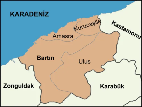 Bartın Province Region, Turkey37 km N
-
Zonguldak Province Region, Turkey56 km W
-
Yenice District District, Karabük Province14 km W
-
Safranbolu District District, Karabük Province17 km E
-
Gökçebey District District, Zonguldak Province30 km W
-
Karabuk District, Karabük Province14 km SE
Sources & licences
Data last updated: · 2 independent sources