Dalaas
Situé dans Bludenz District, Vorarlberg Coordonnées: 47°09′24″ N 10°02′11″ E
Le nom de ce lieu n'a pas encore été vérifié dans cette langue ; il est affiché sous sa forme d'origine.
- Population
- 1 585
- 1,6 k
- Altitude
- 2 305 m
- au-dessus du niveau de la mer
- Heure locale
- UTC+01:00
- Europe/Vienna · UTC+01:00
- Lieux rattachés
- 50
- classés sous Dalaas
À propos : Dalaas
Dalaas est une commune. Situation : Bludenz District, Vorarlberg. Population : 1 585. Altitude : 2 305 m.
En comparaison
- Bludenz District : n° 13 sur 29 lieux par population
- Localité plus grande la plus proche : Bartholomäberg, à 11 km (SO)
- 142 sites et lieux naturels à moins de 10 km Gamsbodenspitze, Tannecker
- Recensés ici : Montagne: 41, Village: 7, Lac: 2
Lieux : Dalaas
50 lieux-
Dalaas Village981
-
Wald am Arlberg Village616
-
Allhöhe Montagne
-
Ausserwald Village
-
Fensterlewand Montagne
-
Flexenspitze Montagne
-
Formaletsch Montagne
-
Formarin-Rothorn Montagne
-
Formarin See Lac
-
Formarin Seekopf Montagne
-
Gamsbodenspitze Montagne
-
Ganahlskopf Montagne
-
Ganteck Village
-
Glongspitze Montagne
-
Grafenspitze Montagne
-
Grubenjochspitze Montagne
-
Gümplekopf Montagne
-
Hinterer Geißkopf Montagne
-
Hirschenspitze Montagne
-
Innerwald Village
-
Johanneskopf Montagne
-
Kretzenstein Montagne
-
Madloch Spitze Montagne
-
Mählsack Montagne
-
Marias Village
-
Mittag Spitze Montagne
-
Mutten Village
-
Obere Grätligrat Spitze Montagne
-
Oberer Schafberg Montagne
-
Obere Wildgrubenspitze Montagne
-
Östliche Plattnitzerjochspitze Montagne
-
Pfaffeneck Montagne
-
Plattnitzer Jochspitze Montagne
-
Pöngertlekopf Montagne
-
Roggalspitze Montagne
-
Rote Wand Montagne
-
Saladina Spitze Montagne
-
Spulleralpkopf Montagne
-
Spullers Bühel Montagne
-
Spullerschafberg Montagne
-
Spullersee Lac
-
Südlicher Formarin-Roßkopf Montagne
-
Tannecker Montagne
-
Untere Grätlisgratspitze Montagne
-
Untere Wildgrubenspitze Montagne
-
Vorderer Geißkopf Montagne
-
Wasen Spitze Montagne
-
Zuger Mittagspitze Montagne
-
Zwölferköpfli Montagne
Sites et nature à proximité
Tout ce qui est proche-
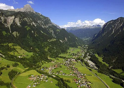 Klostertal Site naturel, Vorarlberg4,8 km SO
-
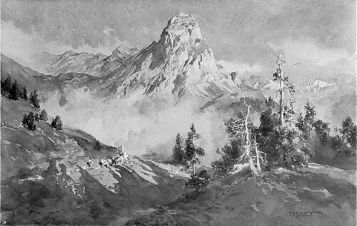 Roggelskopf Montagne, Innerbraz6 km O
-
Schafberg Montagne, Innerbraz6,6 km O
-
Betteltritt Montagne, Sonntag6,3 km NO
Sources et licences
Données mises à jour le: