Sonntag
Situé dans Bludenz District, Vorarlberg Coordonnées: 47°14′00″ N 9°55′00″ E
Le nom de ce lieu n'a pas encore été vérifié dans cette langue ; il est affiché sous sa forme d'origine.
- Population
- 702
- 702
- Altitude
- 1 124 m
- au-dessus du niveau de la mer
- Heure locale
- UTC+01:00
- Europe/Vienna · UTC+01:00
- Lieux rattachés
- 52
- classés sous Sonntag
À propos : Sonntag
Sonntag est une commune. Situation : Bludenz District, Vorarlberg. Population : 702. Altitude : 1 124 m.
En comparaison
- Bludenz District : n° 21 sur 29 lieux par population
- Localité plus grande la plus proche : Raggal, à 4 km (S)
- 137 sites et lieux naturels à moins de 10 km Grosses Walsertal, Pfarrkirche Fontanella
- Recensés ici : Montagne: 33, Village: 16, Cours d’eau: 2, Quartier: 1
Lieux : Sonntag
52 lieux-
Buchholz Village147
-
Boden Village99
-
Boden-Flecken Village77
-
Garsella Village70
-
Seeberg Village68
-
Buchboden Village62
-
Türtsch Village38
-
Sand Village15
-
Bühl Quartier8
-
Litze Village8
-
Stein Village7
-
Bregenzer Village5
-
Studa Village2
-
Betteltritt Montagne
-
Bettlerspitze Montagne
-
Bickelwald Village
-
Bratschenkopf Montagne
-
Breithorn Montagne
-
Diesner Höhe Montagne
-
Feuerstein Montagne
-
Gadnerköpfe Montagne
-
Garmil Montagne
-
Glattjöchlspitze Montagne
-
Glattmahd Montagne
-
Guggernülli Montagne
-
Hirschenspitz Montagne
-
Hochberg Montagne
-
Huttlaspitze Montagne
-
Ischkarneialpe Village
-
Jungfernspitze Montagne
-
Kilkaschrofen Montagne
-
Klesenzaalpe Village
-
Klesenza Hörner Montagne
-
Kunkelspitze Montagne
-
Matonakopf Montagne
-
Misthaufen Montagne
-
Muttawängli Spitz Montagne
-
Östliches Klasenzahorn Montagne
-
Plattabach Cours d’eau
-
Pragimelbach Cours d’eau
-
Rothorn Montagne
-
Ruchwannenkopf Montagne
-
Schlappiner Spitze Montagne
-
Schönbühel Montagne
-
Schöneberg Montagne
-
Schwarze Wand Montagne
-
Sonntag Village
-
Steinmayer Montagne
-
Wandfluh Montagne
-
Wangspitze Montagne
-
Westl.Johanneskopf Montagne
-
Zitterklapfen Montagne
Sites et nature à proximité
Tout ce qui est proche-
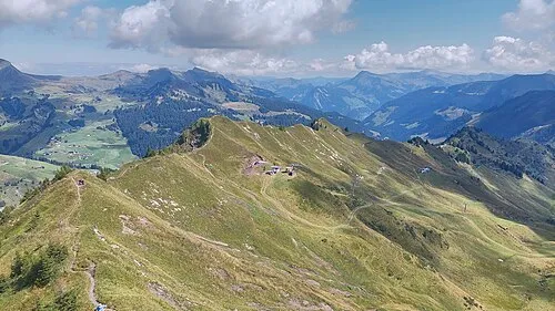 Zwölfergrat Montagne, Fontanella5 km NO
-
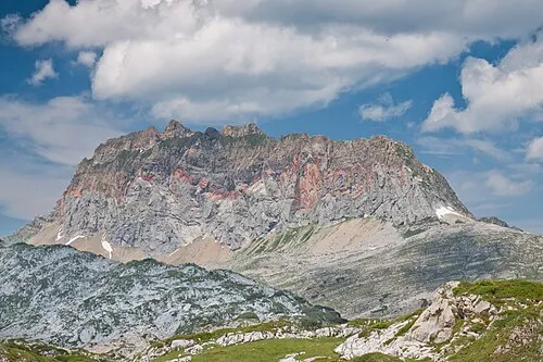 Rote Wand Montagne, Dalaas7,4 km SE
Sources et licences
Données mises à jour le: