Sonntag
Located in Bludenz District, Vorarlberg Coordinates: 47°14′00″ N 9°55′00″ E
- Population
- 702
- 702
- Elevation
- 1,124 m
- above sea level
- Local time
- UTC+01:00
- Europe/Vienna · UTC+01:00
- Places inside
- 52
- listed under Sonntag
About Sonntag
Sonntag is a municipality. Location: Bludenz District, Vorarlberg. Population: 702. Elevation: 1,124 m.
In comparison
- No. 21 of 29 places in Bludenz District by population
- Nearest larger town: Raggal, 4 km S
- 137 sights and natural places within 10 km Grosses Walsertal, Pfarrkirche Fontanella
- Listed here: Mountain: 33, Village: 16, River: 2, Neighbourhood: 1
Places in Sonntag
52 places-
Buchholz Village147
-
Boden Village99
-
Boden-Flecken Village77
-
Garsella Village70
-
Seeberg Village68
-
Buchboden Village62
-
Türtsch Village38
-
Sand Village15
-
Bühl Neighbourhood8
-
Litze Village8
-
Stein Village7
-
Bregenzer Village5
-
Studa Village2
-
Betteltritt Mountain
-
Bettlerspitze Mountain
-
Bickelwald Village
-
Bratschenkopf Mountain
-
Breithorn Mountain
-
Diesner Höhe Mountain
-
Feuerstein Mountain
-
Gadnerköpfe Mountain
-
Garmil Mountain
-
Glattjöchlspitze Mountain
-
Glattmahd Mountain
-
Guggernülli Mountain
-
Hirschenspitz Mountain
-
Hochberg Mountain
-
Huttlaspitze Mountain
-
Ischkarneialpe Village
-
Jungfernspitze Mountain
-
Kilkaschrofen Mountain
-
Klesenzaalpe Village
-
Klesenza Hörner Mountain
-
Kunkelspitze Mountain
-
Matonakopf Mountain
-
Misthaufen Mountain
-
Muttawängli Spitz Mountain
-
Östliches Klasenzahorn Mountain
-
Plattabach River
-
Pragimelbach River
-
Rothorn Mountain
-
Ruchwannenkopf Mountain
-
Schlappiner Spitze Mountain
-
Schönbühel Mountain
-
Schöneberg Mountain
-
Schwarze Wand Mountain
-
Sonntag Village
-
Steinmayer Mountain
-
Wandfluh Mountain
-
Wangspitze Mountain
-
Westl.Johanneskopf Mountain
-
Zitterklapfen Mountain
Nearby attractions & nature
Everything nearby-
Pfarrkirche Fontanella Attraction, Fontanella1.7 km N
-
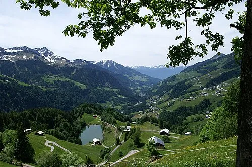 Grosses Walsertal Natural site, Vorarlberg1.3 km E
-
Seewaldsee Lake, Fontanella1.7 km NE
-
Hutlabach River, Vorarlberg3.1 km E
-
Gronggenkopf Mountain, Raggal2.8 km SE
-
Kellaspitze Mountain, Raggal3 km SW
-
Blasenka Mountain, Fontanella3.4 km NE
-
Maruler Guggernülli Mountain, Raggal3.7 km SW
Sources & licences
Data last updated: