St. Stephen-in-Brannel
Bulunduğu yer: Cornwall, İngiltere Koordinatlar: 50°21′09″ K 4°52′43″ B
Bu yerin adı bu dilde henüz doğrulanmadı; özgün haliyle gösteriliyor.
- Rakım
- 147 m
- deniz seviyesinden
- Yerel saat
- UTC+00:00
- Europe/London · UTC+00:00
- İçindeki yerler
- 31
- St. Stephen-in-Brannel altında listelenen
St. Stephen-in-Brannel hakkında
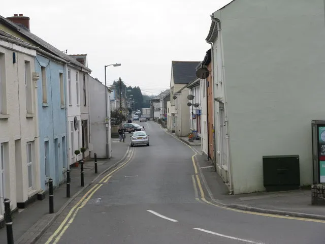
St. Stephen-in-Brannel bir beldedir. Konum: Cornwall, İngiltere. Rakım: 147 m.
Karşılaştırmalı bilgiler
- Daha büyük en yakın yerleşim: Saint Stephen, 2 km GB
- 10 km içinde 35 gezilecek ve doğal yer St Stephen's Beacon, Goonamarris North Hill
- Burada listelenenler: Köy / Mahalle: 23, Dağ: 8
St. Stephen-in-Brannel içindeki yerler
31 yer-
Nanpean Köy / Mahalle2,6 B
-
Saint Stephen Köy / Mahalle2,3 B
-
Carloggas Köy / Mahalle
-
Carpalla Köy / Mahalle
-
Central Treviscoe Köy / Mahalle
-
Coombe Köy / Mahalle
-
Foxhole Köy / Mahalle
-
Goonabarn Köy / Mahalle
-
Goonamarris Köy / Mahalle
-
Goverseth Köy / Mahalle
-
Hendra Köy / Mahalle
-
High Street Köy / Mahalle
-
Hornick Köy / Mahalle
-
Lanjeth Köy / Mahalle
-
Little Treviscoe Köy / Mahalle
-
Longstone Downs Dağ
-
Meledor Köy / Mahalle
-
Rostowrack Downs Dağ
-
Stepaside Köy / Mahalle
-
Terras Köy / Mahalle
-
Trelion Köy / Mahalle
-
Treneague Köy / Mahalle
-
Trethosa Köy / Mahalle
-
Treveiscoe Köy / Mahalle
-
Treviscoe Hill Dağ
-
Watch Hill Dağ
-
Whitemoor Köy / Mahalle
-
Whitemoor Dağ
Cornwall içindeki diğer şehir ve kasabalar
Kaynaklar ve lisanslar
Verilerin son güncellenmesi: