- Höhe
- 2.332 m
- über dem Meeresspiegel
- Ortszeit
- UTC+01:00
- Europe/Paris · UTC+01:00
- Flughäfen
- AJA Ajaccio Napoléon Bonaparte airport42 km
- CLY Calvi Sainte Catherine Airport42 km
Über Pointe Diciotte
Pointe Diciotte ist ein Berg. Lage: Corte, Arrondissement of Corte. Höhe: 2.332 m. Die beste Reisezeit: Juli–August. Nächster Flughafen: Ajaccio Napoléon Bonaparte airport (42 km). In der Nähe: Pointe Lattiniccia und Monte Cardo.
Fotos: Pointe Diciotte
-
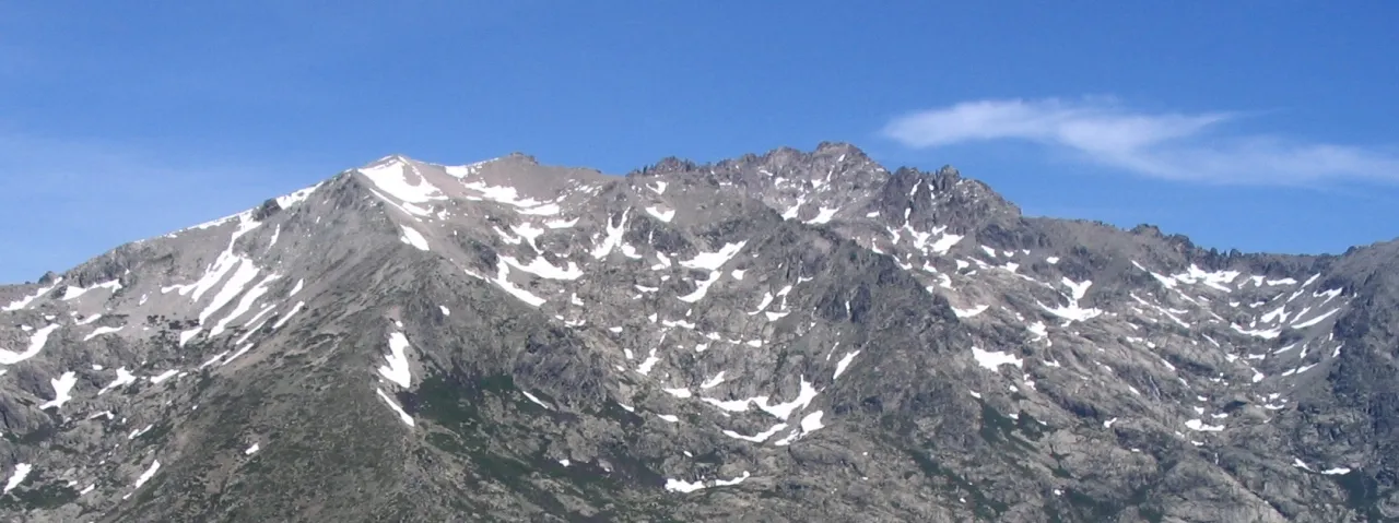
Monte Rotondo Simon Taupenas · CC BY-SA 2.5 -
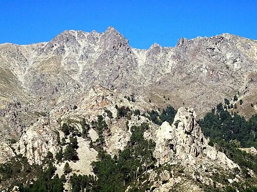
Monte Cardo Pierre Bona · CC BY-SA 3.0


Klima in Pointe Diciotte
Beste Monate für BesichtigungenBeste Monate für Besichtigungen: Juli–August.
Dieser Monat · November
Ein regenreicher Monat
Tag 2° · Nacht -3° · Regen 121 mm
- Wärmster Monat
- Juli (Tag 15°)
- Kältester Monat
- Februar (Nacht -7°)
- Nassester Monat
- November (121 mm)
- Trockenster Monat
- Juli (19 mm)
Balken: mittlere Monatstiefst- und -höchsttemperatur. Darunter: Niederschlag. Monatsmittel 1970–2000 bei etwa 18 km Auflösung, höhenkorrigiert. Hervorgehobene Monate sind mild und relativ trocken. Quelle: WorldClim 2.1 (CC BY 4.0).
Werte als Tabelle anzeigen
| Monat | Jan | Feb | Mär | Apr | Mai | Jun | Jul | Aug | Sep | Okt | Nov | Dez |
|---|---|---|---|---|---|---|---|---|---|---|---|---|
| Mittleres Maximum (°C) | -2° | -2° | 0° | 2° | 7° | 11° | 15° | 15° | 11° | 7° | 2° | -1° |
| Mittleres Minimum (°C) | -6° | -7° | -5° | -3° | 1° | 4° | 8° | 8° | 5° | 2° | -3° | -5° |
| Niederschlag (mm) | 104 | 91 | 88 | 77 | 60 | 40 | 19 | 30 | 70 | 112 | 121 | 107 |
Anreise nach Pointe Diciotte
Nächster Flughafen ist Ajaccio Napoléon Bonaparte airport (AJA), Luftlinie 42 km Richtung Südwesten. Für internationale Flüge: Bastia-Poretta International airport (BIA) (48 km). Nächste Großstadt ist Nizza, 222 km Richtung Nordwesten.
Flughäfen
- Ajaccio Napoléon Bonaparte airport (AJA) Ajaccio 42 kmSüdwesten
- Calvi Sainte Catherine Airport (CLY) Calvi 42 kmNordwesten
- Bastia-Poretta International airport (BIA) Bastia 48 kmNordosten
Großstädte in der Nähe
- Nizza Einwohner: 342.669 222 kmNordwesten
- Toulon Einwohner: 168.701 278 kmWesten
- Marseille Einwohner: 877.215 327 kmNordwesten
- Aix-en-Provence Einwohner: 146.821 331 kmNordwesten
Luftlinie; die Straßenentfernung ist länger. Flughafendaten: OurAirports.
Tagesausflüge ab Pointe Diciotte
Im Umkreis von 100 km: 144 historische und kulturelle Stätten, 577 Naturorte, 324 Seen, Flüsse und Küsten.
0–25 km251 Orte
- Korsika Insel 8 kmS
- Lac de Bastani See 18 kmS
- Capu di a Borba Berg 10 kmN
- Monte Torricella Berg 23 kmO
25–60 km558 Orte
- Plage du Ruppione Strand 51 kmSW
- Plage d'Albitreccia Strand 48 kmSW
- Banda Bianca Strand 55 kmNO
- Plage Saint-François Strand 46 kmSW
60–100 km236 Orte
- Plage de Cupabia Strand 60 kmSW
- Plage de Carataggio Strand 75 kmS
- Plage de Capu Laurosu Strand 65 kmS
- Plage de Purraja Strand 64 kmS
Luftlinie.
Nächstgelegene Städte und Dörfer
Sehenswertes & Natur in der Nähe
Alles in der Nähe-
Pointe Lattiniccia Berg, Corte1,8 km O
-
Monte Cardo Berg, Venaco2,3 km O
-
Monte Rotondo Berg, Corte3,6 km W
-
Pointe de Capezzolo Berg, Venaco3,1 km O
-
Pietra Niella Berg, Venaco3,2 km SW
-
Mont Corbajo Berg, Casanova4,7 km NO
-
Punta della Gianfena Berg, Corte4,8 km NO
-
Pointe de Grafolello Berg, Vivario5,4 km S
Quellen & Lizenzen
Daten zuletzt aktualisiert: · 2 unabhängige Quellen