Ventourata, Cephalonia
Name in Landessprache: Βεντουράτα
Liegt in Kefalonia, Kefallonia Regional Unit Koordinaten: 38°26′13″ N 20°34′03″ O
- Einwohner
- 35
- 35
- Höhe
- 230 m
- über dem Meeresspiegel
- Ortszeit
- UTC+02:00
- Europe/Athens · UTC+02:00
- Flughäfen
- EFL Kefalonia International Airport "Anna Pollatou"36 km
- PVK Aktion National Airport57 km
Über Ventourata, Cephalonia
Ventourata, Cephalonia ist ein Dorf. Lage: Kefalonia, Kefallonia Regional Unit. Einwohner: 35. Höhe: 230 m. Die beste Reisezeit: Mai–Juni, September–Oktober. Nächster Flughafen: Kefalonia International Airport "Anna Pollatou" (36 km). In der Nähe: Kefalonia und Skartsoumbonisi Ithakis.
Einwohnerentwicklung von Ventourata, Cephalonia
| 1991 | 26 | |
|---|---|---|
| 2001 | 31 | |
| 2011 | 30 | |
| 2021 | 35 |
Volkszählungen und amtliche Schätzungen; Quelle: Wikidata.
Klima in Ventourata, Cephalonia
Beste Monate für BesichtigungenBeste Monate für Besichtigungen: Mai–Juni, September–Oktober.
Dieser Monat · November
Ein regenreicher Monat
Tag 17° · Nacht 11° · Regen 160 mm
- Wärmster Monat
- August (Tag 29°)
- Kältester Monat
- Februar (Nacht 6°)
- Nassester Monat
- November (160 mm)
- Trockenster Monat
- Juli (9 mm)
Balken: mittlere Monatstiefst- und -höchsttemperatur. Darunter: Niederschlag. Monatsmittel 1970–2000 bei etwa 18 km Auflösung, höhenkorrigiert. Hervorgehobene Monate sind mild und relativ trocken. Quelle: WorldClim 2.1 (CC BY 4.0).
Werte als Tabelle anzeigen
| Monat | Jan | Feb | Mär | Apr | Mai | Jun | Jul | Aug | Sep | Okt | Nov | Dez |
|---|---|---|---|---|---|---|---|---|---|---|---|---|
| Mittleres Maximum (°C) | 13° | 13° | 15° | 17° | 22° | 26° | 29° | 29° | 26° | 22° | 17° | 14° |
| Mittleres Minimum (°C) | 7° | 6° | 7° | 10° | 13° | 17° | 19° | 19° | 17° | 14° | 11° | 8° |
| Niederschlag (mm) | 115 | 116 | 83 | 62 | 29 | 14 | 9 | 14 | 43 | 107 | 160 | 148 |
Weitere Reiseziele in dieser Zeit: Mai Juni September Oktober
Anreise nach Ventourata, Cephalonia
Nächster Flughafen ist Kefalonia International Airport "Anna Pollatou" (EFL), Luftlinie 36 km Richtung Süden. Nächste Großstadt ist Piräus, 275 km Richtung Osten.
Flughäfen
- Kefalonia International Airport "Anna Pollatou" (EFL) Kefallinia Island 36 kmSüden
- Aktion National Airport (PVK) Preveza 57 kmNorden
- Zakynthos International Airport "Dionysios Solomos" (ZTH) Zakynthos 81 kmSüden
Großstädte in der Nähe
- Piräus Einwohner: 163.688 275 kmOsten
- Athen Einwohner: 664.046 281 kmOsten
- Tirana Einwohner: 418.495 327 kmNorden
- Durrës Einwohner: 195.920 334 kmNorden
Luftlinie; die Straßenentfernung ist länger. Flughafendaten: OurAirports.
Tagesausflüge ab Ventourata, Cephalonia
Im Umkreis von 100 km: 13 historische und kulturelle Stätten, 30 Seen, Flüsse und Küsten.
0–25 km3 Orte
- Kefalonia Insel 21 kmS
- Atheronisi Insel 17 kmSW
- Skartsoumbonisi Ithakis Insel 13 kmSO
25–60 km18 Orte
- Agios Andreas Milapidias monastery Sehenswürdigkeit 34 kmS
- Panagia Kipouraion monastery Sehenswürdigkeit 32 kmSW
- Moni Theotokou Atrou Sehenswürdigkeit 35 kmSO
- Kablafka Strand 41 kmO
60–100 km22 Orte
- Moni Tatarnas Sehenswürdigkeit 100 kmNO
- Retha monastery Sehenswürdigkeit 86 kmNO
- Nisída Sáranta Insel 78 kmO
- Lakopetra Beach Strand 85 kmO
Luftlinie.
Sehenswertes & Natur in der Nähe
Alles in der Nähe-
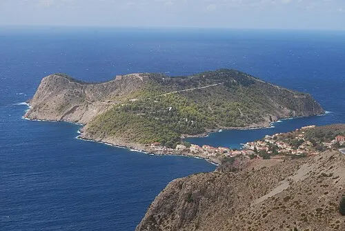 Kefalonia Insel, Kefallonia Regional Unit21 km S
-
Skartsoumbonisi Ithakis Insel, Ithaca13 km SO
Weitere Städte und Orte in Kefalonia
-
Vigli, Kefalonia Dorf, Kefalonia1,8 km SW
-
Chalikeri, Kefalonia Dorf, Kefalonia2,1 km W
-
Mesovounia, Kefalonia Dorf, Kefalonia3,2 km S
-
Psilithrias, Kefalonia Dorf, Kefalonia2,4 km N
-
Plagia, Kefalonia Dorf, Kefalonia4,9 km S
-
 Kothréas Dorf, Kefalonia4,8 km S
Quellen & Lizenzen
Daten zuletzt aktualisiert: · 2 unabhängige Quellen