- Höhe
- 6 m
- über dem Meeresspiegel
- Ortszeit
- UTC+02:00
- Europe/Athens · UTC+02:00
- Flughäfen
- JMK Mykonos Island National Airport36 km
- ATH Athens Eleftherios Venizelos International Airport104 km
Über Kimata beach
Kimata beach ist ein Strand. Lage: Syros, Nomós Kykládon. Die beste Reisezeit: Mai, September–Oktober. Nächster Flughafen: Mykonos Island National Airport (36 km). In der Nähe: Asteria beach und Church of the Dormition of the Virgin, Ermoupolis, Syros.
Fotos: Kimata beach
-
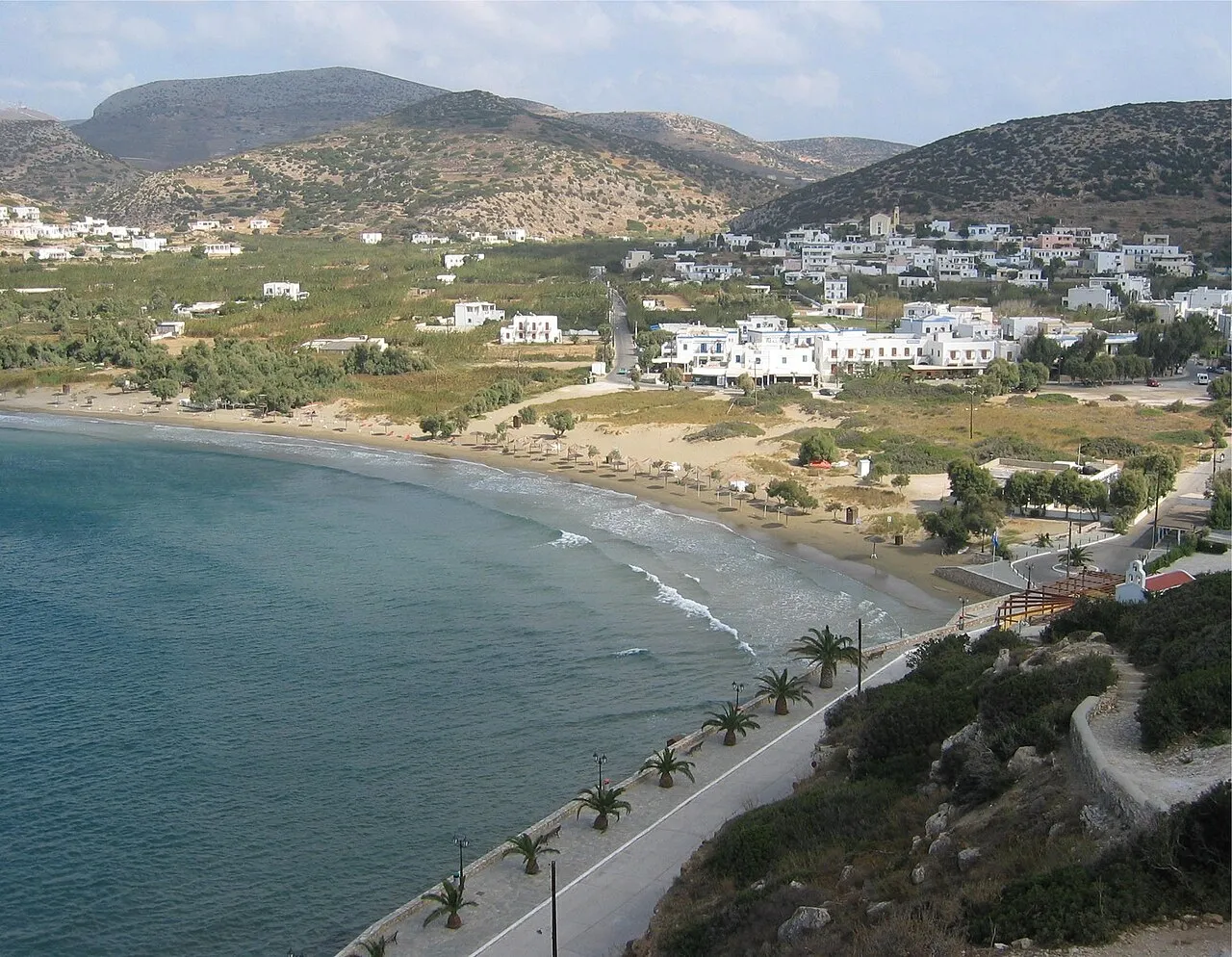
Galissas beach Olavfin · Public domain -
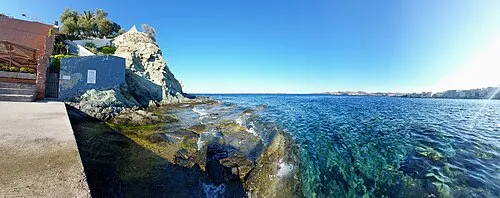
Asteria beach Leeturtle · CC BY-SA 4.0 -
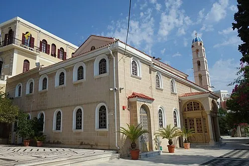
Church of Transfiguration, Ermoupoli, Syros Zde · CC BY-SA 4.0 -
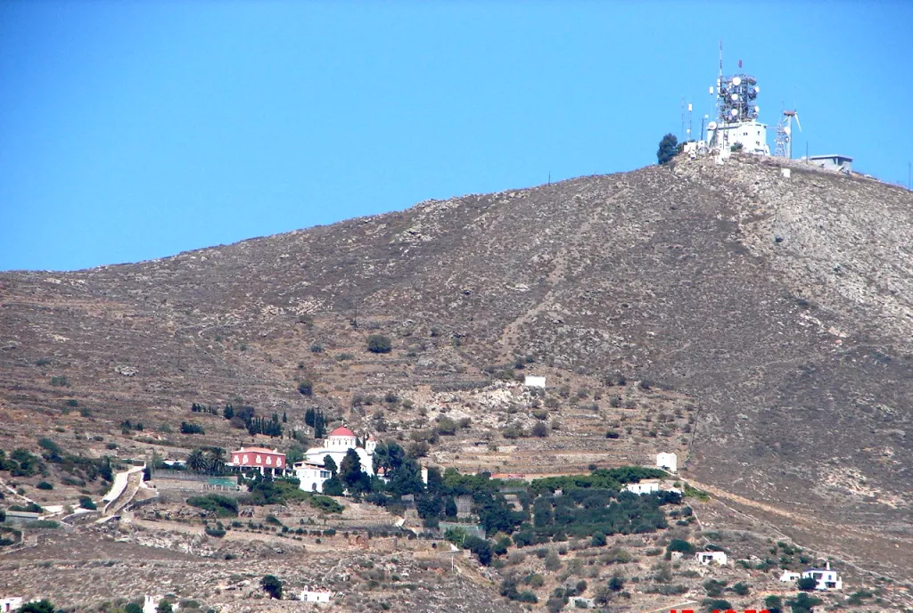
Agia Paraskevi An. Antoniou · CC BY-SA 3.0 -
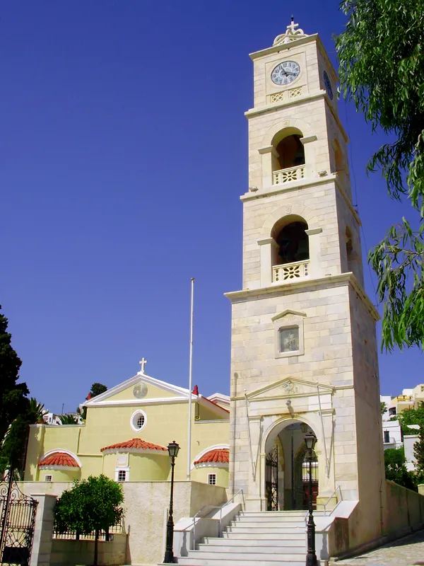
Agios Georgios G Da · CC BY-SA 3.0


Klima in Kimata beach
Beste Monate für BesichtigungenBeste Monate für Besichtigungen: Mai, September–Oktober.
Dieser Monat · November
Außerhalb der besten Reisezeit
Tag 19° · Nacht 15° · Regen 60 mm
- Wärmster Monat
- Juli (Tag 30°)
- Kältester Monat
- Februar (Nacht 10°)
- Nassester Monat
- Dezember (71 mm)
- Trockenster Monat
- Juli (2 mm)
Balken: mittlere Monatstiefst- und -höchsttemperatur. Darunter: Niederschlag. Monatsmittel 1970–2000 bei etwa 18 km Auflösung, höhenkorrigiert. Hervorgehobene Monate sind mild und relativ trocken. Quelle: WorldClim 2.1 (CC BY 4.0).
Werte als Tabelle anzeigen
| Monat | Jan | Feb | Mär | Apr | Mai | Jun | Jul | Aug | Sep | Okt | Nov | Dez |
|---|---|---|---|---|---|---|---|---|---|---|---|---|
| Mittleres Maximum (°C) | 14° | 14° | 16° | 19° | 23° | 28° | 30° | 30° | 26° | 23° | 19° | 15° |
| Mittleres Minimum (°C) | 10° | 10° | 12° | 14° | 18° | 23° | 25° | 25° | 22° | 19° | 15° | 12° |
| Niederschlag (mm) | 68 | 61 | 51 | 23 | 12 | 4 | 2 | 3 | 6 | 40 | 60 | 71 |
Anreise nach Kimata beach
Nächster Flughafen ist Mykonos Island National Airport (JMK), Luftlinie 36 km Richtung Osten. Für internationale Flüge: Athens Eleftherios Venizelos International Airport (ATH) (104 km). Nächste Großstadt ist Athen, 123 km Richtung Nordwesten.
Flughäfen
- Mykonos Island National Airport (JMK) Mykonos 36 kmOsten
- Athens Eleftherios Venizelos International Airport (ATH) Spata-Artemida 104 kmNordwesten
- Santorini International Airport (JTR) Santorini Island 125 kmSüden
Großstädte in der Nähe
- Athen Einwohner: 664.046 123 kmNordwesten
- Piräus Einwohner: 163.688 127 kmNordwesten
- Konak Einwohner: 332.277 217 kmNordosten
- Karabağlar Einwohner: 479.338 219 kmNordosten
- Çiğli Einwohner: 214.065 220 kmNordosten
Luftlinie; die Straßenentfernung ist länger. Flughafendaten: OurAirports.
Tagesausflüge ab Kimata beach
Im Umkreis von 100 km: 14 historische und kulturelle Stätten, 2 Naturorte, 50 Seen, Flüsse und Küsten.
0–25 km23 Orte
- Ampela beach Strand 8 kmSW
- Fetouri beach Strand 8 kmSW
- Foinikas beach Strand 8 kmSW
- Kokkina beach Strand 8 kmSW
25–60 km27 Orte
- Kykladen Insel 32 kmS
- Moni Christou Dasous Sehenswürdigkeit 46 kmS
- Aghios Prokopios beach Strand 54 kmSO
- Grotta beach Strand 53 kmSO
60–100 km16 Orte
- Agiassos beach Strand 68 kmSO
- Lionas beach Strand 66 kmSO
- Prasoura Koufonision Insel 80 kmSO
- Megali Plaka Koufonision Insel 87 kmSO
Luftlinie.
Nächstgelegene Städte und Dörfer
-
Platy Vouni Dorf, Syros3,8 km N
-
 Poseidonia Dorf, Syros7,8 km SW
-
 Tinos Dorf, Tinos22 km NO
-
Mykonos Kleinstadt, Mykonos34 km O
-
Vourni, Tinos Dorf, Tinos19 km NO
Sehenswertes & Natur in der Nähe
Alles in der Nähe-
Asteria beach Strand, Syros0,5 km N
-
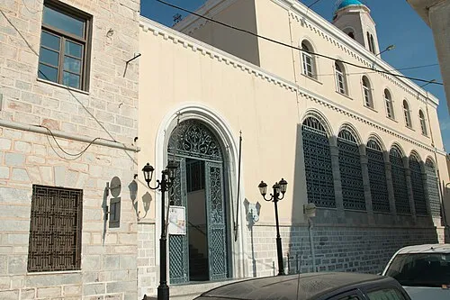 Church of the Dormition of the Virgin, Ermoupolis, Syros Sehenswürdigkeit, Syros0,4 km W
-
Church of Transfiguration, Ermoupoli, Syros Sehenswürdigkeit, Syros0,6 km NW
-
Azolimnos beach Strand, Syros3,9 km SO
-
Kini beach Strand, Südliche Ägäis4,1 km W
-
Lotos beach Strand, Syros4,4 km W
-
Delphini beach Strand, Südliche Ägäis4,6 km NW
-
Vari beach Strand, Syros5,8 km S
Weitere Seen, Flüsse und Küsten in Griechenland
-
Axladi beach Strand, Syros6,1 km S
-
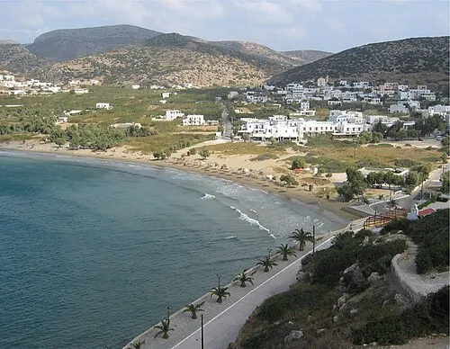 Galissas beach Strand, Syros6,5 km W
-
Agia Pakou beach Strand, Syros6,8 km W
-
Ampela beach Strand, Syros8,1 km SW
Quellen & Lizenzen
Daten zuletzt aktualisiert: · 2 unabhängige Quellen