Featherstone Rowfoot
Liegt in Featherstone, Northumberland Koordinaten: 54°56′25″ N 2°29′35″ W
Der Name dieses Ortes wurde in dieser Sprache noch nicht verifiziert und wird in der Originalform angezeigt.
- Höhe
- 185 m
- über dem Meeresspiegel
- Ortszeit
- UTC+00:00
- Europe/London · UTC+00:00
- Flughäfen
- NCL Newcastle International Airport53 km
- MME Teesside International Airport84 km
Über Featherstone Rowfoot
Featherstone Rowfoot ist ein Dorf. Lage: Featherstone, Northumberland. Höhe: 185 m. Die beste Reisezeit: Juni–August. Nächster Flughafen: Newcastle International Airport (53 km). In der Nähe: Featherstone Castle und Bellister Castle.
Fotos: Featherstone Rowfoot
-
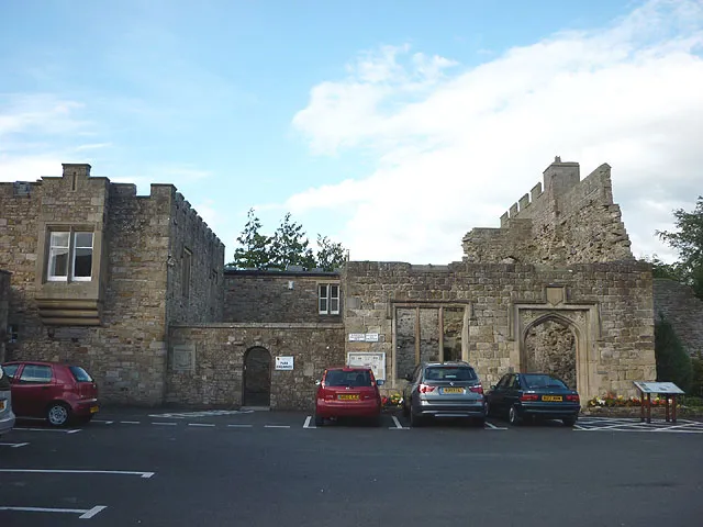
Blenkinsopp Castle Karl and Ali · CC BY-SA 2.0 -
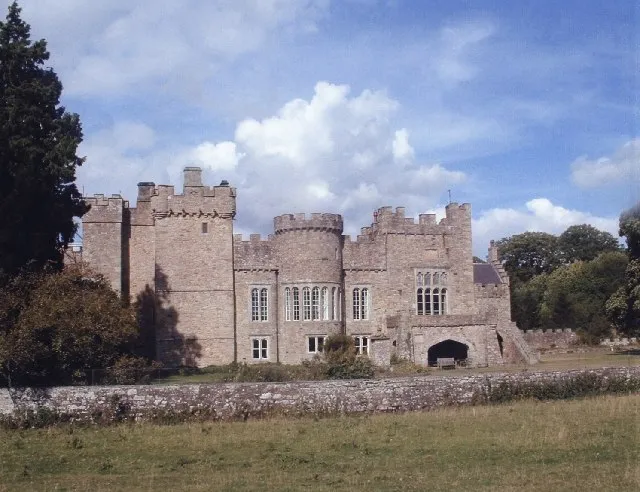
Featherstone Castle Margaret Clough · CC BY-SA 2.0 -
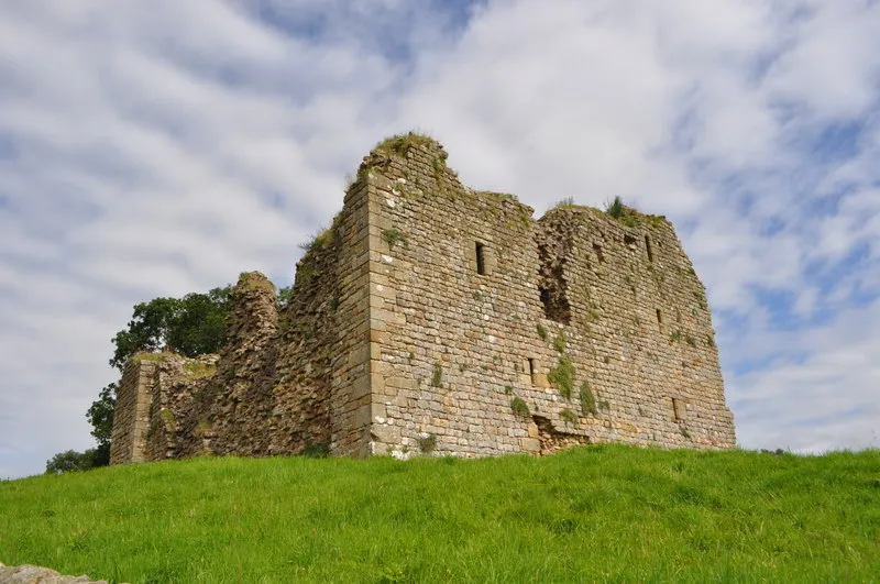
Thirlwall Castle Ashley Dace · CC BY-SA 2.0 -
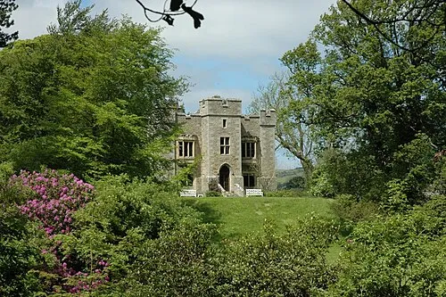
Bellister Castle Anthony Parkes · CC BY-SA 2.0


Klima in Featherstone Rowfoot
Beste Monate für BesichtigungenBeste Monate für Besichtigungen: Juni–August.
Dieser Monat · November
Ein regenreicher Monat
Tag 9° · Nacht 3° · Regen 117 mm
- Wärmster Monat
- Juli (Tag 19°)
- Kältester Monat
- Januar (Nacht 0°)
- Nassester Monat
- Januar (124 mm)
- Trockenster Monat
- April (69 mm)
Balken: mittlere Monatstiefst- und -höchsttemperatur. Darunter: Niederschlag. Monatsmittel 1970–2000 bei etwa 18 km Auflösung, höhenkorrigiert. Hervorgehobene Monate sind mild und relativ trocken. Quelle: WorldClim 2.1 (CC BY 4.0).
Werte als Tabelle anzeigen
| Monat | Jan | Feb | Mär | Apr | Mai | Jun | Jul | Aug | Sep | Okt | Nov | Dez |
|---|---|---|---|---|---|---|---|---|---|---|---|---|
| Mittleres Maximum (°C) | 6° | 6° | 8° | 11° | 14° | 17° | 19° | 19° | 16° | 12° | 9° | 6° |
| Mittleres Minimum (°C) | 0° | 0° | 1° | 3° | 5° | 8° | 10° | 10° | 8° | 6° | 3° | 1° |
| Niederschlag (mm) | 124 | 87 | 98 | 69 | 69 | 72 | 76 | 91 | 94 | 111 | 117 | 122 |
Anreise nach Featherstone Rowfoot
Nächster Flughafen ist Newcastle International Airport (NCL), Luftlinie 53 km Richtung Osten. Nächste Großstadt ist Newcastle upon Tyne, 56 km Richtung Osten.
Flughäfen
- Newcastle International Airport (NCL) Newcastle upon Tyne, Tyne and Wear 53 kmOsten
- Teesside International Airport (MME) Darlington, Durham 84 kmSüdosten
- Edinburgh Airport (EDI) Ingliston, Edinburgh 125 kmNordwesten
Großstädte in der Nähe
- Newcastle upon Tyne Einwohner: 300.125 56 kmOsten
- Sunderland Einwohner: 170.134 71 kmOsten
- Middlesbrough Einwohner: 142.707 91 kmSüdosten
- Edinburgh Einwohner: 514.990 121 kmNorden
- Burnley Einwohner: 149.422 128 kmSüden
Luftlinie; die Straßenentfernung ist länger. Flughafendaten: OurAirports.
Tagesausflüge ab Featherstone Rowfoot
Im Umkreis von 100 km: 822 historische und kulturelle Stätten, 2.746 Naturorte, 545 Seen, Flüsse und Küsten.
0–25 km203 Orte
- Fishgarth Holm Insel 22 kmSW
- Coathouse Island Insel 22 kmW
- Little Corby Island Insel 21 kmW
- Goat Island Insel 23 kmNW
25–60 km1.235 Orte
- Kirkland Scar Insel 44 kmW
- Wood Howe Insel 53 kmSW
- Cherry Holm Insel 53 kmSW
- Deergarth How Island Insel 58 kmSW
60–100 km2.675 Orte
- High Moor Berg 90 kmSW
- Roanhead Beach Strand 100 kmSW
- St. Bees Beach Seafront Strand 87 kmSW
- Powillimount Beach Strand 70 kmW
Luftlinie.
Sehenswertes & Natur in der Nähe
Alles in der Nähe-
Featherstone Castle Historische Stätte, Featherstone1,1 km W
-
Bellister Castle Historische Stätte, Featherstone2,7 km NO
-
Blenkinsopp Castle Historische Stätte, Greenhead4,3 km NW
-
Haltwhistle Castle Historische Stätte, Haltwhistle4,3 km NO
-
Thirlwall Castle Historische Stätte, Thirlwall6 km NW
-
Pike Rigg Berg, Knaresdale with Kirkhaugh8,1 km SO
Quellen & Lizenzen
Daten zuletzt aktualisiert: