Chirbury with Brompton
Liegt in Shropshire, England Koordinaten: 52°34′44″ N 3°04′03″ W
Der Name dieses Ortes wurde in dieser Sprache noch nicht verifiziert und wird in der Originalform angezeigt.
- Höhe
- 192 m
- über dem Meeresspiegel
- Ortszeit
- UTC+00:00
- Europe/London · UTC+00:00
- Orte darin
- 23
- unter Chirbury with Brompton verzeichnet
- Flughäfen
- LPL Liverpool John Lennon Airport85 km
- BHX Birmingham Airport91 km
Über Chirbury with Brompton
Chirbury with Brompton ist eine Gemeinde. Lage: Shropshire, England. Höhe: 192 m. Die beste Reisezeit: Juni–August. Nächster Flughafen: Liverpool John Lennon Airport (85 km). In der Nähe: Nantcribba Castle und Simon's Castle.
Fotos: Chirbury with Brompton
-
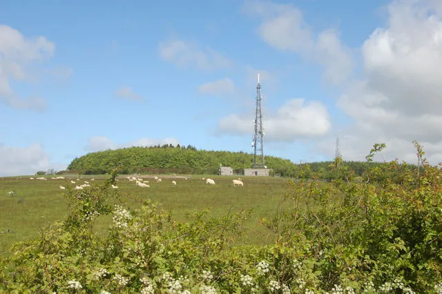
Long Mountain John Firth · CC BY-SA 2.0 -
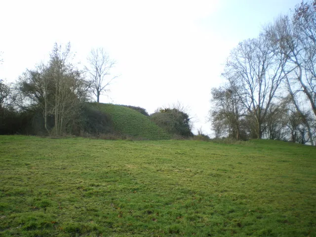
Hen Domen Richard Law · CC BY-SA 2.0 -
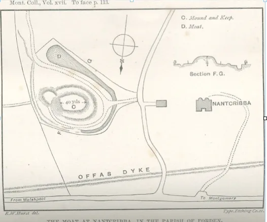
Nantcribba Castle Vize · Public domain


Klima in Chirbury with Brompton
Beste Monate für BesichtigungenBeste Monate für Besichtigungen: Juni–August.
Dieser Monat · November
Ein regenreicher Monat
Tag 9° · Nacht 3° · Regen 100 mm
- Wärmster Monat
- Juli (Tag 20°)
- Kältester Monat
- Februar (Nacht 0°)
- Nassester Monat
- Dezember (105 mm)
- Trockenster Monat
- Juli (57 mm)
Balken: mittlere Monatstiefst- und -höchsttemperatur. Darunter: Niederschlag. Monatsmittel 1970–2000 bei etwa 18 km Auflösung, höhenkorrigiert. Hervorgehobene Monate sind mild und relativ trocken. Quelle: WorldClim 2.1 (CC BY 4.0).
Werte als Tabelle anzeigen
| Monat | Jan | Feb | Mär | Apr | Mai | Jun | Jul | Aug | Sep | Okt | Nov | Dez |
|---|---|---|---|---|---|---|---|---|---|---|---|---|
| Mittleres Maximum (°C) | 6° | 6° | 9° | 11° | 15° | 18° | 20° | 20° | 17° | 13° | 9° | 7° |
| Mittleres Minimum (°C) | 1° | 0° | 2° | 3° | 6° | 9° | 11° | 10° | 8° | 6° | 3° | 2° |
| Niederschlag (mm) | 102 | 74 | 80 | 63 | 59 | 68 | 57 | 75 | 83 | 91 | 100 | 105 |
Anreise nach Chirbury with Brompton
Nächster Flughafen ist Liverpool John Lennon Airport (LPL), Luftlinie 85 km Richtung Norden. Nächste Großstadt ist Telford, 43 km Richtung Osten.
Flughäfen
- Liverpool John Lennon Airport (LPL) Liverpool 85 kmNorden
- Birmingham Airport (BHX) Birmingham, West Midlands 91 kmOsten
- Manchester Airport (MAN) Manchester, Greater Manchester 101 kmNordosten
Großstädte in der Nähe
- Telford Einwohner: 155.570 43 kmOsten
- Wolverhampton Einwohner: 263.700 64 kmOsten
- Dudley Einwohner: 199.059 67 kmOsten
- Worcester Einwohner: 101.659 72 kmSüdosten
- West Bromwich Einwohner: 103.112 73 kmOsten
Luftlinie; die Straßenentfernung ist länger. Flughafendaten: OurAirports.
Tagesausflüge ab Chirbury with Brompton
Im Umkreis von 100 km: 905 historische und kulturelle Stätten, 2.633 Naturorte, 184 Seen, Flüsse und Küsten.
0–25 km396 Orte
- Reservoir See 24 kmNO
- Beacon Hill Berg 24 kmSW
- Stiperstones Berg 9 kmO
- Corndon Hill Berg 3 kmSO
25–60 km1.370 Orte
- The Island Insel 42 kmSO
- Duckbay Island Insel 56 kmNO
- Lake Vyrnwy See 38 kmNW
- Pen-y-gareg Reservoir See 49 kmSW
60–100 km1.956 Orte
- Thurstaston Beach Strand 85 kmN
- Ynys Tywyn Insel 81 kmNW
- Saint Tudwals Island West Insel 98 kmW
- Saint Tudwals Islands Insel 98 kmW
Luftlinie.
Orte in Chirbury with Brompton
23 OrteStädte & Dörfer10
- Black Marsh · Dorf
- Chirbury · Dorf
- Marton · Dorf
- Middleton · Dorf
- Pentreheyling · Dorf
- Priest Weston · Dorf
- Rorrington · Dorf
- Stapeley · Dorf
- Stockton · Dorf
- Wotherton · Dorf
Berge & Natur3
- Rockabank Hill · Berg
- Stapeley Hill · Berg
- The Knoll · Berg
Kulturerbe & Sehenswertes10
- Brompton Mill Castle Mound · Historische Stätte
- Chirbury Castle Mound · Historische Stätte
- Hagley · Historische Stätte
- Marton The Mount · Historische Stätte
- Motte and bailey castle 80m south east of Hockleton Farm · Historische Stätte
- Motte castle adjacent to The Mount cottage · Historische Stätte
- Motte castle at the south end of East Dudston hamlet · Historische Stätte
- Upper Gwarthlow · Historische Stätte
- Wilmington The Mount · Historische Stätte
- Wotherton Castle Mound · Historische Stätte
Sehenswertes & Natur in der Nähe
Alles in der Nähe-
Nantcribba Castle Historische Stätte, Forden with Leighton and Trelystan5 km NW
-
Simon's Castle Historische Stätte, Churchstoke5,2 km S
-
Hen Domen Historische Stätte, Montgomery6,4 km W
-
Hyssington Castle Historische Stätte, Churchstoke5,4 km SO
-
Bromlow Castle Mound Historische Stätte, Worthen with Shelve5,8 km NO
-
Long Mountain Berg, Trewern7,5 km N
-
Ritton Castle Historische Stätte, Worthen with Shelve6,8 km O
-
Lower Min y Llyn Motte Historische Stätte, Forden with Leighton and Trelystan7,1 km W
Quellen & Lizenzen
Daten zuletzt aktualisiert: