Llangattock-Vibon-Avel
Liegt in Monmouthshire, Wales Koordinaten: 51°50′17″ N 2°47′02″ W
Der Name dieses Ortes wurde in dieser Sprache noch nicht verifiziert und wird in der Originalform angezeigt.
- Höhe
- 72 m
- über dem Meeresspiegel
- Ortszeit
- UTC+00:00
- Europe/London · UTC+00:00
- Orte darin
- 20
- unter Llangattock-Vibon-Avel verzeichnet
- Flughäfen
- BRS Bristol Airport51 km
- CWL Cardiff International Airport63 km
Über Llangattock-Vibon-Avel
Llangattock-Vibon-Avel ist eine Gemeinde. Lage: Monmouthshire, Wales. Höhe: 72 m. Die beste Reisezeit: Juni–August. Nächster Flughafen: Bristol Airport (51 km). In der Nähe: Pembridge Castle und Monmouth Castle.
Fotos: Llangattock-Vibon-Avel
-
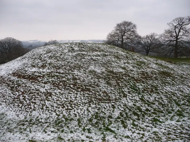
Penrhos Castle Jeremy Bolwell · CC BY-SA 2.0 -
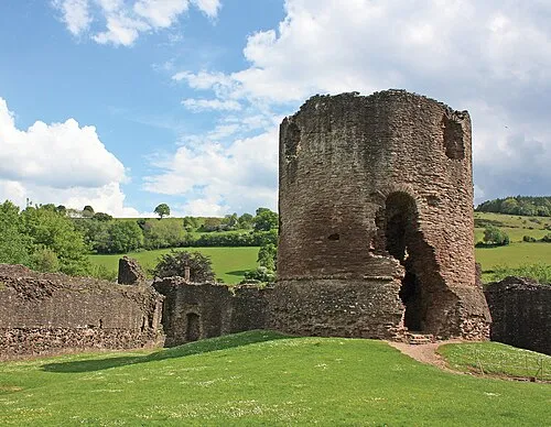
Skenfrith Castle Davidmholmes51 · CC BY-SA 4.0 -
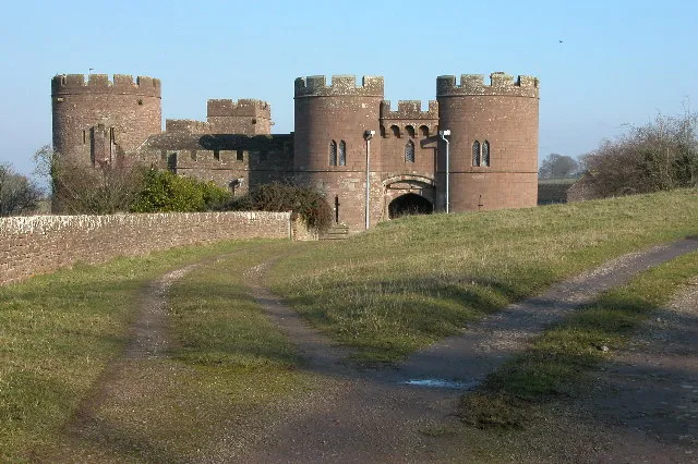
Pembridge Castle Philip Halling · CC BY-SA 2.0 -
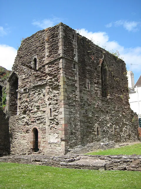
Monmouth Castle Pauline Eccles · CC BY-SA 2.0


Klima in Llangattock-Vibon-Avel
Beste Monate für BesichtigungenBeste Monate für Besichtigungen: Juni–August.
Dieser Monat · November
Ein kalter Monat
Tag 10° · Nacht 4° · Regen 78 mm
- Wärmster Monat
- Juli (Tag 21°)
- Kältester Monat
- Februar (Nacht 2°)
- Nassester Monat
- Januar (88 mm)
- Trockenster Monat
- Juli (43 mm)
Balken: mittlere Monatstiefst- und -höchsttemperatur. Darunter: Niederschlag. Monatsmittel 1970–2000 bei etwa 18 km Auflösung, höhenkorrigiert. Hervorgehobene Monate sind mild und relativ trocken. Quelle: WorldClim 2.1 (CC BY 4.0).
Werte als Tabelle anzeigen
| Monat | Jan | Feb | Mär | Apr | Mai | Jun | Jul | Aug | Sep | Okt | Nov | Dez |
|---|---|---|---|---|---|---|---|---|---|---|---|---|
| Mittleres Maximum (°C) | 7° | 7° | 9° | 12° | 16° | 18° | 21° | 21° | 18° | 14° | 10° | 8° |
| Mittleres Minimum (°C) | 2° | 2° | 3° | 4° | 7° | 10° | 12° | 12° | 10° | 7° | 4° | 3° |
| Niederschlag (mm) | 88 | 61 | 65 | 56 | 57 | 58 | 43 | 65 | 72 | 75 | 78 | 87 |
Anreise nach Llangattock-Vibon-Avel
Nächster Flughafen ist Bristol Airport (BRS), Luftlinie 51 km Richtung Süden. Nächste Großstadt ist Newport (Wales), 32 km Richtung Südwesten.
Flughäfen
- Bristol Airport (BRS) Bristol 51 kmSüden
- Cardiff International Airport (CWL) Cardiff 63 kmSüdwesten
- Birmingham Airport (BHX) Birmingham, West Midlands 99 kmNordosten
Großstädte in der Nähe
- Newport (Wales) Einwohner: 161.506 32 kmSüdwesten
- Gloucester Einwohner: 132.416 37 kmOsten
- Bristol Einwohner: 479.024 45 kmSüden
- Cardiff Einwohner: 372.089 48 kmSüdwesten
- Cheltenham Einwohner: 118.836 49 kmOsten
Luftlinie; die Straßenentfernung ist länger. Flughafendaten: OurAirports.
Tagesausflüge ab Llangattock-Vibon-Avel
Im Umkreis von 100 km: 964 historische und kulturelle Stätten, 2.004 Naturorte, 133 Seen, Flüsse und Küsten.
0–25 km278 Orte
- Llandegfedd Reservoir See 21 kmSW
- Hobbs Berg 24 kmO
- Sugar Loaf Berg 19 kmW
- May Hill Berg 24 kmO
25–60 km1.046 Orte
- Steep Holm Insel 60 kmS
- Flat Holm Insel 56 kmSW
- Barry Island Insel 60 kmSW
- Sully Island Insel 57 kmSW
60–100 km1.777 Orte
- Kilve Beach Strand 78 kmSW
- Glover's Island Insel 64 kmNO
- Crescent Wood Island Insel 100 kmNO
- Stanford Park Island Insel 93 kmO
Luftlinie.
Orte in Llangattock-Vibon-Avel
20 OrteBalken: Einwohnerzahl im Verhältnis zum bevölkerungsreichsten Ort dieser Liste.
Städte & Dörfer10
- Cross Ash · Dorf
- Llanfaenor · Dorf
- Maypole · Dorf
- Newcastle · Dorf
- Norton · Dorf
- Rockfield · Dorf
- Saint Maughans · Dorf
- St Maughan's Green · Dorf
- The Hendre · Dorf
- Walson · Dorf
Berge & Natur5
- Blackbrook Hill · Berg
- Bryn-garth · Berg
- Coedanghred Hill · Berg
- Coed-y-pwll · Berg
- Edmund's Tump · Berg
Kulturerbe & Sehenswertes4
- God's Grace Abbey · Historische Stätte
- Newcastle · Historische Stätte
- Rockfield Castle · Historische Stätte
- Skenfrith Castle · Historische Stätte
Sehenswertes & Natur in der Nähe
Alles in der Nähe-
Pembridge Castle Historische Stätte, Welsh Newton4,4 km NO
-
Monmouth Castle Historische Stätte, Monmouth5,4 km SO
-
Penrhos Castle Historische Stätte, Llantilio Crossenny5,7 km SW
-
Castell Llanddingad Historische Stätte, Mitchel Troy5,4 km S
-
Dixton Motte Historische Stätte, Monmouth6,1 km O
-
White Castle Historische Stätte, Llantilio Crossenny8,2 km W
-
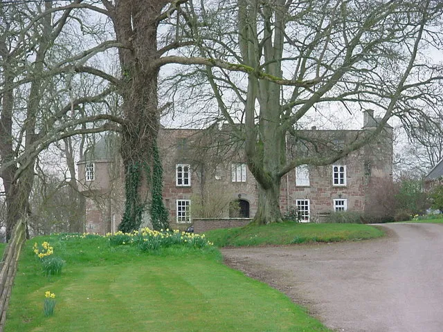 Treago Castle Historische Stätte, St. Weonards8,6 km N
-
Coed y Fedw Tump Historische Stätte, Mitchel Troy7,2 km S
Quellen & Lizenzen
Daten zuletzt aktualisiert: