Kleinalpe
Located in St. Georgen im Lavanttal, Politischer Bezirk Wolfsberg Coordinates: 46°44′32″ N 14°59′20″ E
- Elevation
- 1,759 m
- above sea level
- Local time
- UTC+01:00
- Europe/Vienna · UTC+01:00
- Airports
- GRZ Graz Airport44 km
- KLU Klagenfurt Airport51 km
About Kleinalpe
Kleinalpe is a mountain. Location: St. Georgen im Lavanttal, Politischer Bezirk Wolfsberg. Elevation: 1,759 m. The nearest airport is Graz Airport (44 km). Nearby sights include Brandel and Popler Kogel.
Photos of Kleinalpe
-
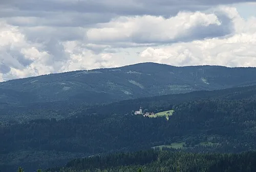
Wolscheneck Josef Moser · CC BY-SA 3.0 -
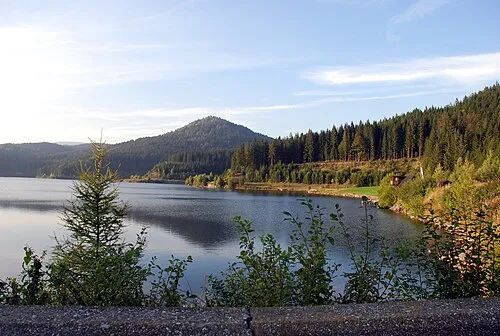
Gradischkogel Josef Moser · CC BY-SA 3.0 -
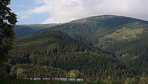
Krakaberg Naturpuur · CC BY-SA 4.0


Climate of Kleinalpe
This month · November
A wet month
Day 0° · Night -8° · Rain 102 mm
- Hottest month
- July (day 16°)
- Coldest month
- January (night -13°)
- Wettest month
- July (147 mm)
- Driest month
- January (48 mm)
Bars: average monthly low and high temperature. Below: precipitation. Monthly averages for 1970–2000 at about 18 km resolution, adjusted for elevation. Highlighted months are mild and relatively dry. Source: WorldClim 2.1 (CC BY 4.0).
Show values as a table
| Month | Jan | Feb | Mar | Apr | May | Jun | Jul | Aug | Sep | Oct | Nov | Dec |
|---|---|---|---|---|---|---|---|---|---|---|---|---|
| Average high (°C) | -5° | -3° | 2° | 6° | 11° | 14° | 16° | 16° | 12° | 7° | 0° | -5° |
| Average low (°C) | -13° | -12° | -9° | -5° | 0° | 3° | 5° | 5° | 1° | -3° | -8° | -12° |
| Precipitation (mm) | 48 | 53 | 78 | 91 | 105 | 144 | 147 | 133 | 114 | 106 | 102 | 73 |
How to get to Kleinalpe
The nearest airport is Graz Airport (GRZ), 44 km to the northeast as the crow flies. The nearest large city is Graz, 50 km to the northeast.
Airports
- Graz Airport (GRZ) Feldkirchen bei Graz 44 kmnortheast
- Klagenfurt Airport (KLU) Klagenfurt am Wörthersee 51 kmwest
- Maribor Edvard Rusjan Airport (MBX) Maribor 61 kmsoutheast
Nearby large cities
- Graz Population: 303.3K 50 kmnortheast
- Klagenfurt Population: 100.3K 54 kmwest
- Ljubljana Population: 272.2K 85 kmsouthwest
- Zagreb Population: 663.6K 128 kmsoutheast
- Rijeka Population: 108K 163 kmsouth
Straight-line distances; road distances are longer. Airport data: OurAirports.
Day trips from Kleinalpe
Within 100 km: 247 historic and cultural sites, 1,417 natural sites, 577 lakes, rivers and coasts.
0–25 km103 places
- Mislinja River 19 kmS
- Meža River 17 kmS
- Raucheck Mountain 10 kmNW
- Moschkogel Mountain 9 kmN
25–60 km654 places
- Ribnica Lake Lake 34 kmSE
- Pohorje Mountain 43 kmSE
- Mrzla Gora Mountain 52 kmSW
- Grintavec Mountain 55 kmSW
60–100 km1,484 places
- Lake Bled Lake 80 kmSW
- Triglav Mountain 97 kmSW
- Šmarna gora Mountain 79 kmSW
- Rjavina Mountain 93 kmSW
Straight-line distances.
Nearest towns and villages
-
Steinberg-Hart Village, St. Georgen im Lavanttal4.9 km W
-
Pontnig Village, St. Georgen im Lavanttal5 km NW
-
Sankt Georgen Village, St. Georgen im Lavanttal6.1 km SW
-
Gundisch Village, St. Georgen im Lavanttal3.3 km SW
-
Gemmersdorf Village, St. Andrä5.6 km W
-
Hofwiesen Village, St. Georgen im Lavanttal6 km W
Nearby attractions & nature
Everything nearby-
Brandel Mountain, St. Georgen im Lavanttal2 km SW
-
Popler Kogel Mountain, St. Georgen im Lavanttal2.3 km SE
-
Krennkogel Mountain, St. Georgen im Lavanttal3.2 km N
-
Krakaberg Mountain, St. Georgen im Lavanttal4.4 km N
-
Dreieckkogel Mountain, Eibiswald4.6 km SE
-
Kleiner Speikkogel Mountain, St. Georgen im Lavanttal4.6 km N
-
Gosseck Mountain, Lavamünd4.7 km S
-
Gradischkogel Mountain, Lavamünd6.2 km SE
Sources & licences
Data last updated: · 2 independent sources