Hohenburg
Located in Lendorf, Spittal an der Drau District Coordinates: 46°52′16″ N 13°26′39″ E
- Elevation
- 1,517 m
- above sea level
- Local time
- UTC+01:00
- Europe/Vienna · UTC+01:00
- Airports
- KLU Klagenfurt Airport73 km
- LJU Ljubljana Jože Pučnik Airport106 km
About Hohenburg
Hohenburg is a village. Location: Lendorf, Spittal an der Drau District. Elevation: 1,517 m. The nearest airport is Klagenfurt Airport (73 km). Nearby sights include Kirschberger Graben and Steinkopf.
Photos of Hohenburg
-
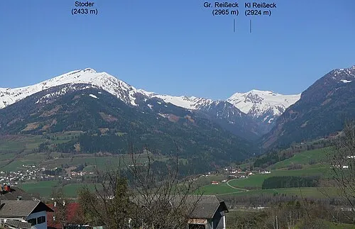
Stoder Peter Tritthart · CC0 -
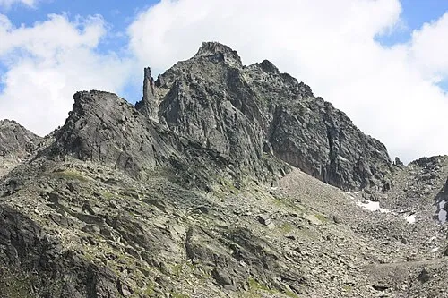
Kleine Leier JJ55 · Public domain -
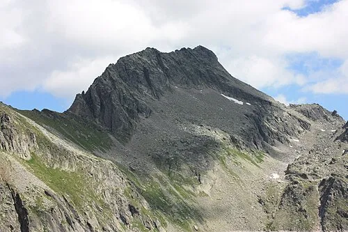
Hohe Leier JJ55 · Public domain


Climate of Hohenburg
This month · November
A wet month
Day 3° · Night -4° · Rain 128 mm
- Hottest month
- July (day 17°)
- Coldest month
- January (night -8°)
- Wettest month
- July (181 mm)
- Driest month
- February (70 mm)
Bars: average monthly low and high temperature. Below: precipitation. Monthly averages for 1970–2000 at about 18 km resolution, adjusted for elevation. Highlighted months are mild and relatively dry. Source: WorldClim 2.1 (CC BY 4.0).
Show values as a table
| Month | Jan | Feb | Mar | Apr | May | Jun | Jul | Aug | Sep | Oct | Nov | Dec |
|---|---|---|---|---|---|---|---|---|---|---|---|---|
| Average high (°C) | -1° | 0° | 3° | 6° | 11° | 15° | 17° | 17° | 13° | 9° | 3° | 0° |
| Average low (°C) | -8° | -8° | -6° | -3° | 2° | 5° | 7° | 7° | 4° | 1° | -4° | -7° |
| Precipitation (mm) | 79 | 70 | 98 | 120 | 137 | 171 | 181 | 161 | 143 | 133 | 128 | 99 |
How to get to Hohenburg
The nearest airport is Klagenfurt Airport (KLU), 73 km to the east as the crow flies. The nearest large city is Klagenfurt, 71 km to the east.
Airports
- Klagenfurt Airport (KLU) Klagenfurt am Wörthersee 73 kmeast
- Ljubljana Jože Pučnik Airport (LJU) Zgornji Brnik 106 kmsoutheast
- Salzburg Airport (SZG) Salzburg 108 kmnorth
Nearby large cities
- Klagenfurt Population: 100.3K 71 kmeast
- Salzburg Population: 157.2K 108 kmnorth
- Ljubljana Population: 272.2K 122 kmsoutheast
- Graz Population: 303.3K 154 kmeast
- Innsbruck Population: 132.5K 162 kmwest
Straight-line distances; road distances are longer. Airport data: OurAirports.
Day trips from Hohenburg
Within 100 km: 245 historic and cultural sites, 3,578 natural sites, 940 lakes, rivers and coasts.
0–25 km248 places
- Weissensee Lake 20 kmS
- Unterer Zwenberger See Lake 13 kmNW
- Unterer Schwarzhorn See Lake 24 kmNW
- Striedensee Lake 24 kmW
25–60 km1,404 places
- Prestreljenik Mountain 57 kmS
- Vršič Mountain 54 kmSE
- Planica Natural site 49 kmSE
- Mangrt Mountain 51 kmS
60–100 km3,111 places
- Hoher Dachstein Mountain 68 kmN
- Lake Bohinj Lake 73 kmSE
- Lake Bled Lake 75 kmSE
- Triglav Mountain 62 kmSE
Straight-line distances.
Nearby attractions & nature
Everything nearby-
Kirschberger Graben Natural site, Carinthia0.9 km NW
-
Steinkopf Mountain, Trebesing1.5 km NE
-
Eckberg Mountain, Trebesing2.9 km SE
-
Stoder Mountain, Trebesing3.2 km N
-
Hühnersberg Mountain, Trebesing3 km N
-
Böse Nase Mountain, Lendorf3.4 km NW
Sources & licences
Data last updated: