Hafnergruppe
Located in Malta, Spittal an der Drau District Coordinates: 47°04′05″ N 13°24′03″ E
- Elevation
- 2,857 m
- above sea level
- Local time
- UTC+01:00
- Europe/Vienna · UTC+01:00
- Airports
- KLU Klagenfurt Airport86 km
- SZG Salzburg Airport86 km
About Hafnergruppe
Hafnergruppe is a mountain. Location: Malta, Spittal an der Drau District. Elevation: 2,857 m. The nearest airport is Klagenfurt Airport (86 km). Nearby sights include Großer Hafner and Karschneideck.
Climate of Hafnergruppe
This month · November
A wet month
Day -5° · Night -11° · Rain 141 mm
- Hottest month
- July (day 7°)
- Coldest month
- February (night -16°)
- Wettest month
- July (194 mm)
- Driest month
- February (85 mm)
Bars: average monthly low and high temperature. Below: precipitation. Monthly averages for 1970–2000 at about 18 km resolution, adjusted for elevation. Highlighted months are mild and relatively dry. Source: WorldClim 2.1 (CC BY 4.0).
Show values as a table
| Month | Jan | Feb | Mar | Apr | May | Jun | Jul | Aug | Sep | Oct | Nov | Dec |
|---|---|---|---|---|---|---|---|---|---|---|---|---|
| Average high (°C) | -9° | -9° | -7° | -4° | 1° | 4° | 7° | 7° | 4° | 0° | -5° | -8° |
| Average low (°C) | -15° | -16° | -14° | -11° | -6° | -3° | -1° | -1° | -4° | -7° | -11° | -14° |
| Precipitation (mm) | 94 | 85 | 118 | 135 | 148 | 182 | 194 | 172 | 149 | 136 | 141 | 119 |
How to get to Hafnergruppe
The nearest airport is Klagenfurt Airport (KLU), 86 km to the southeast as the crow flies. The nearest large city is Klagenfurt, 85 km to the southeast.
Airports
- Klagenfurt Airport (KLU) Klagenfurt am Wörthersee 86 kmsoutheast
- Salzburg Airport (SZG) Salzburg 86 kmnorth
- Ljubljana Jože Pučnik Airport (LJU) Zgornji Brnik 124 kmsoutheast
Nearby large cities
- Klagenfurt Population: 100.3K 85 kmsoutheast
- Salzburg Population: 157.2K 86 kmnorth
- Linz Population: 204.8K 153 kmnortheast
- Innsbruck Population: 132.5K 154 kmwest
- Graz Population: 303.3K 155 kmeast
Straight-line distances; road distances are longer. Airport data: OurAirports.
Day trips from Hafnergruppe
Within 100 km: 301 historic and cultural sites, 4,000 natural sites, 1,120 lakes, rivers and coasts.
0–25 km320 places
- Unterer Zwenberger See Lake 15 kmSW
- Unterer Schwarzsee Lake 6 kmNW
- Unterer Schwarzhorn See Lake 9 kmW
- Unterer Schönalmsee Lake 25 kmNE
25–60 km1,944 places
- Hoher Dachstein Mountain 48 kmN
- Fürlegsee Lake 60 kmW
- Vorderer Langtalsee Lake 48 kmW
- Seeriessee Lake 41 kmNE
60–100 km3,157 places
- Klamm Natural site 85 kmNE
- Sille River 80 kmSW
- Wildsee Lake 90 kmE
- Eissee Lake 77 kmW
Straight-line distances.
Nearest towns and villages
-
Muhr Municipality, Tamsweg District5.7 km NE
-
Vordermuhr Neighbourhood, Muhr8.3 km NE
-
Rotgülden Village, Muhr6 km NE
-
Zederhaus Municipality, Tamsweg District12 km N
-
Brandstatt Village, Malta11 km SE
-
Ollschützen Village, Muhr6.6 km NE
Nearby attractions & nature
Everything nearby-
Großer Hafner Mountain, Malta0.2 km N
-
Karschneideck Mountain, Rennweg am Katschberg1.2 km E
-
Hafner Mountain, Malta1.3 km W
-
Maltatal Natural site, Carinthia2 km S
-
Grosser Sonnblick Mountain, Malta2.3 km SE
-
Silbereck Mountain, Muhr3 km NE
-
Oberer Rotgüldensee Lake, State of Salzburg1.7 km N
-
Kleiner Sonnblick Mountain, Malta3.2 km SE
More nature in Austria
-
Vorderer Findelkarkopf Mountain, Malta3.3 km SW
-
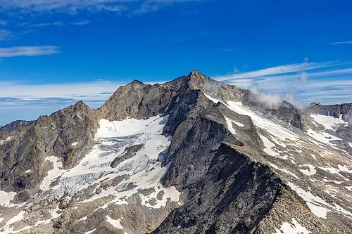 Hochalmspitze Mountain, Malta8.3 km SW
-
Vordere Steinkar Spitze Mountain, Malta6.4 km W
-
Hintere Steinkar Spitze Mountain, Malta6.4 km W
-
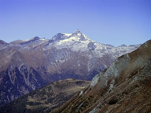 Ankogel Mountain, Malta12 km W
-
Schmiednock Mountain, Malta7.7 km S
Sources & licences
Data last updated: