- Elevation
- 1,623 m
- above sea level
- Local time
- UTC+01:00
- Europe/Vienna · UTC+01:00
- Airports
- KLU Klagenfurt Airport19 km
- LJU Ljubljana Jože Pučnik Airport34 km
About Mnihovec
Mnihovec is a mountain. Location: Gallizien, Völkermarkt District. Elevation: 1,623 m. The nearest airport is Klagenfurt Airport (19 km). Nearby sights include Minichoutz and Altberg.
Climate of Mnihovec
This month · November
A wet month
Day -1° · Night -8° · Rain 113 mm
- Hottest month
- July (day 17°)
- Coldest month
- January (night -14°)
- Wettest month
- June (137 mm)
- Driest month
- January (48 mm)
Bars: average monthly low and high temperature. Below: precipitation. Monthly averages for 1970–2000 at about 18 km resolution, adjusted for elevation. Highlighted months are mild and relatively dry. Source: WorldClim 2.1 (CC BY 4.0).
Show values as a table
| Month | Jan | Feb | Mar | Apr | May | Jun | Jul | Aug | Sep | Oct | Nov | Dec |
|---|---|---|---|---|---|---|---|---|---|---|---|---|
| Average high (°C) | -6° | -3° | 2° | 7° | 12° | 15° | 17° | 17° | 12° | 6° | -1° | -6° |
| Average low (°C) | -14° | -13° | -9° | -5° | 0° | 3° | 5° | 5° | 1° | -3° | -8° | -12° |
| Precipitation (mm) | 48 | 50 | 73 | 92 | 96 | 137 | 137 | 119 | 112 | 115 | 113 | 73 |
How to get to Mnihovec
The nearest airport is Klagenfurt Airport (KLU), 19 km to the northwest as the crow flies. The nearest large city is Klagenfurt, 20 km to the northwest.
Airports
- Klagenfurt Airport (KLU) Klagenfurt am Wörthersee 19 kmnorthwest
- Ljubljana Jože Pučnik Airport (LJU) Zgornji Brnik 34 kmsouth
- Graz Airport (GRZ) Feldkirchen bei Graz 88 kmnortheast
Nearby large cities
- Klagenfurt Population: 100.3K 20 kmnorthwest
- Graz Population: 303.3K 93 kmnortheast
- Rijeka Population: 108K 133 kmsouth
- Zagreb Population: 663.6K 138 kmsoutheast
- Salzburg Population: 157.2K 181 kmnorthwest
Straight-line distances; road distances are longer. Airport data: OurAirports.
Day trips from Mnihovec
Within 100 km: 196 historic and cultural sites, 1,120 natural sites, 426 lakes, rivers and coasts.
0–25 km217 places
- Lake Turner Lake 8 kmNE
- Lake Klopein Lake 11 kmNE
- Kleiner See Lake 14 kmNE
- Gösselsdorfer See Lake 9 kmNE
25–60 km390 places
- Wildsee Lake 57 kmN
- Wörthersee Lake 32 kmW
- Lake Ossiach Lake 45 kmW
- Magdalenensee Lake 50 kmW
60–100 km1,135 places
- Eberlsee Lake 97 kmN
- Tubaysee Lake 98 kmN
- Krugsee Lake 92 kmN
- Angersee Lake 100 kmNW
Straight-line distances.
Nearest towns and villages
-
Wildenstein Village, Gallizien2.9 km N
-
Gallizien Village, Gallizien3 km N
-
Glantschach Village, Gallizien3.3 km NE
-
Abriach Village, Gallizien3.3 km NW
-
Krejanzach Village, Gallizien3.3 km N
-
Enzelsdorf Village, Gallizien3.9 km NE
Nearby attractions & nature
Everything nearby-
Minichoutz Mountain, Gallizien0.3 km SW
-
Altberg Mountain, Gallizien1.7 km NE
-
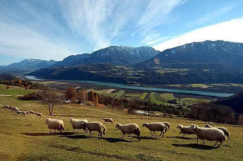 Hochobir Mountain, Zell2.9 km SW
-
Wildensteiner Wasserfall Natural site, Carinthia1.7 km NW
-
Kleinobir Mountain, Gallizien2.7 km W
-
Jovanberg Mountain, Eisenkappel-Vellach3.6 km SE
-
Kuhberg Mountain, Zell4.7 km SW
-
Agnesquelle Natural site, Carinthia3.9 km SE
Sources & licences
Data last updated: