Rosskogel
Located in Langenwang, Bruck-Mürzzuschlag District Coordinates: 47°36′00″ N 15°35′00″ E
- Elevation
- 1,221 m
- above sea level
- Local time
- UTC+01:00
- Europe/Vienna · UTC+01:00
About Rosskogel
Rosskogel is a mountain. Location: Langenwang, Bruck-Mürzzuschlag District. Elevation: 1,221 m.
In comparison
- No. 5200 of 7537 mountains in Austria by elevation
- 28 sights and natural places within 10 km Althohenwang, Schloss Feistritz
Airports nearest to Rosskogel
- Graz Airport (GRZ) Feldkirchen bei Graz 69 km
- Vienna International Airport (VIE) Vienna 93 km
- Maribor Edvard Rusjan Airport (MBX) Maribor 125 km
Straight-line distance; airports with scheduled flights only. Source: OurAirports (public domain).
Nearest towns and villages
-
Feistritzberg Village, Langenwang1.9 km S
-
Malleisten Village, Krieglach2.2 km SW
-
Mitterberg Village, Langenwang3.1 km SE
-
Langenwang Village, Langenwang4.5 km SE
-
Massing Village, Krieglach3.1 km NW
-
Hönigsberg Village, Mürzzuschlag4.5 km SE
Nearby attractions & nature
Everything nearby-
Kreuzschober Mountain, Mürzzuschlag4.2 km NE
-
Mahdtalkogel Mountain, Neuberg an der Mürz4.5 km NE
-
Draxlerkogel Mountain, Sankt Barbara im Mürztal5.3 km NW
-
Hocheck Mountain, Neuberg an der Mürz4.5 km NW
-
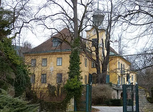 Schloss Feistritz Historic site, Langenwang3.7 km S
-
Traibach River, Styria3.9 km S
-
Sommer Berg Mountain, Krieglach5.3 km W
-
Althohenwang Historic site, Langenwang3.1 km SE
Sources & licences
Data last updated: