Tanzegg
Located in Pinggau, Hartberg-Fürstenfeld District Coordinates: 47°27′00″ N 16°06′00″ E
- Population
- 105
- 105
- Elevation
- 560 m
- above sea level
- Local time
- UTC+01:00
- Europe/Vienna · UTC+01:00
About Tanzegg
Tanzegg is a village. Location: Pinggau, Hartberg-Fürstenfeld District. Population: 105. Elevation: 560 m.
In comparison
- No. 9 of 10 places in Pinggau by population
- Nearest larger town: Elsenau, 2 km SE
- 7 sights and natural places within 10 km Schloss Bärnegg, Schaffern Bach
Airports nearest to Tanzegg
- Graz Airport (GRZ) Feldkirchen bei Graz 71 km
- Vienna International Airport (VIE) Vienna 81 km
- Maribor Edvard Rusjan Airport (MBX) Maribor 112 km
Straight-line distance; airports with scheduled flights only. Source: OurAirports (public domain).
Nearby attractions & nature
Everything nearby-
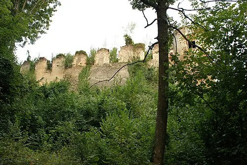 Schloss Bärnegg Historic site, Pinggau2.2 km SE
-
Schaffern Bach River, Austria3.7 km S
-
 Schloss Thalberg Historic site, Dechantskirchen8.4 km SW
-
Ziegersberg Historic site, Zöbern6.1 km NE
-
Steinerne Stiege Mountain, Pinggau12 km NW
-
Spitzer Riegel Mountain, Mönichkirchen7.5 km N
Sources & licences
Data last updated: