Hohes Augst-Eck
Located in Altaussee, Liezen District Coordinates: 47°42′00″ N 13°50′00″ E
- Elevation
- 1,895 m
- above sea level
- Local time
- UTC+01:00
- Europe/Vienna · UTC+01:00
About Hohes Augst-Eck
Hohes Augst-Eck is a mountain. Location: Altaussee, Liezen District. Elevation: 1,895 m.
In comparison
- No. 3386 of 7537 mountains in Austria by elevation
- 130 sights and natural places within 10 km Rauchfang, Niederes Augst-Eck
Nearest towns and villages
-
Grundlsee Municipality, Liezen District8.5 km SE
-
Altaussee Village, Altaussee8.7 km SW
-
Puchen Village, Altaussee9.1 km SW
-
Fischerndorf Village, Altaussee8.9 km SW
-
Gössl Village, Grundlsee9 km SE
-
Lichtersberg Village, Altaussee11 km SW
Nearby attractions & nature
Everything nearby-
Rauchfang Mountain, Altaussee<0.1 km N
-
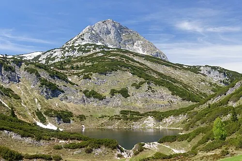 Rinnerkogel Mountain, Ebensee2.3 km N
-
Niederes Augst-Eck Mountain, Altaussee1.3 km W
-
Grießkogel Mountain, Altaussee1.3 km W
-
Kleiner Wildkogel Mountain, Altaussee1.3 km W
-
Hinterer Schwarzmooskogel Mountain, Altaussee1.9 km S
-
Kleiner Rinner Mountain, Altaussee1.9 km N
-
Großer Scheiblingkogel Mountain, Styria2.2 km NW
More nature in Austria
-
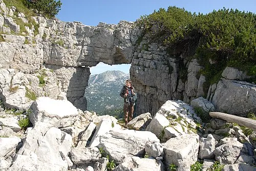 Schönberg Mountain, Altaussee3.8 km W
-
Vorderer Raucher Mountain, Altaussee3.8 km W
-
Vorderer Schwarzmooskogel Mountain, Altaussee3.9 km S
-
Hinterer Raucher Mountain, Altaussee5 km W
-
Großer Wildkogel Mountain, Altaussee2.5 km W
-
Schafberg Mountain, Altaussee5.3 km W
Sources & licences
Data last updated: