Zwoelfer
Located in Mitterberg-Sankt Martin, Liezen District Coordinates: 47°30′51″ N 13°59′33″ E
- Elevation
- 2,146 m
- above sea level
- Local time
- UTC+01:00
- Europe/Vienna · UTC+01:00
- Airports
- SZG Salzburg Airport80 km
- LNZ Linz-Hörsching Airport82 km
About Zwoelfer
Zwoelfer is a mountain. Location: Mitterberg-Sankt Martin, Liezen District. Elevation: 2,146 m. The nearest airport is Salzburg Airport (80 km). Nearby sights include Steinfeld Spitze and Grimming.
Photos of Zwoelfer
-
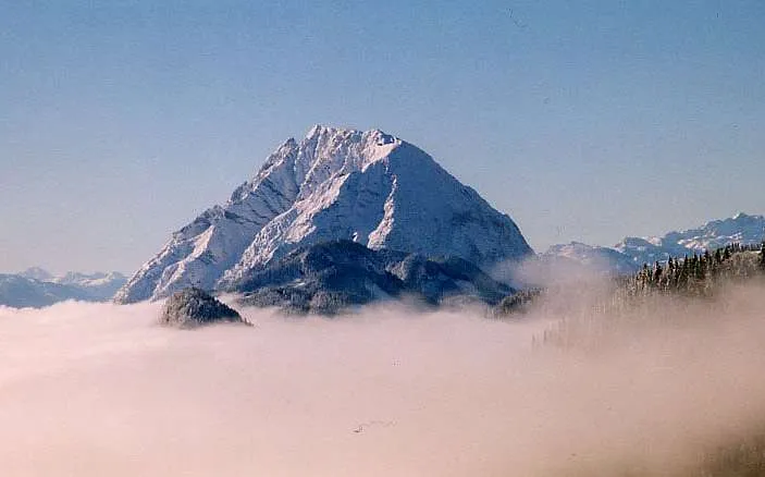
Grimming Tigerente at German Wikipedia · CC BY-SA 3.0 -
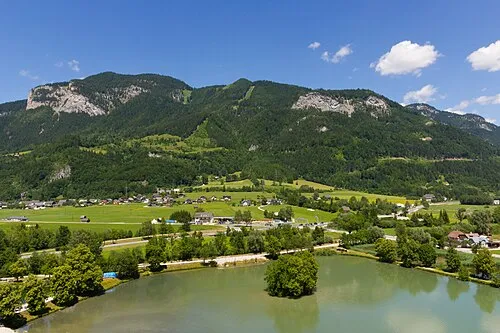
Brandangerkogel Liberaler Humanist · CC BY-SA 3.0 -
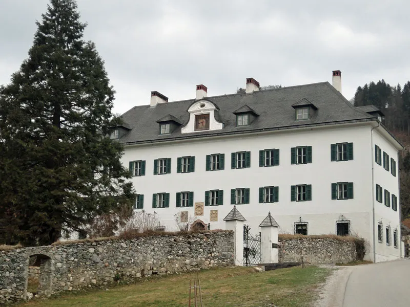
Schloss Gstatt Pezibär · CC BY-SA 3.0


Climate of Zwoelfer
This month · November
A cold month
Day -2° · Night -9° · Rain 96 mm
- Hottest month
- July (day 12°)
- Coldest month
- January (night -14°)
- Wettest month
- July (183 mm)
- Driest month
- February (72 mm)
Bars: average monthly low and high temperature. Below: precipitation. Monthly averages for 1970–2000 at about 18 km resolution, adjusted for elevation. Highlighted months are mild and relatively dry. Source: WorldClim 2.1 (CC BY 4.0).
Show values as a table
| Month | Jan | Feb | Mar | Apr | May | Jun | Jul | Aug | Sep | Oct | Nov | Dec |
|---|---|---|---|---|---|---|---|---|---|---|---|---|
| Average high (°C) | -7° | -5° | -2° | 1° | 7° | 10° | 12° | 12° | 9° | 4° | -2° | -6° |
| Average low (°C) | -14° | -13° | -10° | -7° | -3° | 0° | 2° | 2° | -1° | -5° | -9° | -13° |
| Precipitation (mm) | 79 | 72 | 101 | 98 | 115 | 165 | 183 | 155 | 122 | 90 | 96 | 100 |
How to get to Zwoelfer
The nearest airport is Salzburg Airport (SZG), 80 km to the northwest as the crow flies. The nearest large city is Salzburg, 78 km to the northwest.
Airports
- Salzburg Airport (SZG) Salzburg 80 kmnorthwest
- Linz-Hörsching Airport (LNZ) Linz 82 kmnorth
- Klagenfurt Airport (KLU) Klagenfurt am Wörthersee 100 kmsouth
Nearby large cities
- Salzburg Population: 157.2K 78 kmnorthwest
- Linz Population: 204.8K 91 kmnorth
- Klagenfurt Population: 100.3K 102 kmsouth
- Graz Population: 303.3K 120 kmsoutheast
- Ljubljana Population: 272.2K 167 kmsouth
Straight-line distances; road distances are longer. Airport data: OurAirports.
Day trips from Zwoelfer
Within 100 km: 296 historic and cultural sites, 3,173 natural sites, 968 lakes, rivers and coasts.
0–25 km545 places
- Klamm Natural site 24 kmE
- Brunner See Lake 20 kmNE
- Leistensee Lake 9 kmNE
- Putterersee Lake 11 kmE
25–60 km1,816 places
- Hoher Dachstein Mountain 29 kmW
- Seeriessee Lake 26 kmSW
- Untersee Lake 35 kmSW
- Wildsee Lake 38 kmSW
60–100 km2,076 places
- Gusen I Concentration Camp Historic site 90 kmNE
- Wildsee Lake 70 kmSE
- Brandlsee Lake 98 kmW
- Brechlsee Lake 97 kmW
Straight-line distances.
Nearest towns and villages
-
Sankt Martin am Grimming Village, Mitterberg-Sankt Martin3 km S
-
Diemlern Village, Mitterberg-Sankt Martin2.9 km SE
-
Salza Village, Mitterberg-Sankt Martin3.4 km SW
-
Tipschern Village, Mitterberg-Sankt Martin4.7 km SW
-
Klachau Village, Bad Mitterndorf4.1 km N
-
Krungl Village, Bad Mitterndorf4.2 km N
Nearby attractions & nature
Everything nearby-
Steinfeld Spitze Mountain, Mitterberg-Sankt Martin0.6 km E
-
Grimming Mountain, Bad Mitterndorf2 km NE
-
Schartenspitze Mountain, Mitterberg-Sankt Martin1.2 km E
-
Kulm Kogel Mountain, Bad Mitterndorf2.2 km N
-
Diemlernerwald Natural site, Styria2.4 km SE
-
Mittereck Mountain, Mitterberg-Sankt Martin2.6 km SW
-
Krunglwald Natural site, Styria2.9 km NW
-
Multereck Mountain, Stainach-Pürgg3.1 km NE
Sources & licences
Data last updated: