Judenburg
Located in Murtal District, Styria Coordinates: 47°11′00″ N 14°38′56″ E
- Population
- 10,063
- 10.1K
- Elevation
- 747 m
- above sea level
- Local time
- UTC+01:00
- Europe/Vienna · UTC+01:00
- Places inside
- 18
- listed under Judenburg
About Judenburg
Judenburg is a municipality. Location: Murtal District, Styria. Population: 10,063. Elevation: 747 m.
In comparison
- No. 2 of 20 places in Murtal District by population
- Nearest larger town: Knittelfeld, 13 km E
- 22 sights and natural places within 10 km Schloss Weyer, Ruine Antoneum
- Listed here: Village: 14, Historic site: 2, Mountain: 1, Town: 1
Places in Judenburg
18 places-
Judenburg Town8.5K
-
Oberweg Village513
-
Strettweg Village375
-
Feeberg Village178
-
Waltersdorf Village131
-
Auerling Village129
-
Reifling Village60
-
Ossach Village46
-
Gasselsdorf Village33
-
Ritzersdorf Village14
-
Allerheiligen Village
-
Liechtensteinberg Mountain
-
Murdorf Village
-
Oberweg Fichtenhain Village
-
Paßhammer Village
-
Ruine Antoneum Historic site
-
Schloss Weyer Historic site
-
Weißes Kreuz Village
Nearby attractions & nature
Everything nearby-
Ruine Liechtenstein Historic site, Weißkirchen in Steiermark2.9 km SE
-
Fohnsdorfer Bühel Mountain, Fohnsdorf4.9 km N
-
Hölzlberg Mountain, Gaal7.5 km N
-
Schloss Sauerbrunn Historic site, Sankt Peter ob Judenburg6.5 km W
-
Ederkogel Mountain, Pöls-Oberkurzheim7.5 km NW
-
Reiflingberg Mountain, Obdach7.5 km S
-
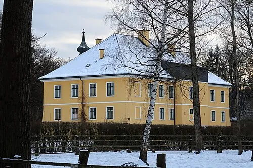 Schloss Authal Historic site, Weißkirchen in Steiermark7.9 km E
-
Flatschacherschlag Mountain, Fohnsdorf7.6 km NE
Sources & licences
Data last updated: