Sonntagsbühel
Located in Stadl-Predlitz, Politischer Bezirk Murau Coordinates: 46°59′13″ N 13°58′01″ E
- Elevation
- 2,112 m
- above sea level
- Local time
- UTC+01:00
- Europe/Vienna · UTC+01:00
- Airports
- KLU Klagenfurt Airport48 km
- LJU Ljubljana Jože Pučnik Airport93 km
About Sonntagsbühel
Sonntagsbühel is a mountain. Location: Stadl-Predlitz, Politischer Bezirk Murau. Elevation: 2,112 m. The nearest airport is Klagenfurt Airport (48 km). Nearby sights include Dammeggernock and Grünbühel.
Photos of Sonntagsbühel
-
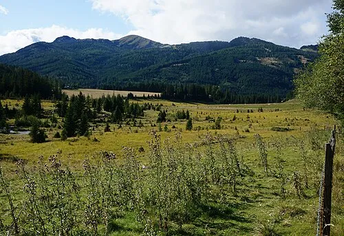
Dammeggernock Naturpuur · CC BY-SA 4.0

Climate of Sonntagsbühel
This month · November
A wet month
Day -1° · Night -8° · Rain 145 mm
- Hottest month
- July (day 12°)
- Coldest month
- February (night -12°)
- Wettest month
- July (193 mm)
- Driest month
- February (79 mm)
Bars: average monthly low and high temperature. Below: precipitation. Monthly averages for 1970–2000 at about 18 km resolution, adjusted for elevation. Highlighted months are mild and relatively dry. Source: WorldClim 2.1 (CC BY 4.0).
Show values as a table
| Month | Jan | Feb | Mar | Apr | May | Jun | Jul | Aug | Sep | Oct | Nov | Dec |
|---|---|---|---|---|---|---|---|---|---|---|---|---|
| Average high (°C) | -4° | -4° | -2° | 1° | 7° | 10° | 12° | 12° | 9° | 6° | -1° | -4° |
| Average low (°C) | -12° | -12° | -10° | -7° | -2° | 1° | 3° | 3° | 0° | -3° | -8° | -11° |
| Precipitation (mm) | 86 | 79 | 113 | 140 | 150 | 190 | 193 | 170 | 160 | 146 | 145 | 115 |
How to get to Sonntagsbühel
The nearest airport is Klagenfurt Airport (KLU), 48 km to the southeast as the crow flies. The nearest large city is Klagenfurt, 48 km to the southeast.
Airports
- Klagenfurt Airport (KLU) Klagenfurt am Wörthersee 48 kmsoutheast
- Ljubljana Jože Pučnik Airport (LJU) Zgornji Brnik 93 kmsoutheast
- Graz Airport (GRZ) Feldkirchen bei Graz 112 kmeast
Nearby large cities
- Klagenfurt Population: 100.3K 48 kmsoutheast
- Graz Population: 303.3K 112 kmeast
- Salzburg Population: 157.2K 114 kmnorthwest
- Linz Population: 204.8K 149 kmnorth
- Rijeka Population: 108K 188 kmsouth
Straight-line distances; road distances are longer. Airport data: OurAirports.
Day trips from Sonntagsbühel
Within 100 km: 264 historic and cultural sites, 3,290 natural sites, 914 lakes, rivers and coasts.
0–25 km207 places
- Schattensee Lake 22 kmN
- Prebersee Lake 24 kmN
- Lambrecht See Lake 22 kmNE
- Hauserersee Lake 9 kmNE
25–60 km1,436 places
- Seeriessee Lake 44 kmN
- Untersee Lake 49 kmNW
- Wildsee Lake 37 kmNW
- Wildsee Lake 47 kmE
60–100 km2,825 places
- Hoher Dachstein Mountain 61 kmNW
- Klamm Natural site 65 kmNE
- Vorderer Langtalsee Lake 90 kmW
- Treffnersee Lake 75 kmNE
Straight-line distances.
Nearest towns and villages
-
Allach Village, Stadl-Predlitz1.9 km SW
-
Kaltwasser Village, Stadl-Predlitz4 km NE
-
Turrach Village, Stadl-Predlitz6.7 km SW
-
Hannebauer Village, Stadl-Predlitz4.3 km W
-
Kaiser Village, Stadl-Predlitz5 km W
-
Flattnitz Village, Glödnitz7 km SE
Nearby attractions & nature
Everything nearby-
Dammeggernock Mountain, Stadl-Predlitz1.5 km E
-
Grünbühel Mountain, Stadl-Predlitz1.9 km NW
-
Würflingerhöhe Mountain, Stadl-Predlitz3.5 km N
-
Wildanger Mountain, Stadl-Predlitz3.4 km SW
-
Strannerhöhe Mountain, Stadl-Predlitz4.2 km N
-
Tschaudinock Mountain, Stadl-Predlitz4.3 km NW
-
Eisenhut Mountain, Stadl-Predlitz4.8 km SW
-
Großer Speikkofel Mountain, Carinthia4.8 km SW
More nature in Austria
-
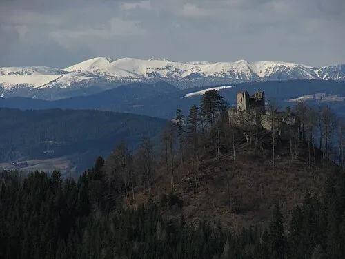 Prankerhöhe Mountain, Stadl-Predlitz8.7 km NE
-
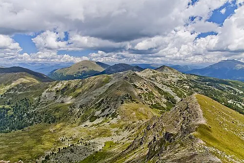 Reisseck Mountain, Stadl-Predlitz8.8 km W
-
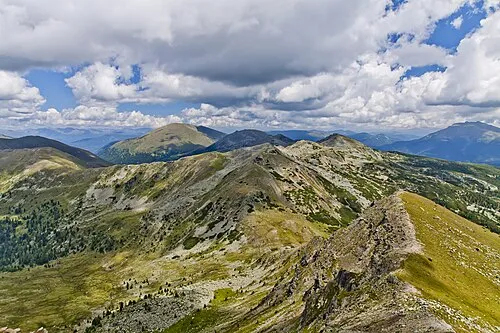 Mühlbachernock Mountain, Stadl-Predlitz8.7 km SW
-
Goldachnock Mountain, Stadl-Predlitz8.2 km NE
-
Schwarnbrunn Mountain, Stadl-Predlitz8.3 km NE
-
Rotofen Mountain, Stadl-Predlitz8.3 km NW
Sources & licences
Data last updated: