Sankt Anna am Aigen
Located in Südoststeiermark District, Styria Coordinates: 46°50′14″ N 15°58′28″ E
- Population
- 2,357
- 2.4K
- Elevation
- 368 m
- above sea level
- Local time
- UTC+01:00
- Europe/Vienna · UTC+01:00
- Places inside
- 37
- listed under Sankt Anna am Aigen
About Sankt Anna am Aigen
Sankt Anna am Aigen is a municipality. Location: Südoststeiermark District, Styria. Population: 2,357. Elevation: 368 m.
In comparison
- No. 15 of 26 places in Südoststeiermark District by population
- Nearest larger town: Bad Gleichenberg, 8 km NW
- 64 sights and natural places within 10 km Schirrenkogel, Rotterberg
- Listed here: Village: 33, Mountain: 2, Landmark: 1, Neighbourhood: 1
Places in Sankt Anna am Aigen
37 places-
Aigen Village403
-
Plesch Village366
-
Jamm Village352
-
Waltra Village276
-
Gießelsdorf Village256
-
Frutten Village209
-
Hochstraden Village145
-
Sichauf Village144
-
Risola Village74
-
Buch Village
-
Damberg Village
-
Egg Village
-
Eisenberg Village
-
Gaisruck Village
-
Gießelsdorfberg Village
-
Globitsch Village
-
Himberg Village
-
Hopfenberg Village
-
Jammberg Village
-
Jammzeil Neighbourhood
-
Klapping Village
-
Kraschitz Village
-
Lahmbach Village
-
Liedtberg Village
-
Münzen Village
-
Pichl Village
-
Risolaberg Village
-
Rutschen Village
-
Sankt Anna am Aigen Village
-
Schaitzen Village
-
Schemming Village
-
Schirrenkogel Mountain
-
Sendeturm Stradner Kogel Landmark
-
Stindlkreuz Village
-
Stradner Kogel Mountain
-
Weinberg Village
-
Woboth Village
Nearby attractions & nature
Everything nearby-
Rotterberg Mountain, Burgenland2 km E
-
Roberbach River, Austria2.4 km NE
-
Schulenwald Natural site, Styria2.9 km SW
-
Wachtriegel Mountain, Burgenland3.2 km E
-
Kalchberg Mountain, Neuhaus am Klausenbach4.1 km NE
-
Kogelwald Natural site, Styria3.5 km NW
-
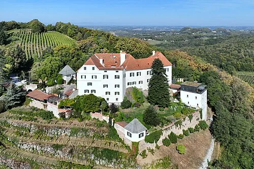 Schloß Kapfenstein Historic site, Kapfenstein5.2 km N
-
Jeserbach River, Styria3.4 km N
Sources & licences
Data last updated: