- Elevation
- 2,493 m
- above sea level
- Local time
- UTC+01:00
- Europe/Vienna · UTC+01:00
- Airports
- INN Innsbruck Airport37 km
- FMM Memmingen Allgau Airport86 km
About Wannig
Wannig is a mountain. Location: Nassereith, Politischer Bezirk Imst. Elevation: 2,493 m. The nearest airport is Innsbruck Airport (37 km). Nearby sights include Oberer Geierkopf and Handschuhspitze.
Photos of Wannig
-
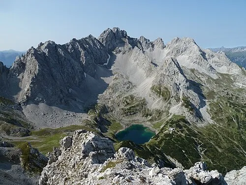
Grünstein Stefan Kasberger · CC BY-SA 4.0 -
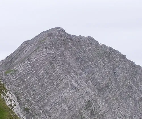
Gartnerwand Sven Schefzyk · CC BY-SA 3.0


Climate of Wannig
This month · November
A cold month
Day -3° · Night -9° · Rain 88 mm
- Hottest month
- July (day 11°)
- Coldest month
- January (night -13°)
- Wettest month
- July (166 mm)
- Driest month
- February (68 mm)
Bars: average monthly low and high temperature. Below: precipitation. Monthly averages for 1970–2000 at about 18 km resolution, adjusted for elevation. Highlighted months are mild and relatively dry. Source: WorldClim 2.1 (CC BY 4.0).
Show values as a table
| Month | Jan | Feb | Mar | Apr | May | Jun | Jul | Aug | Sep | Oct | Nov | Dec |
|---|---|---|---|---|---|---|---|---|---|---|---|---|
| Average high (°C) | -7° | -6° | -3° | 0° | 5° | 8° | 11° | 10° | 7° | 3° | -3° | -6° |
| Average low (°C) | -13° | -13° | -10° | -8° | -3° | -1° | 2° | 2° | -1° | -4° | -9° | -12° |
| Precipitation (mm) | 69 | 68 | 84 | 94 | 117 | 157 | 166 | 153 | 104 | 81 | 88 | 80 |
How to get to Wannig
The nearest airport is Innsbruck Airport (INN), 37 km to the east as the crow flies. The nearest large city is Innsbruck, 41 km to the east.
Airports
- Innsbruck Airport (INN) Innsbruck 37 kmeast
- Memmingen Allgau Airport (FMM) Memmingen 86 kmnorthwest
- Sankt Gallen Altenrhein Airport (ACH) St. Gallen 100 kmwest
Nearby large cities
- Innsbruck Population: 132.5K 41 kmeast
- Munich Population: 1.5M 104 kmnortheast
- Augsburg Population: 301.1K 115 kmnorth
- Ulm Population: 120.5K 135 kmnorthwest
- Winterthur Population: 111.8K 162 kmwest
Straight-line distances; road distances are longer. Airport data: OurAirports.
Day trips from Wannig
Within 100 km: 308 historic and cultural sites, 5,126 natural sites, 1,187 lakes, rivers and coasts.
0–25 km445 places
- Wildsee Lake 24 kmE
- Weissensee Lake 3 kmN
- Taxersee Lake 22 kmSE
- Seebensee Lake 6 kmNE
25–60 km2,472 places
- Bayerisches Oberland Mountain 52 kmNE
- Schloss Hirschberg am Haarsee Historic site 59 kmNE
- Kapfkopf Mountain 44 kmSW
- Bürkelkopf Mountain 55 kmSW
60–100 km3,704 places
- Lake Davos Lake 96 kmSW
- Weiher Diepoldsau Lake 90 kmW
- Gotschnaseeli Lake 94 kmSW
- Lai da Juata Lake 87 kmSW
Straight-line distances.
Nearest towns and villages
-
Nassereith Village, Nassereith3.1 km SW
-
Biberwier Municipality, Politischer Bezirk Reutte3.6 km N
-
Holzleiten Village, Obsteig2.7 km SE
-
Aschland Village, Obsteig2.7 km SE
-
Fernstein Village, Nassereith3.8 km NW
-
Obsteig Municipality, Politischer Bezirk Imst6.7 km SE
Nearby attractions & nature
Everything nearby-
Oberer Geierkopf Mountain, Nassereith1.2 km SW
-
Handschuhspitze Mountain, Obsteig1.6 km E
-
Gampenköpfle Mountain, Obsteig2.1 km E
-
Grünstein Mountain, Obsteig4.4 km E
-
Auf dem Horn Mountain, Obsteig4.3 km S
-
Marienberg Mountain, Obsteig4.4 km E
-
Schachtkopf Mountain, Biberwier4.2 km NE
-
Höllkopf Mountain, Obsteig4.3 km E
More nature in Austria
-
Gartnerwand Mountain, Nassereith6.4 km NW
-
Simmering Mountain, Nassereith5.9 km S
-
Loreck Mountain, Nassereith8 km NW
-
Loreakopf Mountain, Nassereith7.4 km W
-
Schönbichlkopf Mountain, Nassereith9.2 km W
Sources & licences
Data last updated: