Hoadl
Located in Grinzens, Politischer Bezirk Innsbruck Land Coordinates: 47°10′59″ N 11°16′53″ E
- Elevation
- 2,340 m
- above sea level
- Local time
- UTC+01:00
- Europe/Vienna · UTC+01:00
- Airports
- INN Innsbruck Airport10 km
- BZO Bolzano Airport81 km
About Hoadl
Hoadl is a mountain. Location: Grinzens, Politischer Bezirk Innsbruck Land. Elevation: 2,340 m. The nearest airport is Innsbruck Airport (10 km). Nearby sights include Axamer Lizum and Senderstal.
Photos of Hoadl
-
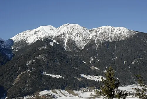
Nederjoch Haneburger · Public domain -
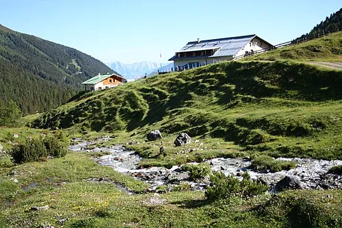
Senderstal Simon Legner · CC BY-SA 4.0


Climate of Hoadl
This month · November
A cold month
Day -2° · Night -9° · Rain 77 mm
- Hottest month
- July (day 13°)
- Coldest month
- January (night -12°)
- Wettest month
- July (150 mm)
- Driest month
- February (52 mm)
Bars: average monthly low and high temperature. Below: precipitation. Monthly averages for 1970–2000 at about 18 km resolution, adjusted for elevation. Highlighted months are mild and relatively dry. Source: WorldClim 2.1 (CC BY 4.0).
Show values as a table
| Month | Jan | Feb | Mar | Apr | May | Jun | Jul | Aug | Sep | Oct | Nov | Dec |
|---|---|---|---|---|---|---|---|---|---|---|---|---|
| Average high (°C) | -6° | -5° | -1° | 2° | 7° | 10° | 13° | 12° | 9° | 4° | -2° | -5° |
| Average low (°C) | -12° | -12° | -10° | -7° | -2° | 1° | 3° | 3° | 0° | -4° | -9° | -11° |
| Precipitation (mm) | 56 | 52 | 68 | 79 | 103 | 140 | 150 | 137 | 95 | 75 | 77 | 66 |
How to get to Hoadl
The nearest airport is Innsbruck Airport (INN), 10 km to the northeast as the crow flies. The nearest large city is Innsbruck, 12 km to the northeast.
Airports
- Innsbruck Airport (INN) Innsbruck 10 kmnortheast
- Bolzano Airport (BZO) Bolzano (BZ) 81 kmsouth
- Memmingen Allgau Airport (FMM) Memmingen 119 kmnorthwest
Nearby large cities
- Innsbruck Population: 132.5K 12 kmnortheast
- Munich Population: 1.5M 108 kmnorth
- Augsburg Population: 301.1K 135 kmnorth
- Salzburg Population: 157.2K 149 kmnortheast
- Ulm Population: 120.5K 166 kmnorthwest
Straight-line distances; road distances are longer. Airport data: OurAirports.
Day trips from Hoadl
Within 100 km: 181 historic and cultural sites, 5,008 natural sites, 1,065 lakes, rivers and coasts.
0–25 km298 places
- Wildsee Lake 17 kmNW
- Taxersee Lake 14 kmNW
- Obernberger See Lake 24 kmS
- Mutterberger See Lake 22 kmSW
25–60 km1,931 places
- Bayerisches Oberland Mountain 53 kmN
- Zireiner See Lake 51 kmNE
- Wild See Lake 30 kmSE
- Wilder See Lake 32 kmW
60–100 km4,025 places
- Schloss Hirschberg am Haarsee Historic site 70 kmN
- Lai da Juata Lake 94 kmSW
- Lai Verd Lake 94 kmSW
- Lai da Costainas Lake 94 kmSW
Straight-line distances.
Nearest towns and villages
-
Axams Municipality, Politischer Bezirk Innsbruck Land2.8 km N
-
Axamer Lizum Village, Axams2.1 km NE
-
Telfes im Stubai Municipality, Politischer Bezirk Innsbruck Land4.1 km SE
-
Axams Town, Axams5.3 km N
-
Birgitz Municipality, Politischer Bezirk Innsbruck Land4.8 km N
-
Grinzens Village, Grinzens5.6 km NW
Nearby attractions & nature
Everything nearby-
Axamer Lizum Mountain, Axams0.1 km E
-
Senderstal Natural site, Tyrol1.1 km W
-
Pleisen Mountain, Zirl1 km N
-
Widdersberg Mountain, Axams1.3 km E
-
Hochtennspitze Mountain, Grinzens1.5 km SE
-
Malgrubenspitze Mountain, Axams1.7 km SE
-
Schlicker Zinnen Mountain, Telfes im Stubai1.7 km S
-
Sunntiger Mountain, Grinzens1.8 km SW
Sources & licences
Data last updated: