Kirchl
Located in Hochfilzen, Politischer Bezirk Kitzbühel Coordinates: 47°29′49″ N 12°37′39″ E
- Elevation
- 1,691 m
- above sea level
- Local time
- UTC+01:00
- Europe/Vienna · UTC+01:00
- Airports
- SZG Salzburg Airport43 km
- INN Innsbruck Airport100 km
About Kirchl
Kirchl is a mountain. Location: Hochfilzen, Politischer Bezirk Kitzbühel. Elevation: 1,691 m. The nearest airport is Salzburg Airport (43 km). Nearby sights include Geierkogel and Wiesensee.
Photos of Kirchl
-
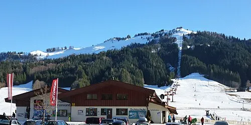
Buchensteinwand Tnemtsoni · CC BY-SA 3.0 -
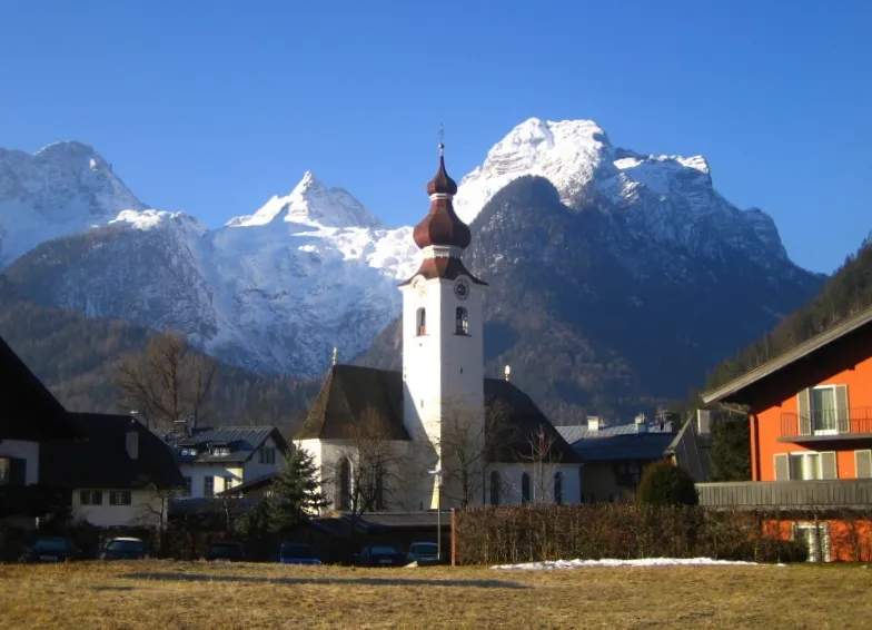
Breithorn pufacz · Public domain


Climate of Kirchl
This month · November
A cold month
Day 2° · Night -5° · Rain 86 mm
- Hottest month
- July (day 16°)
- Coldest month
- January (night -9°)
- Wettest month
- July (173 mm)
- Driest month
- February (64 mm)
Bars: average monthly low and high temperature. Below: precipitation. Monthly averages for 1970–2000 at about 18 km resolution, adjusted for elevation. Highlighted months are mild and relatively dry. Source: WorldClim 2.1 (CC BY 4.0).
Show values as a table
| Month | Jan | Feb | Mar | Apr | May | Jun | Jul | Aug | Sep | Oct | Nov | Dec |
|---|---|---|---|---|---|---|---|---|---|---|---|---|
| Average high (°C) | -2° | -1° | 2° | 5° | 11° | 14° | 16° | 16° | 13° | 9° | 2° | -1° |
| Average low (°C) | -9° | -9° | -6° | -3° | 1° | 4° | 7° | 7° | 4° | 0° | -5° | -8° |
| Precipitation (mm) | 69 | 64 | 82 | 87 | 112 | 155 | 173 | 153 | 107 | 82 | 86 | 82 |
How to get to Kirchl
The nearest airport is Salzburg Airport (SZG), 43 km to the northeast as the crow flies. The nearest large city is Salzburg, 46 km to the northeast.
Airports
- Salzburg Airport (SZG) Salzburg 43 kmnortheast
- Innsbruck Airport (INN) Innsbruck 100 kmwest
- Munich Airport (MUC) Munich 114 kmnorthwest
Nearby large cities
- Salzburg Population: 157.2K 46 kmnortheast
- Innsbruck Population: 132.5K 97 kmwest
- Munich Population: 1.5M 106 kmnorthwest
- Linz Population: 204.8K 153 kmnortheast
- Klagenfurt Population: 100.3K 160 kmsoutheast
Straight-line distances; road distances are longer. Airport data: OurAirports.
Day trips from Kirchl
Within 100 km: 260 historic and cultural sites, 4,268 natural sites, 1,178 lakes, rivers and coasts.
0–25 km346 places
- Lake Zell Lake 24 kmSE
- Wildsee Lake 10 kmSW
- Wiesensee Lake 1 kmNW
- Schwarzsee Lake 20 kmW
25–60 km2,154 places
- Frauenchiemsee Island 44 kmN
- Herreninsel Island 44 kmNW
- Fürlegsee Lake 40 kmS
- Vorderer Langtalsee Lake 56 kmS
60–100 km3,206 places
- Hoher Dachstein Mountain 74 kmE
- Bayerisches Oberland Mountain 96 kmW
- Sille River 81 kmS
- Seeriessee Lake 86 kmE
Straight-line distances.
Nearest towns and villages
-
Hochfilzen Village, Hochfilzen3.5 km S
-
St. Ulrich am Pillersee Municipality, Politischer Bezirk Kitzbühel3.8 km NW
-
Warming Village, Hochfilzen1.7 km SW
-
Sankt Ulrich am Pillersee Village, St. Ulrich am Pillersee5.4 km NW
-
St. Jakob in Haus Municipality, Politischer Bezirk Kitzbühel5.4 km W
-
Magnesilwerk Village, Hochfilzen3.4 km S
Nearby attractions & nature
Everything nearby-
Geierkogel Mountain, St. Ulrich am Pillersee0.6 km NE
-
Wiesensee Lake, Tyrol0.9 km NW
-
Hochsäul Mountain, Hochfilzen3 km E
-
Buchensteinwand Mountain, Fieberbrunn3.7 km SW
-
Kleines Marchent Horn Mountain, Hochfilzen3.3 km SE
-
Grosses Marchent Horn Mountain, Hochfilzen3.3 km SE
-
Ochsenhorn Mountain, State of Salzburg4 km NE
-
Heueck Mountain, Hochfilzen4.5 km E
Sources & licences
Data last updated: