Kleinglockner
Located in Kals am Großglockner, Politischer Bezirk Lienz Coordinates: 47°04′27″ N 12°41′41″ E
- Elevation
- 3,770 m
- above sea level
- Local time
- UTC+01:00
- Europe/Vienna · UTC+01:00
- Airports
- SZG Salzburg Airport83 km
- INN Innsbruck Airport104 km
About Kleinglockner
Kleinglockner is a mountain. Location: Kals am Großglockner, Politischer Bezirk Lienz. Elevation: 3,770 m. The nearest airport is Salzburg Airport (83 km). Nearby sights include Grossglockner and Glocknergruppe.
Climate of Kleinglockner
This month · November
A wet month
Day -11° · Night -16° · Rain 126 mm
- Hottest month
- July (day 1°)
- Coldest month
- February (night -21°)
- Wettest month
- July (174 mm)
- Driest month
- February (89 mm)
Bars: average monthly low and high temperature. Below: precipitation. Monthly averages for 1970–2000 at about 18 km resolution, adjusted for elevation. Highlighted months are mild and relatively dry. Source: WorldClim 2.1 (CC BY 4.0).
Show values as a table
| Month | Jan | Feb | Mar | Apr | May | Jun | Jul | Aug | Sep | Oct | Nov | Dec |
|---|---|---|---|---|---|---|---|---|---|---|---|---|
| Average high (°C) | -15° | -15° | -13° | -10° | -5° | -2° | 1° | 1° | -2° | -6° | -11° | -13° |
| Average low (°C) | -20° | -21° | -19° | -16° | -11° | -8° | -6° | -6° | -8° | -11° | -16° | -19° |
| Precipitation (mm) | 96 | 89 | 117 | 126 | 134 | 157 | 174 | 159 | 123 | 113 | 126 | 111 |
How to get to Kleinglockner
The nearest airport is Salzburg Airport (SZG), 83 km to the north as the crow flies. The nearest large city is Salzburg, 85 km to the north.
Airports
- Salzburg Airport (SZG) Salzburg 83 kmnorth
- Innsbruck Airport (INN) Innsbruck 104 kmwest
- Bolzano Airport (BZO) Bolzano (BZ) 125 kmsouthwest
Nearby large cities
- Salzburg Population: 157.2K 85 kmnorth
- Innsbruck Population: 132.5K 101 kmwest
- Klagenfurt Population: 100.3K 133 kmeast
- Munich Population: 1.5M 145 kmnorthwest
- Linz Population: 204.8K 182 kmnortheast
Straight-line distances; road distances are longer. Airport data: OurAirports.
Day trips from Kleinglockner
Within 100 km: 206 historic and cultural sites, 4,251 natural sites, 996 lakes, rivers and coasts.
0–25 km813 places
- Fürlegsee Lake 9 kmNW
- Vorderer Langtalsee Lake 11 kmSE
- Eissee Lake 24 kmW
- Brandlsee Lake 19 kmN
25–60 km1,640 places
- Sille River 38 kmSW
- Kleiner Paarsee Lake 40 kmNE
- Großer Paarsee Lake 40 kmNE
- Schuhflickersee Lake 41 kmNE
60–100 km3,000 places
- Hoher Dachstein Mountain 82 kmNE
- Frauenchiemsee Island 91 kmN
- Herreninsel Island 90 kmN
- Piz Gralba Mountain 92 kmSW
Straight-line distances.
Nearest towns and villages
-
Burg Village, Kals am Großglockner7.7 km SW
-
Jörgnalm Village, Kals am Großglockner5.4 km S
-
Großdorf Village, Kals am Großglockner8.4 km SW
-
Heiligenblut Municipality, Spittal an der Drau District8.8 km E
-
Glor-Berg Village, Kals am Großglockner8.4 km S
-
Ködnitz Neighbourhood, Kals am Großglockner9.1 km SW
Nearby attractions & nature
Everything nearby-
Grossglockner Mountain, Kals am Großglockner0.1 km NW
-
Glocknergruppe Mountain, Heiligenblut0.1 km N
-
Glocknerhorn Mountain, Heiligenblut0.3 km NW
-
Teufelshorn Mountain, Kals am Großglockner0.3 km NW
-
Kleinglocknerkees Natural site, Carinthia0.5 km E
-
Glocknerkees Natural site, Carinthia0.5 km N
-
Adlersruhe Mountain, Kals am Großglockner0.7 km SE
-
Hofmannspitze Mountain, Kals am Großglockner0.9 km NW
More nature in Austria
-
Eiskögele Mountain, Kals am Großglockner4.1 km NW
-
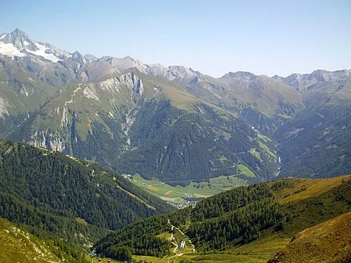 Figerhorn Mountain, Kals am Großglockner5 km S
-
Blaue Köpfe Mountain, Kals am Großglockner0.9 km SE
-
Schere Mountain, Kals am Großglockner1.2 km SW
-
Luisenkopf Mountain, Kals am Großglockner1.2 km SW
-
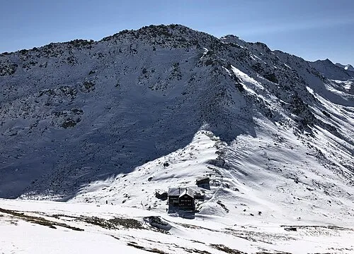 Kastenegg Mountain, Kals am Großglockner4.8 km S
Sources & licences
Data last updated: