Bach
Located in Politischer Bezirk Reutte, Tyrol Coordinates: 47°16′11″ N 10°24′13″ E
- Population
- 629
- 629
- Elevation
- 1,060 m
- above sea level
- Local time
- UTC+01:00
- Europe/Vienna · UTC+01:00
- Places inside
- 16
- listed under Bach
About Bach
Bach is a municipality. Location: Politischer Bezirk Reutte, Tyrol. Population: 629. Elevation: 1,060 m.
In comparison
- No. 17 of 37 places in Politischer Bezirk Reutte by population
- Nearest larger town: Elbigenalp, 3 km N
- 93 sights and natural places within 10 km Alperschonbach, Hinterer Sonnenkogel
- Listed here: Village: 10, Mountain: 6
Places in Bach
16 places-
Bach Village399
-
Stockach Village166
-
Bichl Village
-
Fallenbacher Spitze Mountain
-
Hinterer Sonnenkogel Mountain
-
Muttlerkopf Mountain
-
Obergiblen Village
-
Obergrünau Village
-
Oberstockach Village
-
Peischelspitze Mountain
-
Ruitel Spitze Mountain
-
Seesumpf Village
-
Sulzlbach Village
-
Tajaspitze Mountain
-
Untergrünau Village
-
Unterstockach Village
Nearby attractions & nature
Everything nearby-
Alperschonbach River, Tyrol0.4 km SW
-
Jöchlespitze Mountain, Holzgau3.8 km W
-
Sulzlbach River, Tyrol3.5 km SW
-
Krottenkopf Mountain, Holzgau5.9 km NW
-
Rothorn Spitze Mountain, Holzgau4.3 km W
-
Jöchelspitze Mountain, Holzgau4.3 km W
-
Strahlkopf Mountain, Holzgau4.5 km NW
-
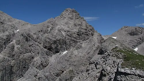 Öfnerspitze Mountain, Germany6.8 km NW
Sources & licences
Data last updated: