Mühlwaldköpfl = Gartigköpfl
Located in Berwang, Politischer Bezirk Reutte Coordinates: 47°24′21″ N 10°47′48″ E
- Elevation
- 1,719 m
- above sea level
- Local time
- UTC+01:00
- Europe/Vienna · UTC+01:00
- Airports
- INN Innsbruck Airport44 km
- FMM Memmingen Allgau Airport77 km
About Mühlwaldköpfl = Gartigköpfl
Mühlwaldköpfl = Gartigköpfl is a mountain. Location: Berwang, Politischer Bezirk Reutte. Elevation: 1,719 m. The nearest airport is Innsbruck Airport (44 km). Nearby sights include Hintertoren Tal and Gartnerwand.
Photos of Mühlwaldköpfl = Gartigköpfl
-
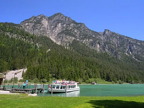
Tauernberg Christian Allinger Camera location 47° 27′ 19.99″ N, 10° 45′ 38.57″ E View this and other nearby images on: OpenStreetMa · CC BY 2.0 -
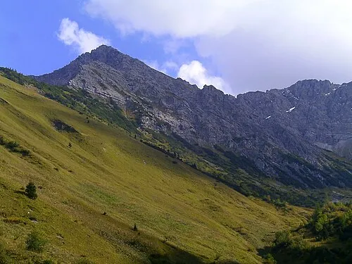
Roter Stein Jensibua · CC BY-SA 3.0 -
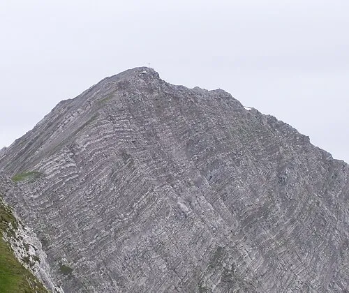
Gartnerwand Sven Schefzyk · CC BY-SA 3.0


Climate of Mühlwaldköpfl = Gartigköpfl
This month · November
A cold month
Day 2° · Night -4° · Rain 86 mm
- Hottest month
- July (day 16°)
- Coldest month
- January (night -8°)
- Wettest month
- July (165 mm)
- Driest month
- February (69 mm)
Bars: average monthly low and high temperature. Below: precipitation. Monthly averages for 1970–2000 at about 18 km resolution, adjusted for elevation. Highlighted months are mild and relatively dry. Source: WorldClim 2.1 (CC BY 4.0).
Show values as a table
| Month | Jan | Feb | Mar | Apr | May | Jun | Jul | Aug | Sep | Oct | Nov | Dec |
|---|---|---|---|---|---|---|---|---|---|---|---|---|
| Average high (°C) | -2° | -1° | 2° | 5° | 10° | 13° | 16° | 16° | 12° | 8° | 2° | -1° |
| Average low (°C) | -8° | -8° | -6° | -3° | 2° | 5° | 7° | 7° | 4° | 1° | -4° | -7° |
| Precipitation (mm) | 70 | 69 | 82 | 91 | 115 | 154 | 165 | 152 | 104 | 79 | 86 | 80 |
How to get to Mühlwaldköpfl = Gartigköpfl
The nearest airport is Innsbruck Airport (INN), 44 km to the east as the crow flies. The nearest large city is Innsbruck, 48 km to the east.
Airports
- Innsbruck Airport (INN) Innsbruck 44 kmeast
- Memmingen Allgau Airport (FMM) Memmingen 77 kmnorthwest
- Sankt Gallen Altenrhein Airport (ACH) St. Gallen 94 kmwest
Nearby large cities
- Innsbruck Population: 132.5K 48 kmeast
- Munich Population: 1.5M 100 kmnortheast
- Augsburg Population: 301.1K 108 kmnorth
- Ulm Population: 120.5K 126 kmnorthwest
- Winterthur Population: 111.8K 157 kmwest
Straight-line distances; road distances are longer. Airport data: OurAirports.
Day trips from Mühlwaldköpfl = Gartigköpfl
Within 100 km: 359 historic and cultural sites, 5,070 natural sites, 1,213 lakes, rivers and coasts.
0–25 km629 places
- Weissensee Lake 7 kmSE
- Vilsalpsee Lake 23 kmW
- Traualpsee Lake 22 kmW
- Seebensee Lake 11 kmSE
25–60 km2,329 places
- Bayerisches Oberland Mountain 51 kmNE
- Schloss Hirschberg am Haarsee Historic site 55 kmNE
- Kapfkopf Mountain 46 kmSW
- Bürkelkopf Mountain 57 kmSW
60–100 km3,684 places
- Lake Davos Lake 97 kmSW
- Weiher Diepoldsau Lake 85 kmW
- Gotschnaseeli Lake 94 kmSW
- Lai da Juata Lake 92 kmS
Straight-line distances.
Nearest towns and villages
Nearby attractions & nature
Everything nearby-
Hintertoren Tal Natural site, Tyrol1.6 km NW
-
Gartnerwand Mountain, Nassereith2.8 km SE
-
Bleispitze Mountain, Berwang1.8 km SE
-
Roter Stein Mountain, Berwang3.4 km SW
-
Zingerstein Mountain, Bichlbach3.1 km N
-
Axljoch Berg Mountain, Berwang3.7 km W
-
Kohlbergspitze Mountain, Bichlbach3.6 km N
-
Loreck Mountain, Nassereith4.9 km SW
Sources & licences
Data last updated: