Freinberg
Located in Politischer Bezirk Schärding, Upper Austria Coordinates: 48°33′59″ N 13°30′46″ E
- Population
- 1,527
- 1.5K
- Elevation
- 446 m
- above sea level
- Local time
- UTC+01:00
- Europe/Vienna · UTC+01:00
- Places inside
- 26
- listed under Freinberg
About Freinberg
Freinberg is a municipality. Location: Politischer Bezirk Schärding, Upper Austria. Population: 1,527. Elevation: 446 m.
In comparison
- No. 19 of 30 places in Politischer Bezirk Schärding by population
- Nearest larger town: Passau, 5 km W
- 45 sights and natural places within 10 km Edtwald, Kräutelstein
- Listed here: Village: 25, Historic site: 1
Places in Freinberg
26 places-
Freinberg Village365
-
Haibach Village356
-
Hinding Village235
-
Anzberg Village221
-
Kritzing Village105
-
Saming Village67
-
Lehen Village65
-
Hanzing Village44
-
Aigen Village
-
Außerhareth Village
-
Breitteich Village
-
Edt Village
-
Erledt Village
-
Grinzing Village
-
Haibach bei Schärding Village
-
Höh Village
-
Innerhareth Village
-
Lochdobl Village
-
Mauthner Village
-
Neudling Village
-
Neusaming Village
-
Oberhaibach Village
-
Parz Village
-
Ruine Königstein Historic site
-
Unterfreinberg Village
-
Weg Village
Nearby attractions & nature
Everything nearby-
Edtwald Natural site, Upper Austria1.2 km SE
-
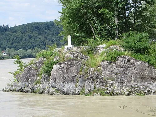 Kräutelstein Island, Bavaria2.1 km NW
-
Faberwald Natural site, Upper Austria2.2 km E
-
Mühlbach River, Upper Austria2.1 km NE
-
Bachinger Bach River, Upper Austria2.3 km S
-
Passau II Concentration Camp (Waldwerke) Historic site, Passau3 km NW
-
Kößlgraben Natural site, Upper Austria2.7 km E
-
Riedlbach River, Upper Austria2.6 km SE
Sources & licences
Data last updated: