Mettmach
Located in Ried im Innkreis District, Upper Austria Coordinates: 48°10′24″ N 13°20′34″ E
- Population
- 2,378
- 2.4K
- Elevation
- 462 m
- above sea level
- Local time
- UTC+01:00
- Europe/Vienna · UTC+01:00
- Places inside
- 28
- listed under Mettmach
About Mettmach
Mettmach is a municipality. Location: Ried im Innkreis District, Upper Austria. Population: 2,378. Elevation: 462 m.
In comparison
- No. 5 of 36 places in Ried im Innkreis District by population
- Nearest larger town: Aspach, 3 km NW
- 7 sights and natural places within 10 km Alt Bach, Federnberg
- Listed here: Village: 28
Places in Mettmach
28 places-
Mettmach Village475
-
Großweiffendorf Village271
-
Mitterdorf Village244
-
Warmanstadl Village156
-
Oberdorf Village116
-
Neundling Village115
-
Kleinreith Village91
-
Nösting Village88
-
Kleinweiffendorf Village79
-
Nagsdorf Village77
-
Gledt Village60
-
Hub Village55
-
Aichet Village46
-
Gügling Village44
-
Lehen Village34
-
Duttenberg Village30
-
Grading Village23
-
Katzenberg Village23
-
Bockenbach Village20
-
Kriegledt Village16
-
Staxroith Village15
-
Scherwolling Village11
-
Berstenham Village10
-
Karlberg Village3
-
Aigen Village2
-
Arnberg am Kobernausser Walde Village
-
Gross Reith Village
-
Wimpling Village
Nearby attractions & nature
Everything nearby-
Federnberg Mountain, Mehrnbach6.2 km NE
-
Alt Bach River, Upper Austria5.8 km NW
-
Guggenberg Mountain, Wippenham7.9 km NE
-
Steigl Berg Mountain, Lohnsburg am Kobernausserwald8.2 km S
-
Aich Berg Mountain, Rossbach8.7 km W
-
Geinberg Mountain, Polling im Innkreis9.6 km NW
-
Mettmach Bach River, Upper Austria8.7 km NW
-
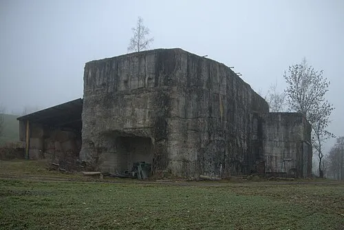 Redl Zipf Concentration Camp (Schlier) Historic site, Neukirchen an der Vöckla20 km SE
Sources & licences
Data last updated: