Haslach an der Mühl
Located in Rohrbach district, Upper Austria Coordinates: 48°34′31″ N 14°02′29″ E
- Population
- 2,530
- 2.5K
- Elevation
- 535 m
- above sea level
- Local time
- UTC+01:00
- Europe/Vienna · UTC+01:00
- Places inside
- 6
- listed under Haslach an der Mühl
About Haslach an der Mühl
Haslach an der Mühl is a municipality. Location: Rohrbach district, Upper Austria. Population: 2,530. Elevation: 535 m.
In comparison
- No. 5 of 39 places in Rohrbach district by population
- Nearest larger town: Rohrbach-Berg, 3 km W
- 8 sights and natural places within 10 km Pfarrkirche Haslach, Kleine Michl
- Listed here: Village: 5, Attraction: 1
Places in Haslach an der Mühl
6 places-
Haslach an der Mühl Village1.7K
-
Felberau Village289
-
Jaukenberg Village281
-
Hartmannsdorf Village140
-
Neudorf Village138
-
Pfarrkirche Haslach Attraction
Nearby attractions & nature
Everything nearby-
Kleine Michl River, Austria1.1 km SW
-
Michelbach River, Austria3.2 km W
-
Hollerberg Mountain, Auberg4.7 km S
-
Hintzing Mountain, Sankt Stefan am Walde4.4 km E
-
Lüftner Berg Mountain, Sankt Peter am Wimberg5.6 km SE
-
Lindový vrch Mountain, Přední Výtoň8.5 km NE
-
Waldkapelle Maria Rast Attraction, Vorderweißenbach8.7 km E
-
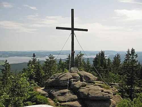 Bärenstein Mountain, Ulrichsberg13 km N
Sources & licences
Data last updated: