Schwarzenberg am Böhmerwald
Located in Rohrbach district, Upper Austria Coordinates: 48°44′14″ N 13°50′02″ E
- Population
- 582
- 582
- Elevation
- 769 m
- above sea level
- Local time
- UTC+01:00
- Europe/Vienna · UTC+01:00
- Places inside
- 8
- listed under Schwarzenberg am Böhmerwald
About Schwarzenberg am Böhmerwald
Schwarzenberg am Böhmerwald is a municipality. Location: Rohrbach district, Upper Austria. Population: 582. Elevation: 769 m.
In comparison
- No. 32 of 39 places in Rohrbach district by population
- Nearest larger town: Breitenberg, 5 km SW
- 26 sights and natural places within 10 km Weißbach, Hartmannsbach
- Listed here: Mountain: 4, Village: 3, Neighbourhood: 1
Places in Schwarzenberg am Böhmerwald
8 places-
Schwarzenberg am Böhmerwald Village437
-
Hinteranger Village129
-
Dachsberg Mountain
-
Einsiedelberg Mountain
-
Oberschwarzenberg Village
-
Teufelsschüssel Mountain
-
Unterschwarzenberg Neighbourhood
-
Zwiesel Berg Mountain
Nearby attractions & nature
Everything nearby-
Weißbach River, Upper Austria1 km W
-
Hartmannsbach River, Upper Austria1.2 km SW
-
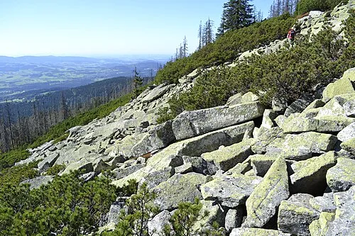 Bayerischer Plöckenstein Mountain, Nová Pec3.8 km N
-
Frauenholz Natural site, Upper Austria3.5 km S
-
Buchenwald Natural site, Upper Austria4.1 km NE
-
Adalbert-Stifter-Quelle Natural site, Upper Austria4.1 km NE
-
Hraničník [Nová Pec] Mountain, Rohrbach district5.4 km E
-
Frauenbach River, Upper Austria4.1 km S
Sources & licences
Data last updated: