Zell am Pettenfirst
Located in Vöcklabruck District, Upper Austria Coordinates: 48°04′28″ N 13°35′58″ E
- Population
- 1,222
- 1.2K
- Elevation
- 538 m
- above sea level
- Local time
- UTC+01:00
- Europe/Vienna · UTC+01:00
- Places inside
- 24
- listed under Zell am Pettenfirst
About Zell am Pettenfirst
Zell am Pettenfirst is a municipality. Location: Vöcklabruck District, Upper Austria. Population: 1,222. Elevation: 538 m.
In comparison
- No. 37 of 52 places in Vöcklabruck District by population
- Nearest larger town: Ungenach, 3 km SE
- 10 sights and natural places within 10 km Urhammer Berg, Hausruck
- Listed here: Village: 23, Neighbourhood: 1
Places in Zell am Pettenfirst
24 places-
Zell am Pettenfirst Village193
-
Hochrain Village122
-
Pettenfirst Village95
-
Kreuth Village94
-
Bruck Village79
-
Schwarzland Village76
-
Heinrichsberg Village64
-
Vornholz Village60
-
Gerhardsberg Village59
-
Wolfsdoppl Village42
-
Hinteredt Village40
-
Kalletsberg Village40
-
Burgstall Village38
-
Schablberg Village36
-
Roith Village35
-
Hinterschachen Village30
-
Schierling Village26
-
Ehwalchen Village22
-
Kopplbrenn Village21
-
Franzeneck Village20
-
Ketzerhub Village20
-
Wegleithen Village17
-
Gewerbestraße Neighbourhood7
-
Gstötten Village
Nearby attractions & nature
Everything nearby-
Urhammer Berg Mountain, Ottnang am Hausruck4.8 km N
-
Hausruck Mountain, Upper Austria4.8 km N
-
Göblberg Mountain, Ampflwang im Hausruckwald5.7 km NW
-
Göblberg Mountain, Frankenburg am Hausruck5.8 km W
-
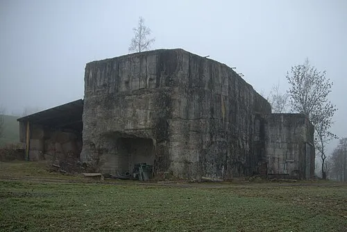 Redl Zipf Concentration Camp (Schlier) Historic site, Neukirchen an der Vöckla8.4 km SW
-
Ampfelwang Bach River, Upper Austria6.4 km S
-
Turmberg Mountain, Haag am Hausruck8.5 km N
-
Vöckla Bach River, Upper Austria8.3 km S
Sources & licences
Data last updated: