Wels
Located in Wels Stadt, Upper Austria Coordinates: 48°10′28″ N 14°01′18″ E
- Population
- 60,739
- 60.7K
- Elevation
- 319 m
- above sea level
- Local time
- UTC+01:00
- Europe/Vienna · UTC+01:00
- Places inside
- 37
- listed under Wels
About Wels
Wels is a municipality. Location: Wels Stadt, Upper Austria. Population: 60,739. Elevation: 319 m.
In comparison
- Nearest larger town: Linz, 25 km NE
- 6 sights and natural places within 10 km Wels II Concentration Camp, Aiterbach
- Listed here: Neighbourhood: 24, Village: 9, Town: 2, City: 1
Places in Wels
37 places-
Wels City16.9K
-
Lichtenegg Town6.2K
-
Wimpassing Neighbourhood5.7K
-
Oberhaid Neighbourhood5.1K
-
WÖS Town5K
-
Laahen Neighbourhood4.8K
-
Bernardin Neighbourhood4.3K
-
Brandln Neighbourhood3K
-
Schafwiesen Village2.2K
-
Wispl Neighbourhood2K
-
Haidl Neighbourhood1.9K
-
Hochpoint Neighbourhood1.5K
-
Oberhart Village1.1K
-
Untereisenfeld Neighbourhood1K
-
Dickerldorf Neighbourhood1K
-
Pernau Neighbourhood999
-
Niederthan Village613
-
Rosenau Neighbourhood460
-
Stadlhof Neighbourhood433
-
Unterleithen Neighbourhood318
-
Oberthan Neighbourhood232
-
Waidhausen Neighbourhood221
-
Aichberg Village160
-
Roithen Neighbourhood150
-
Berg Village149
-
Trausenegg Neighbourhood118
-
Nöham Neighbourhood117
-
Höllwiesen Neighbourhood111
-
Puchberg Village96
-
Mitterlaab Neighbourhood84
-
Hölzl Neighbourhood80
-
Kirchham Village43
-
Oberlaab Neighbourhood35
-
Doppelgraben Village20
-
Gassl Neighbourhood16
-
Aschet Village
-
Wels II Concentration Camp Historic site
Nearby attractions & nature
Everything nearby-
Aiterbach River, Upper Austria2.7 km S
-
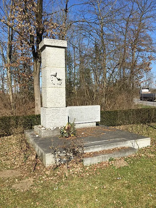 Gunskirchen Concentration Camp (Wels I) Historic site, Gunskirchen6.8 km SW
-
Schloss Dietach Historic site, Weißkirchen an der Traun5.9 km E
-
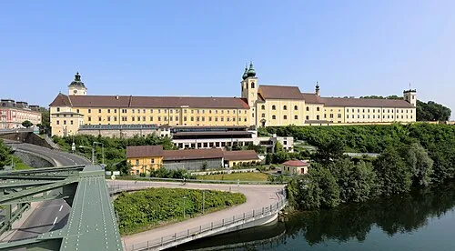 Lambach Abbey Attraction, Lambach14 km SW
-
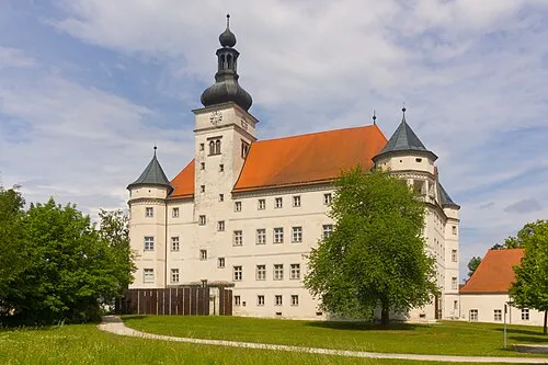 Hartheim Euthanasia Centre Historic site, Alkoven14 km NE
-
Ridlberg Mountain, Alkoven12 km NE
-
Pollhamm Mountain, Sattledt12 km S
-
Trattnach River, Upper Austria9.4 km NW
Sources & licences
Data last updated: