Mohnenfluh
Located in Schröcken, Politischer Bezirk Bregenz Coordinates: 47°13′57″ N 10°06′08″ E
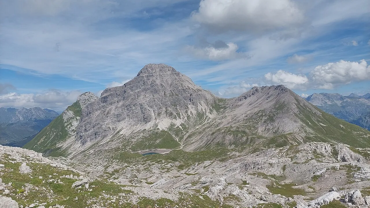
- Elevation
- 2,542 m
- above sea level
- Local time
- UTC+01:00
- Europe/Vienna · UTC+01:00
- Airports
- ACH Sankt Gallen Altenrhein Airport50 km
- FDH Bodensee Airport Friedrichshafen66 km
About Mohnenfluh
Mohnenfluh is a mountain. Location: Schröcken, Politischer Bezirk Bregenz. Elevation: 2,542 m.
The Mohnenfluh is a 2,544-metre (8,346 ft) high mountain in the Austrian state of Vorarlberg. The Mohnenfluh is the second-highest summit in the region of Schröcken after the Braunarlspitze, and is in the Lechquellen Mountains. An ascent is usually made via the Mohnen Saddle (2,315 m) and the south arête. The Bregenzer Ach rises on the eastern flank of the Mohnenfluh above Schröcken at a height of about 2,400 metres (7,870 ft). The name "Mohn(-en)" may be connected to the word Mond ("moon").
Source: Wikipedia · CC BY-SA 4.0
At a glance
- Topographic prominence
- 387 m
Source: Wikidata
Photos of Mohnenfluh
-

Saibo29 · CC BY-SA 4.0 -

böhringer friedrich · CC BY-SA 2.5 -

Robinhood50 · CC BY-SA 4.0 -

Robinhood50 · CC BY 4.0 -

böhringer friedrich · CC BY-SA 2.5


Climate of Mohnenfluh
This month · November
A wet month
Day -3° · Night -10° · Rain 109 mm
- Hottest month
- July (day 10°)
- Coldest month
- February (night -14°)
- Wettest month
- July (175 mm)
- Driest month
- February (94 mm)
Bars: average monthly low and high temperature. Below: precipitation. Monthly averages for 1970–2000 at about 18 km resolution, adjusted for elevation. Highlighted months are mild and relatively dry. Source: WorldClim 2.1 (CC BY 4.0).
Show values as a table
| Month | Jan | Feb | Mar | Apr | May | Jun | Jul | Aug | Sep | Oct | Nov | Dec |
|---|---|---|---|---|---|---|---|---|---|---|---|---|
| Average high (°C) | -7° | -6° | -4° | -1° | 4° | 8° | 10° | 10° | 7° | 3° | -3° | -5° |
| Average low (°C) | -14° | -14° | -11° | -8° | -4° | -1° | 1° | 2° | -1° | -5° | -10° | -12° |
| Precipitation (mm) | 99 | 94 | 98 | 102 | 121 | 159 | 175 | 162 | 120 | 94 | 109 | 107 |
How to get to Mohnenfluh
The nearest airport is Sankt Gallen Altenrhein Airport (ACH), 50 km to the northwest as the crow flies. For international flights: Bodensee Airport Friedrichshafen (FDH) (66 km). The nearest large city is Innsbruck, 98 km to the east.
Airports
- Sankt Gallen Altenrhein Airport (ACH) St. Gallen 50 kmnorthwest
- Bodensee Airport Friedrichshafen (FDH) Friedrichshafen 66 kmnorthwest
- Memmingen Allgau Airport (FMM) Memmingen 85 kmnorth
Nearby large cities
- Innsbruck Population: 132.5K 98 kmeast
- Winterthur Population: 111.8K 108 kmwest
- Zurich Population: 415.4K 118 kmwest
- Ulm Population: 120.5K 130 kmnorth
- Augsburg Population: 301.1K 140 kmnortheast
Straight-line distances; road distances are longer. Airport data: OurAirports.
Day trips from Mohnenfluh
Within 100 km: 351 historic and cultural sites, 5,954 natural sites, 1,260 lakes, rivers and coasts.
0–25 km807 places
- Zürser See Lake 7 kmSE
- Vordersee Lake 21 kmE
- Sünser See Lake 21 kmW
- Spullersee Lake 9 kmS
25–60 km2,520 places
- Lake Davos Lake 50 kmS
- Voralpsee Lake 55 kmW
- Weiher Diepoldsau Lake 37 kmNW
- Gotschnaseeli Lake 46 kmSW
60–100 km4,238 places
- Mainau Island 86 kmNW
- Dominikanerinsel Konstanz Island 85 kmNW
- Strandbad Steckborn Beach 98 kmNW
- Insel Lützelau Island 99 kmW
Straight-line distances.
Nearest towns and villages
Nearby attractions & nature
Everything nearby-
Zuger Hochlicht Mountain, Lech0.7 km S
-
Juppenspitze Mountain, Schröcken0.8 km NE
-
Butzensee Lake, Schröcken0.7 km W
-
Butzenspitze Mountain, Lech2.1 km W
-
Kriegerhorn Mountain, Lech2.3 km SE
-
Zuger Horn Mountain, Lech2.6 km SW
-
Körbersee Lake, Schröcken2.3 km N
-
Braunarlspitze Mountain, Lech2.9 km W
Sources & licences
Data last updated: · 2 independent sources