Krumovo
Local name: Крумово
Located in Rodopi, Plovdiv Coordinates: 42°05′00″ N 24°49′00″ E
- Population
- 3,470
- 3.5K
- Elevation
- 164 m
- above sea level
- Local time
- UTC+02:00
- Europe/Sofia · UTC+02:00
- Places inside
- 1
- listed under Krumovo
About Krumovo
Krumovo is a municipality. Location: Rodopi, Plovdiv. Population: 3,470. Elevation: 164 m.
Krumovo (Bulgarian: Крумово) is a village in the Plovdiv Province, southern Bulgaria named after the Bulgarian Khan Krum. As of 2006 it has 3,378 inhabitants. The village is located at 2 km to the south of the Maritsa river and at 12 km to the south-east of Plovdiv. The Plovdiv International Airport is located in the vicinity of the village. It is also famous for its grapes sort Krumovski mavrud. Every 2 years the BIAF Airshow is held on the Krumovo Airbase, resulting in heavy parking problems in the village.
Read more on Wikipedia Text: Wikipedia contributors · CC BY-SA 4.0 · shortened
At a glance
- Area
- 19.3 km²
Source: Wikidata
In comparison
- No. 3 of 13 places in Rodopi by population
- Nearest larger town: Kuklen, 6 km SW
Places in Krumovo
1 place-
Krumovo Village
Nearby attractions & nature
Everything nearby-
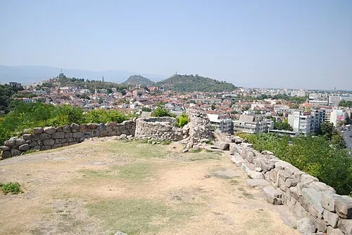 Nebet Tepe Mountain, Plovdiv9.2 km NW
-
Ruen Mountain, Kuklen11 km S
Sources & licences
Data last updated: · 2 independent sources