Shiroka luka
Local name: Широка лъка
Located in Smolyan, Smolyan Coordinates: 41°41′45″ N 24°34′45″ E
- Population
- 812
- 812
- Elevation
- 1,496 m
- above sea level
- Local time
- UTC+02:00
- Europe/Sofia · UTC+02:00
- Places inside
- 1
- listed under Shiroka luka
About Shiroka luka
Shiroka luka is a municipality. Location: Smolyan, Smolyan. Population: 812. Elevation: 1,496 m.
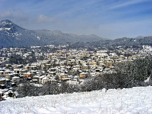
Shiroka Laka (Bulgarian: Широка лъка [ʃiˈrɔkɐ ˈɫɤkɐ]) is a village in the very south of Bulgaria, located in Smolyan municipality, Smolyan Province. It is a proclaimed architectural and folklore reserve and lies in the central Rhodope Mountains, 23 km (14 mi) northwest of Smolyan, 16 km (10 mi) west of Pamporovo and 22 km (14 mi) southeast of Devin. The dominant and traditional religion in the village is Eastern Orthodox Christianity and the population is 573 (as of September 2005).
Read more on Wikipedia Text: Wikipedia contributors · CC BY-SA 4.0 · shortened
At a glance
- Area
- 54.6 km²
Source: Wikidata
In comparison
- No. 3 of 40 places in Smolyan by population
- Nearest larger town: Chepelare, 10 km NE
Places in Shiroka luka
1 place-
Kukuvitsa Village14
Nearby attractions & nature
Everything nearbyOther cities and towns in Smolyan
Sources & licences
Data last updated: · 2 independent sources