Panagia Evangelístria
Local name: Παναγία Ευαγγελίστρια
Located in Káto Polemídia, Limassol District Coordinates: 34°41′37″ N 33°00′03″ E
- Population
- 3,696
- 3.7K
- Elevation
- 62 m
- above sea level
- Local time
- UTC+02:00
- Asia/Nicosia · UTC+02:00
- Airports
- PFO Paphos International Airport47 km
- LCA Larnaca International Airport61 km
About Panagia Evangelístria
Panagia Evangelístria is a village. Location: Káto Polemídia, Limassol District. Population: 3,696. Elevation: 62 m.
Panagias Evangelistrias is a district of the municipality of Kato Polemidia in Cyprus.
Source: Wikipedia · CC BY-SA 4.0
Photos of Panagia Evangelístria
-
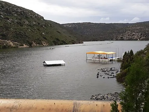
Polemidia Reservoir Xaris333 · CC BY-SA 4.0 -
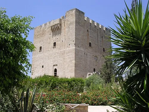
Kolossi Castle Vegard Ottervig · Public domain


Places bordering Panagia Evangelístria
- Apostle Barnabas
- Makarios C
- Agia Fylaxis
- Saint Nicholas
Climate of Panagia Evangelístria
Best months for sightseeingBest months for sightseeing: April, November.
This month · November
A good month to visit
Day 23° · Night 12° · Rain 57 mm
- Hottest month
- August (day 34°)
- Coldest month
- January (night 7°)
- Wettest month
- December (118 mm)
- Driest month
- July (2 mm)
Bars: average monthly low and high temperature. Below: precipitation. Monthly averages for 1970–2000 at about 18 km resolution, adjusted for elevation. Highlighted months are mild and relatively dry. Source: WorldClim 2.1 (CC BY 4.0).
Show values as a table
| Month | Jan | Feb | Mar | Apr | May | Jun | Jul | Aug | Sep | Oct | Nov | Dec |
|---|---|---|---|---|---|---|---|---|---|---|---|---|
| Average high (°C) | 17° | 17° | 19° | 23° | 27° | 31° | 34° | 34° | 32° | 28° | 23° | 18° |
| Average low (°C) | 7° | 8° | 9° | 12° | 16° | 20° | 22° | 23° | 20° | 17° | 12° | 9° |
| Precipitation (mm) | 107 | 79 | 60 | 27 | 17 | 6 | 2 | 2 | 5 | 31 | 57 | 118 |
How to get to Panagia Evangelístria
The nearest airport is Paphos International Airport (PFO), 47 km to the west as the crow flies. The nearest large city is Limassol, 4 km to the east.
Airports
- Paphos International Airport (PFO) Paphos 47 kmwest
- Larnaca International Airport (LCA) Larnaca 61 kmeast
- Ercan International Airport (ECN) Tymbou (Kirklar) 69 kmnortheast
Nearby large cities
- Limassol Population: 154K 4 kmeast
- Nicosia Population: 200.5K 62 kmnortheast
- Silifke Population: 132.7K 205 kmnortheast
- Alanya Population: 364.2K 224 kmnorthwest
- Karaman Population: 175.4K 277 kmnorth
Straight-line distances; road distances are longer. Airport data: OurAirports.
Day trips from Panagia Evangelístria
Within 100 km: 1,269 historic and cultural sites, 453 natural sites, 99 lakes, rivers and coasts.
0–25 km297 places
- Governor’s Beach Beach 25 kmE
- Kalentzi Mountain 2 kmNW
- Kaminia Mountain 6 kmW
- Xivounon Mountain 5 kmNE
25–60 km867 places
- Mount Olympus Mountain 30 kmNW
- Cyprus Island 34 kmN
- Stavrovoúni Attraction 45 kmNE
- Tsada Community Park Natural site 51 kmW
60–100 km657 places
- Toxéftra Beach Beach 67 kmNW
- Poseidon Beach Beach 91 kmE
- Nissi Beach Beach 94 kmE
- Kastela Beach 63 kmE
Straight-line distances.
Nearby attractions & nature
Everything nearby-
Ágios Nikólaos Attraction, Káto Polemídia0.8 km W
-
Ágios Geórgios Attraction, Káto Polemídia1.3 km E
-
Kalentzi Mountain, Káto Polemídia1.7 km NW
-
Polemidhia Forest Natural site, Limassol District2.3 km NE
-
Polemidia Reservoir Lake, Limassol District3.3 km NW
-
Panagia Karmiotissa church Attraction, Páno Polemídia2.9 km NW
Sources & licences
Data last updated: · 2 independent sources