Arnaoutogeitonia
Local name: Αρναουτογειτονιά
Located in Limassol Municipality, Limassol District Coordinates: 34°40′27″ N 33°02′02″ E
- Population
- 1,743
- 1.7K
- Elevation
- 13 m
- above sea level
- Local time
- UTC+02:00
- Asia/Nicosia · UTC+02:00
- Airports
- PFO Paphos International Airport50 km
- LCA Larnaca International Airport59 km
About Arnaoutogeitonia
Arnaoutogeitonia is a village. Location: Limassol Municipality, Limassol District. Population: 1,743. Elevation: 13 m.
Arnaoutigitonia (or Arnaoudkia or Arnaout) (Greek: Αρναουτογειτονιά ή Αρναουθκιά ή Αρναούτ) is a Neighbourhood, Quarter, Mahalla or Parish of the Municipality of Limassol.
Source: Wikipedia · CC BY-SA 4.0
Photos of Arnaoutogeitonia
-
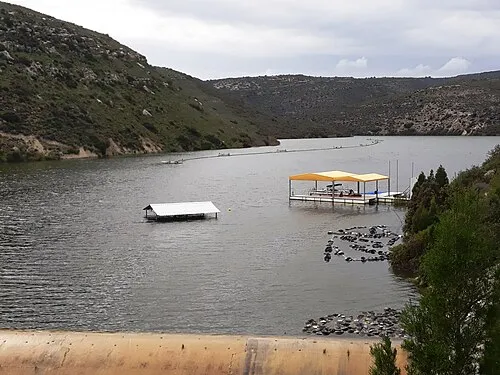
Polemidia Reservoir Xaris333 · CC BY-SA 4.0

Places bordering Arnaoutogeitonia
- Agios Ioannis
- Katholiki
- Tziami Tzentit
- Tsiflikoudia
Population of Arnaoutogeitonia over time
| 1982 | 1,743 | |
|---|---|---|
| 1992 | 903 | |
| 2001 | 975 | |
| 2011 | 905 |
Censuses and official estimates; source: Wikidata.
Climate of Arnaoutogeitonia
Best months for sightseeingBest months for sightseeing: April, November.
This month · November
A good month to visit
Day 23° · Night 13° · Rain 57 mm
- Hottest month
- August (day 35°)
- Coldest month
- January (night 8°)
- Wettest month
- December (118 mm)
- Driest month
- July (2 mm)
Bars: average monthly low and high temperature. Below: precipitation. Monthly averages for 1970–2000 at about 18 km resolution, adjusted for elevation. Highlighted months are mild and relatively dry. Source: WorldClim 2.1 (CC BY 4.0).
Show values as a table
| Month | Jan | Feb | Mar | Apr | May | Jun | Jul | Aug | Sep | Oct | Nov | Dec |
|---|---|---|---|---|---|---|---|---|---|---|---|---|
| Average high (°C) | 17° | 17° | 19° | 23° | 27° | 31° | 34° | 35° | 32° | 29° | 23° | 19° |
| Average low (°C) | 8° | 8° | 9° | 13° | 16° | 20° | 23° | 23° | 20° | 17° | 13° | 10° |
| Precipitation (mm) | 107 | 79 | 60 | 27 | 17 | 6 | 2 | 2 | 5 | 31 | 57 | 118 |
How to get to Arnaoutogeitonia
The nearest airport is Paphos International Airport (PFO), 50 km to the west as the crow flies. The nearest large city is Limassol, 1 km to the north.
Airports
- Paphos International Airport (PFO) Paphos 50 kmwest
- Larnaca International Airport (LCA) Larnaca 59 kmnortheast
- Ercan International Airport (ECN) Tymbou (Kirklar) 69 kmnortheast
Nearby large cities
- Limassol Population: 154K 1 kmnorth
- Nicosia Population: 200.5K 63 kmnortheast
- Silifke Population: 132.7K 206 kmnortheast
- Alanya Population: 364.2K 228 kmnorthwest
- Mersin Population: 537.8K 278 kmnortheast
Straight-line distances; road distances are longer. Airport data: OurAirports.
Day trips from Arnaoutogeitonia
Within 100 km: 1,277 historic and cultural sites, 458 natural sites, 99 lakes, rivers and coasts.
0–25 km265 places
- Governor’s Beach Beach 22 kmE
- Kalentzi Mountain 5 kmNW
- Kaminia Mountain 9 kmW
- Xivounon Mountain 6 kmN
25–60 km844 places
- Mount Olympus Mountain 33 kmNW
- Cyprus Island 37 kmN
- Stavrovoúni Attraction 44 kmNE
- Tsada Community Park Natural site 55 kmW
60–100 km725 places
- Toxéftra Beach Beach 70 kmNW
- Poseidon Beach Beach 89 kmNE
- Nissi Beach Beach 92 kmE
- Kastela Beach 61 kmNE
Straight-line distances.
Nearby attractions & nature
Everything nearby-
Frourion Lemesou Historic site, Limassol Municipality0.7 km SE
-
Ayios Eraklidhios Historic site, Limassol Municipality2.7 km SW
-
Ágios Geórgios Attraction, Káto Polemídia2.8 km NW
-
Ágios Nikólaos Attraction, Káto Polemídia4.4 km NW
-
Polemidhia Forest Natural site, Limassol District4.7 km NW
-
Kalentzi Mountain, Káto Polemídia5.4 km NW
Other cities and towns in Limassol Municipality
-
Apostoloi Petros kai Pavlos Village, Limassol Municipality2.3 km N
-
Agia Zoni Village, Limassol Municipality1.5 km NE
-
 Zakaki Village, Limassol Municipality3.4 km SW
-
Agios Georgios Village, Limassol Municipality1.9 km NW
-
Agia Trias Village, Limassol Municipality1.7 km NE
-
Agios Antonios Village, Limassol Municipality0.7 km SE
Sources & licences
Data last updated: · 2 independent sources