Étang de Beaulieu
Located in Côtes-d'Armor, Brittany Region Coordinates: 48°23′50″ N 2°12′34″ W
- Elevation
- 89 m
- above sea level
- Local time
- UTC+01:00
- Europe/Paris · UTC+01:00
About Étang de Beaulieu
Étang de Beaulieu is a lake. Location: Côtes-d'Armor, Brittany Region. Elevation: 89 m.
In comparison
- 3 sights and natural places within 10 km Rosette, Grand Étang de Jugon
Airports nearest to Étang de Beaulieu
- Rennes-Saint-Jacques Airport (RNS) Saint-Jacques-de-la-Lande, Ille-et-Vilaine 51 km
- Jersey Airport (JER) St. Peter 90 km
- Guernsey Airport (GCI) Saint Peter Port 119 km
Straight-line distance; airports with scheduled flights only. Source: OurAirports (public domain).
Nearest towns and villages
-
Languédias Village, Arrondissement of Dinan1.1 km S
-
Languédias Village, Languédias1 km S
-
Trébédan Village, Arrondissement of Dinan2.8 km E
-
Trébédan Village, Trébédan2.8 km E
-
Arrondissement of Dinan Municipality, Côtes-d'Armor7.8 km NE
-
Plélan-le-Petit Village, Arrondissement of Dinan4.2 km N
Nearby attractions & nature
Everything nearby-
Grand Étang de Jugon Lake, Côtes-d'Armor7.9 km W
-
Rosette River, Côtes-d'Armor7.1 km W
-
Forêt de la Hunaudais Natural site, Côtes-d'Armor15 km NW
-
Forêt de Saint-Aubin Natural site, Côtes-d'Armor16 km NW
-
Étang du Guébriand Lake, Côtes-d'Armor15 km N
-
Linon River, Côtes-d'Armor15 km E
-
Forêt de Coëtquen Natural site, Côtes-d'Armor20 km E
-
Arguenon River, Brittany Region21 km N
More lakes, rivers and coasts in France
-
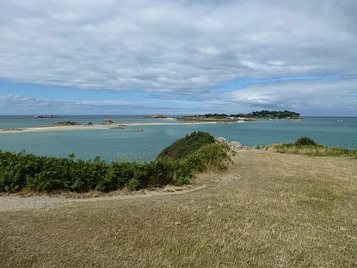 archipel des Ébihens Island, L'Isle25 km N
-
Chifrouet River, Côtes-d'Armor25 km W
-
Ruisseau de Guinejort River, Côtes-d'Armor16 km E
-
Ruisseau Montafilan River, Côtes-d'Armor16 km N
-
Frémur River, Côtes-d'Armor28 km N
-
Ruisseau du Guébriand River, Côtes-d'Armor19 km N
Sources & licences
Data last updated: