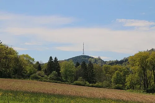
Forêt de Wissembourg
Located in Bas-Rhin, Grand Est Coordinates: 49°00′33″ N 8°00′56″ E
- Elevation
- 159 m
- above sea level
- Local time
- UTC+01:00
- Europe/Paris · UTC+01:00
About Forêt de Wissembourg
Forêt de Wissembourg is a natural site. Location: Bas-Rhin, Grand Est.
In comparison
- 36 sights and natural places within 10 km Ruß-Graben, Monument du Geisberg
Nearest towns and villages
-
Schleithal Village, Arrondissement of Haguenau3 km SE
-
Schweighofen Village, Landkreis Südliche Weinstraße2.9 km NW
-
Kapsweyer Village, Landkreis Südliche Weinstraße3.9 km N
-
Kapsweyer Village, Kapsweyer3.9 km N
-
Steinfeld Village, Landkreis Südliche Weinstraße4.6 km N
-
Schweighofen Village, Schweighofen3.8 km NW
Nearby attractions & nature
Everything nearby-
Lerchenberg Mountain, Kapsweyer4.5 km N
-
Gähberg Mountain, Kapsweyer5 km N
-
Wolfsberg Mountain, Schweighofen5.2 km NW
-
Sauschwamm Natural site, Rhineland-Palatinate4.7 km NE
-
Wachholder Berg Mountain, Schweigen-Rechtenbach5.9 km NW
-
Eichelgarten Natural site, Rhineland-Palatinate5.1 km E
-
Raffelsberg Mountain, Oberotterbach6.5 km N
-
Krapfenberg Mountain, Vollmersweiler7.4 km NE
More nature in France
-
 Eselsberg Mountain, Wissembourg9.7 km W
-
Luchsenkopf Mountain, Wissembourg10 km W
-
Muehlenkopf Mountain, Wissembourg10 km W
-
Diebhalt Mountain, Climbach12 km W
-
Schleife Mountain, Climbach12 km W
-
Soultzerkopf Mountain, Lampertsloch14 km W
Sources & licences
Data last updated: